MyTopo
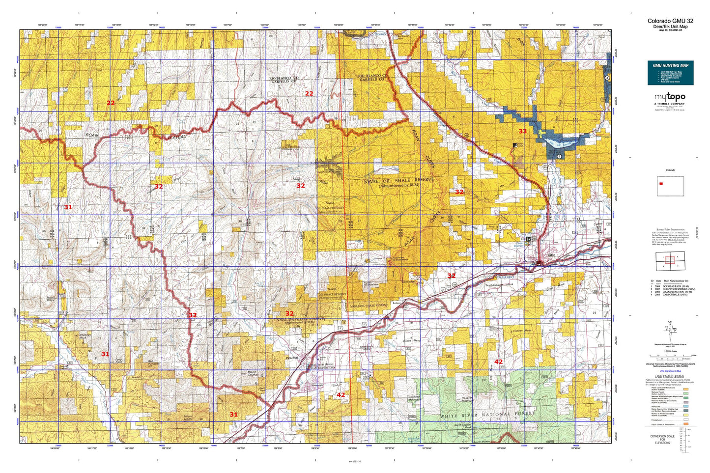
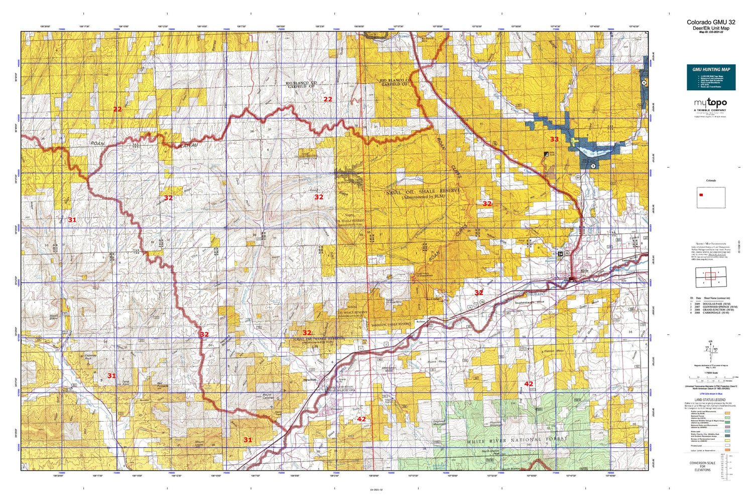
Colorado GMU 32 Map
Couldn't load pickup availability
Hunting unit map of Colorado Game Management Unit 32 with topographic lines and unit boundaries. This topo map features UTM / MGRS and Latitude/Longitude grids, plus public land ownership. It comes folded on waterproof paper. Be fully prepared for your hunt with a MyTopo GMU map!.
This map contains the following named places: 81635,Allen Point,Allenwater Creek,Anvil Points,Anvil Points Oil Shale Mines,Balzac Gulch,Barnes Ridge,Battlement Cemetery,Battlement Creek,Battlement Mesa,Battlement Mesa Census Designated Place,Battlement School,Bear Cabin Gulch,Bear Creek,Bear Gulch,Bear Run,Beaver Creek,Ben Good Creek,Bloat Gulch,Bowdish Gulch,Bowdish Trail,Bragg Spring,Buck Gulch,Bull Fork,Bull Gulch,Bureau of Mines Oil Shale Experiment Station,Cabin Water,Cache Creek,Camp Gulch,Cascade Canyon,Chambers Pit,Cherry Gulch,Chicken Gulch,Chimney Rock,Circle Dot Gulch,Clear Creek,Clear Creek Ditch,Conn Creek,Conn Creek School,Connley Gulch,Conwell Ditch,Cornell Ditch,Corral Gulch,Cottonwood Creek,Cottonwood Gulch,Cottonwood Point,Crawford Trail,Creek and Newman Ditch,Crouch Spring,Crystal Creek,Daisy Ditch,Davis Gulch,Davis Point,Deep Gulch,Deer Park Gulch,Devils Park,Diamond Ditch,Doe Creek,Doe Gulch,Doghead Mountain,Doodlebug Gulch,Doyle Trail,Dry Creek,East Anvil Point,East Fork Conn Creek,East Fork Falls,East Fork Parachute Creek,East Forked Gulch,East Middle Fork Falls,East Middle Fork Parachute Creek,Estes Gulch,Farmer Mutual Mine,First Anvil Creek,First Water Gulch,Flatiron Mesa,Forked Gulch,Fravert Reservoir,Garden Gulch,Gardner Gulch,Garfield County,Garfield County Landfill,Gibler Gulch,Gilman Gulch,Glover Park,Glover Point,Golden Castle Gulch,Goodrich Gulch,Goodrich Park,Grand Valley Fire Protection District - Station 31,Grand Valley Heliport,Grand Valley High School,Granlee Ditch,Granlee Gulch,Grassy Gulch,Hayes Gulch,Haystack Mountain,Hayward Spring,Helm Gulch,Helmer Gulch,High Mesa,Hobo Ditch,Holms Mesa,Hopple Gulch,Horse Park,House Log Gulch,Houston Mountain,Hubbard Gulch,Hubbard Mesa,HVS and S Ditch,J Q S Gulch,J V Gulch,Jackrabbit Ridge,Jacks Pocket,Jangle Ditch,Kelly Gulch,Kimball Creek,Kimball Creek School,KZKS-FM (Rifle),Lacy,Light Gulch,Lindauer Point,Little Creek,Log Mesa,Lone Tree Spring,Long Point,Long Ridge,Low Cost Ditch,Magpie Gulch,McKay Gulch,Middle Fork Parachute Creek,Middle Water,Milk Cabin Gulch,Monument Gulch,Morrisania Mesa,Mount Blaine,Mount Callahan,Mount Callahan Spring,Murphy Reservoir,Northwater Creek,Parachute,Parachute Branch Library,Parachute Creek,Parachute Ditch,Parachute Fire Department,Parachute Police Department,Parachute Post Office,Parachute Town Hall,Pearl Creek,Pete and Bill Creek,Pete Spring Gulch,Pine Trail Reservoir,Pioneer Ditch,Porcupine Creek,Porcupine Gulch,Potts Creek,Prefontaine Mesa,Pritchard Spring,Pyramid Point,Rasberry Creek,Red Gulch,Red Pinnacle,Red Point,Rifle Arch,Rifle Creek,Rifle Division,Riley Gulch,Roan Creek Community Center,Roan Plateau,Rulison,Rulison Gulch,Rulison Oil Shale Mine,Russey - Hurlburt Cemetery,Schoolhouse Point,Schutte Creek,Scott Gulch,Scott Spring,Second Anvil Creek,Second Water Gulch,Sharrard Park,Sheep Gulch,Sheep Kill Gulch,Sheep Trail Hollow,Short Gulch,Short Ridge,Short Water,Sleepy Ridge,South Fork Starkey Gulch,Spring Gulch,Spruce Creek,Spruce Point Trail,Square S Ranch,Starkey Gulch,Stone Quarry Gulch,Tank Gulch,Taughenbaugh Mesa,Ted Estes Mine,Third Water Gulch,Thirty Two Mile Gulch,Tichner Draw,Timber Gulch,Tom Creek,Tourist Run,Town of Parachute,Trail Gulch,Trail Ridge,Trapper Creek,Webster Hill,Webster Mesa,West Anvil Point,West Fork Falls,West Fork Parachute Creek,West Forked Gulch,Wet Fork West Fork Parachute Creek,Wheeler Gulch,Whiskey Gulch,Wiesse Creek,Willow Creek,Wolf Creek,Yellow Slide Gulch,Yellowjacket Creek


