MyTopo
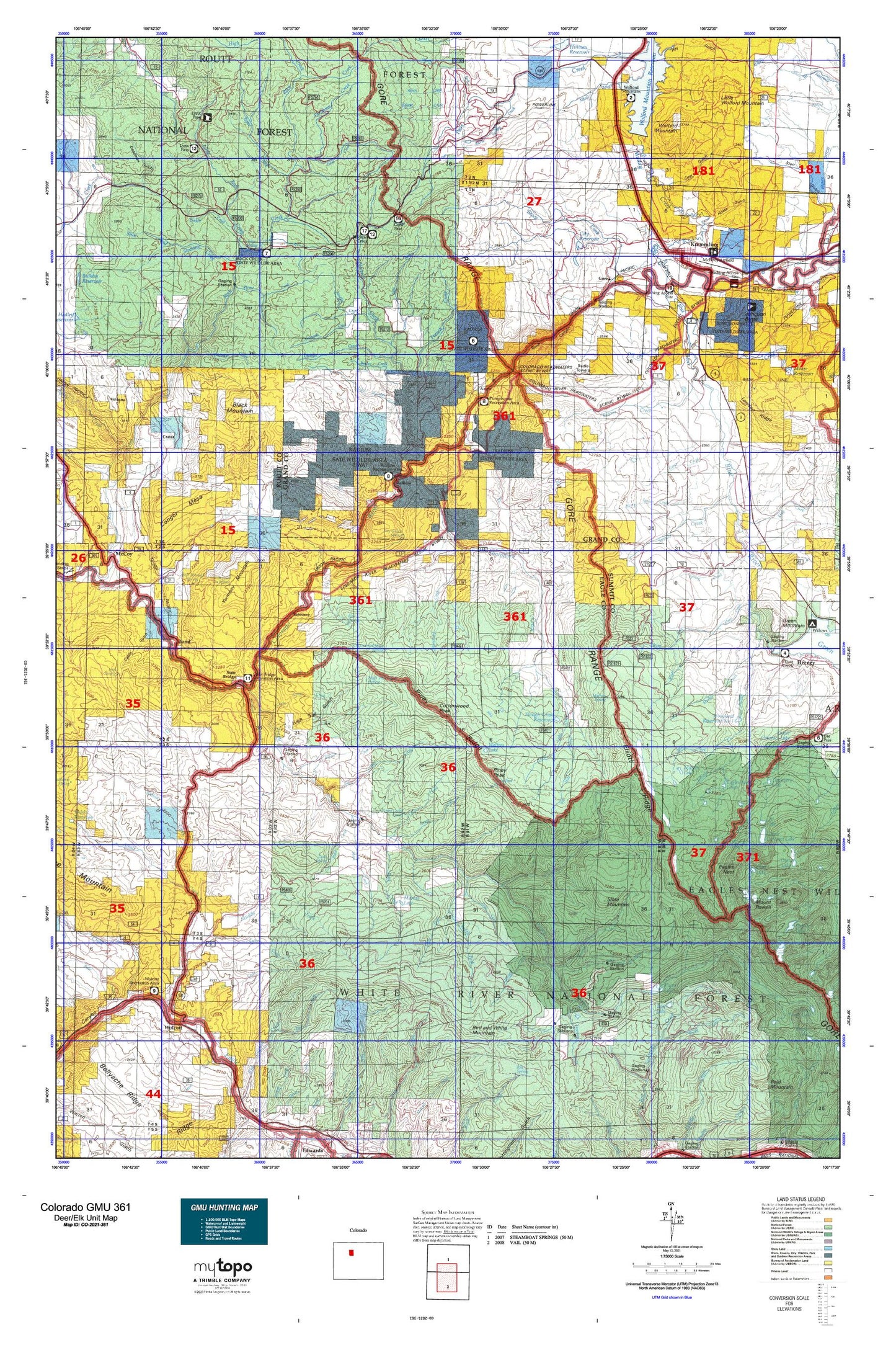
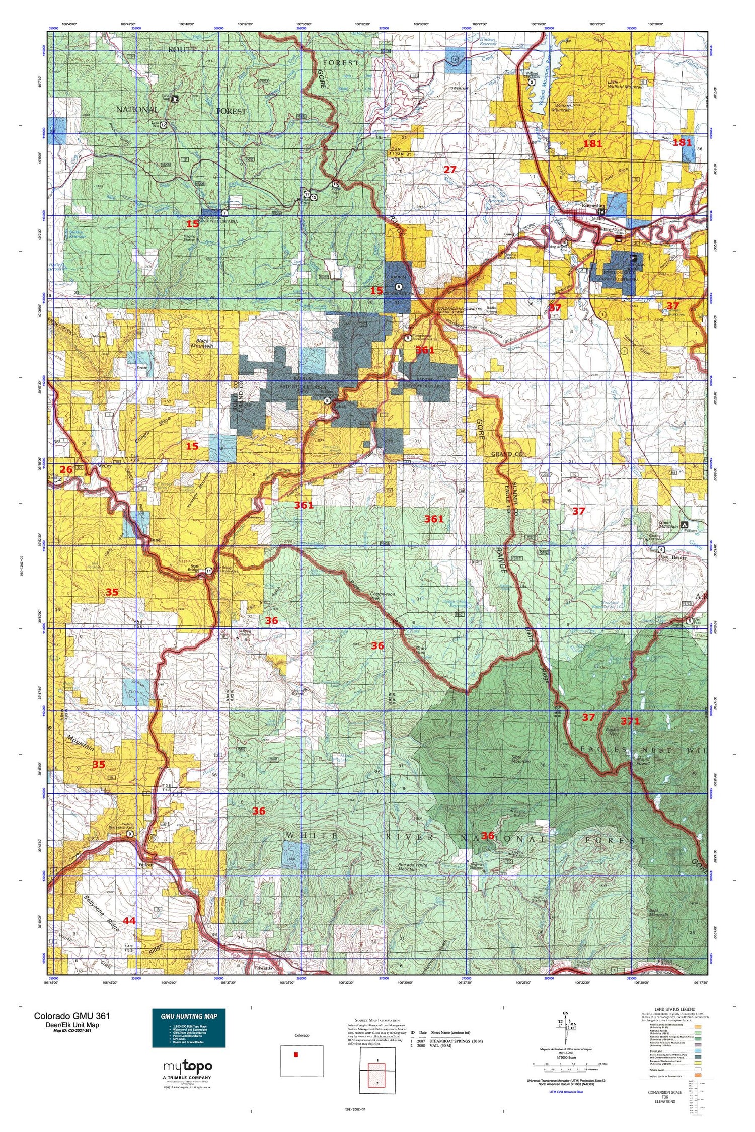
Colorado GMU 361 Map
Couldn't load pickup availability
Hunting unit map of Colorado Game Management Unit 361 with topographic lines and unit boundaries. This topo map features UTM / MGRS and Latitude/Longitude grids, plus public land ownership. It comes folded on waterproof paper. Be fully prepared for your hunt with a MyTopo GMU map!.
This map contains the following named places: 80423,80463,81655,Abbet Place,Alex Spring Reservoir,Alkali Creek,Alkali Slough,Allen Ditch,Ammons Creek,Aspen Creek,Azure,Barger Ditch,Beaver Creek,Beaver Dam Lake,Big Hole Creek,Big Park,Big Park Creek,Birch Creek,Black Creek,Black Mountain,Blacktail Creek,Blacktail Creek Campground,Blacktail Creek Picnic Area,Blue Lake,Blue River,Bobcat Creek,Bocco Mountain,Bond,Box Canyon Creek,Box Canyon Lake,Burke Spring Creek,Cache Creek,Cache Creek Access Trail,Camp Creek,Cantril Ranch,Canyon Creek,Cash Ditch,Castle Creek,Castle Reservoir,Cat Lake,Champion Mine,Chimney Rock,City Reservoir,Clark Spring Reservoir,Cliff Lake,Clyde Tunnel,Cole Black Creek,Congor Mesa,Copper Spur,Cottonwood Creek,Cottonwood Peak,Crater,Crazy Horse Creek,De Berard Ranch,Decker Creek,Deep Creek,Devils Slide Creek,Dice Hill,Dickson Creek,Doenz Place,Dry Creek,Dry Lake,Duck Lake,Eagles Nest,Eaglesmere Lakes,Eaglesmere Trail,East Beard Reservoir,East Fork Blacktail Creek,East Fork Red Canyon Creek,East Fork Three Licks Creek,East Meadow Creek,East Saint Louis Mine,Elk Creek,Elliott Creek,Engle Ranch,Ennis Ranch,Farnham Creek,First Fork South Fork Piney River,Freeman Creek,French Creek,George Lake,Goodson Creek,Gore,Gore Creek,Gore Pass Campground,Grape Creek,Green Mountain,Green Mountain Camp,Griffith Lake,Griggs Reservoir,Guthrie Thomas Ditch,Gutzler Lakes,Hazel Creek,High Rock Creek,Horn Ranch,Horse Creek,Horse Pond,Horseshoe Creek,Indian Grove Reservoir,Inspiration Point,James Spring Reservoir,Jenkins Creek,Jolley Creek,Jones Reservoir,Jouflas Spring Reservoir,Junction Butte,Kayser Mutual Ditch,Kids Pond,King Creek,Kirtz Ditch,Kremmling,Lagunita Lake,Lava Creek,Lava Lake,Little Blacktail Creek,Little Cottonwood Reservoir,Little Green Mountain,Little Henry Creek,Little Rock Creek,Little Wolford Mountain,Loback Ditch,Lone Lick Creek,Lone Lick Lakes,Long Park,Lost Lake,Lost Lake Trail,Lynx Pass Campground,Mahan Lake,Marma Lake,Martin Creek,Martin Ranch,Marugg Creek,McCoy,McCoy Reservoir,McElroy Reservoir,McPhee Creek,Meadow Creek,Meridian Peak,Midway Trail,Milk Creek,Mirror Lake,Modlin Creek,Moniger Creek,Moore Reservoir,Morris Reservoir,Morrison Divide Trail,Mount Powell,Muddy Creek,Noonan Ditch,Noonan Ranch,North Fork Deep Creek,North Fork Elliott Creek,North Fork Pass Creek,North Fork Piney River,North Spruce Creek,Oneill Holland Ditch,Orestod,Orr Ranch,Oxford Lake,Petty Mountain,Pine Creek,Piney Crossing Campground,Piney Guard Station,Piney Lake,Piney Lake Trail,Piney Peak,Piney River,Pinney Ranch,Porcupine Creek,Radium,Rancho Del Rio,Red and White Mountain,Red Canyon Stock Driveway,Red Mountain,Rock Creek,Rock Creek Campground,Rock Creek Trail,Rock Gap Dam Reservoir,Rube Creek,San Toy Mountain,Sheep Creek,Sheep Drive Trail,Sheep Mountain,Sheephorn,Sheephorn Creek,Sheephorn Mountain,Sherwood Ditch,Shoe and Stocking Campground,Shoe and Stocking Creek,Slate Creek,Slate Mountain,Slough Grass Lake,Smith Ranch,Soda Creek,Soda Lakes,South Fork Deep Creek,South Fork Dickson Creek,South Fork Piney River,South Fork Red Sandstone Creek,Spalding Reservoir,Spring Creek,Spruce Creek,Stark Creek,State Bridge,Strutsell Sawmill,Tepee Creek,Tepee Creek Trail,Thomas Creek,Three Licks Creek,Tie Creek,Tipperary Lake,Tipple,Toponas Creek Campground,Town of Kremmling,Trail Creek,Twin Lakes,Upper Cataract Lake,Upper Craven Reservoir,Ute Creek,Ute Spring Reservoir,Volcano,Walters Lake,Way Reservoir,West Peak,Whiskey Creek,Whitaker Ranch,Willow Creek,Wolcott,Wolford Mountain,Wolford Mountain Reservoir,Yarmany Reservoir,Yarmony,Yarmony Creek,Yarmony Mountain,Yust Ranch


