MyTopo
Colorado GMU 481 Map
Couldn't load pickup availability
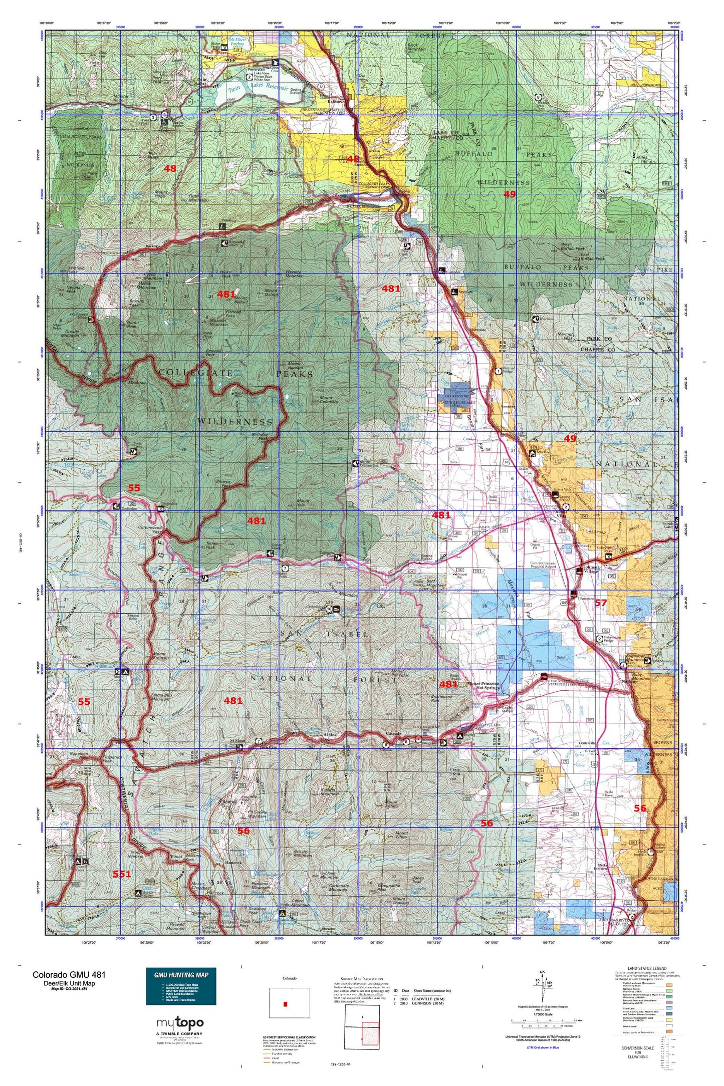
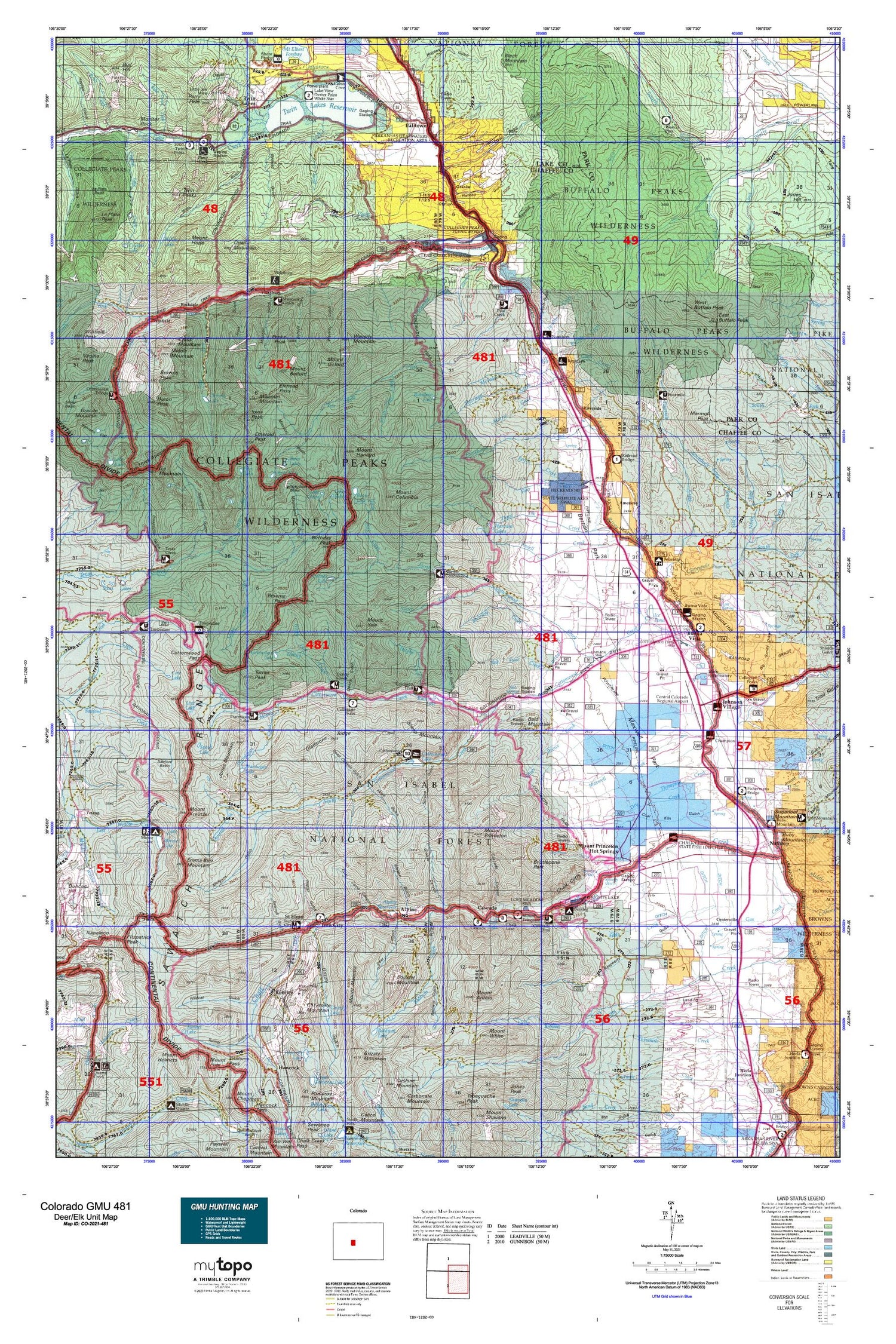
Hunting unit map of Colorado Game Management Unit 481 with topographic lines and unit boundaries. This topo map features UTM / MGRS and Latitude/Longitude grids, plus public land ownership. It comes folded on waterproof paper. Be fully prepared for your hunt with a MyTopo GMU map!.
This map contains the following named places: 3 Elk Reservoir,81211,81236,Alpine,Alpine Lake,Americus,Anglemeyer Lake,Arkansas Valley Canal,Bald Mountain,Baldwin Creek,Baldwin Lake,Balltown,Bassam Creek,Bear Lake,Beavr City,Berrian School,Birthday Peak,Black Cloud Creek,Blackbear Creek,Bone Basin,Boulder Mountain,Browns Cabin,Browns Peak,Buena Vista,Buena Vista Division,Buena Vista Square Shopping Center,Buffalo Creek,Buffalo Peaks,Buffalo Peaks Wilderness,Cache Creek,Cascade Campground,Centerville,Chaffee County,Chalk Cliff Fish Hatchery,Chalk Creek,Chalk Lake,Chalk Lake Campground,Chrysolite Mountain,Clear Creek,Clear Creek Reservoir,Clohesy Lake,Collegiate Peaks Campground,Colt Spring Campground,Columbia Creek,Cottonwood Campground,Cottonwood Creek,Cottonwood Lake,Cottonwood Lake Campground,Cottonwood Lake Picnic Ground,Cottonwood Maxwell Ditch,Cow Lake,Cronin Peak,Cross Mountain,Crystal Lake,Crystal Lake Creek,Davis Meadow,Deep Creek,Denny Creek,Dry Creek,East Buffalo Peak,Eddy Creek,Emerald Peak,Emma Burr Mountain,Ervin Peak,Ferris Creek,Fitzpatrick Peak,Flume Creek,Four Elk Creek,Fourmile Creek,Fourmile Creek - Buffalo Meadows Trail,Fox Lake,Frenchman Creek,Gable Creek,Garden Basin,Goddard Ranch,Granite,Graphite Basin,Graphite Creek,Graphite Lake,Grey Copper Creek,Grizzly Lake,Halfway Station,Hamilton,Hangmans Cabin,Hartenstein Lake,Harvard Lakes,Harvard Trail,Holywater Beaver Ponds,Horn Fork Basin,Horn Fork Creek,Horn Fork Trail,Hughes Creek,Hughes Meadow Campground,Huron Peak,Ice Mountain,Ice Pond,Indian Flats,Iowa Peak,Iron City,Johnson Village,Jones Mountain,Kroenke Lake,Lake Ann,Lake Claire,Lake Creek,Lake Fork,Lake Rebecca,Little Browns Creek,Little Cottonwood Creek,Little Fourmile Creek,Little Johns Cabin,Lois Lake,Lost Lake,Lynch Creek,Marmot Peak,Mary Bray Ditch,Maxwell Creek,Maxwell School,McFadden Creek,McKenna Ditch,Mercury Creek,Merriam Creek,Michigan Ditch,Middle Cottonwood Creek,Middle Mountain,Midland Hill,Mineral Basin,Mineral Creek,Mirror Lake,Mirror Lake Campground,Missouri Basin,Missouri Mountain,Monitor Rock,Morris Creek,Morrison Creek,Mount Antero,Mount Belford,Mount Blaurock,Mount Columbia,Mount Cosgriff,Mount Harvard,Mount Hope,Mount Kreutzer,Mount Mamma,Mount Oxford,Mount Princeton,Mount Princeton Campground,Mount Princeton Hot Springs,Mount White,Mount Yale,Napoleon Mountain,Nathrop,North Cottonwood Creek,North Fork Chalk Creek,North Fork Clear Creek,North Fork Denny Creek,North Fork Middle Cottonwood Creek,North Fork Sevenmile Creek,North Texas Creek,Osbourne Creek,Parry Peak,Parry Peak Campground,Pear Lake,Pecks Peak,Pine Creek,Pine Creek School,Pine Creek Trail,Powell Creek,Princeton,Ptarmigan Creek,Ptarmigan Lake,Quail Mountain,Rainbow Lake,Rancho Sawatch,Red Deer Creek,Rich Creek,Rich Creek - Buffalo Meadows Trail,Rich Creek Campground,Rinker Peak,Riverside,Riverside School,Rock Creek,Rockdale,Romley,Ruby Mountain,Saint Elmo,San Isabel National Forest,Sanford Basin,Sawmill Hill,Sevenmile Creek,Sheep Mountain,Silver Creek,Silver Creek Ditch,Silver King Lake,Silver Prince Creek,South Cottonwood Creek,South Fork Campground,South Fork Clear Creek,South Fork Sevenmile Creek,South Pine Creek,South Pine Creek Trail,South Texas Creek,Spout Lake,Spring Branch,Spring Creek,Sugarloaf Mountain,T-Cross Ranch,Texas Creek Trail,Texas Lakes,The Three Apostles,Thompson Creek,Three Elk Creek,Tiger Lily Creek,Town of Buena Vista,Trout Creek,Tumble Creek,Tumble Creek Trail,Tunnel Lake,Turner Peak,Twin Lakes,Twin Lakes Reservoir,Twin Peaks,Twin Peaks Campground,Vicksburg,Wapaca Trail,Waverly Mountain,West Buffalo Peak,Weston Pass Campground,Weston Pass Ranch,White Star Campground,Willis Lake,Willow Creek,Winfield,Wolf and Neerland Ditch,Woodchopper Creek


