MyTopo
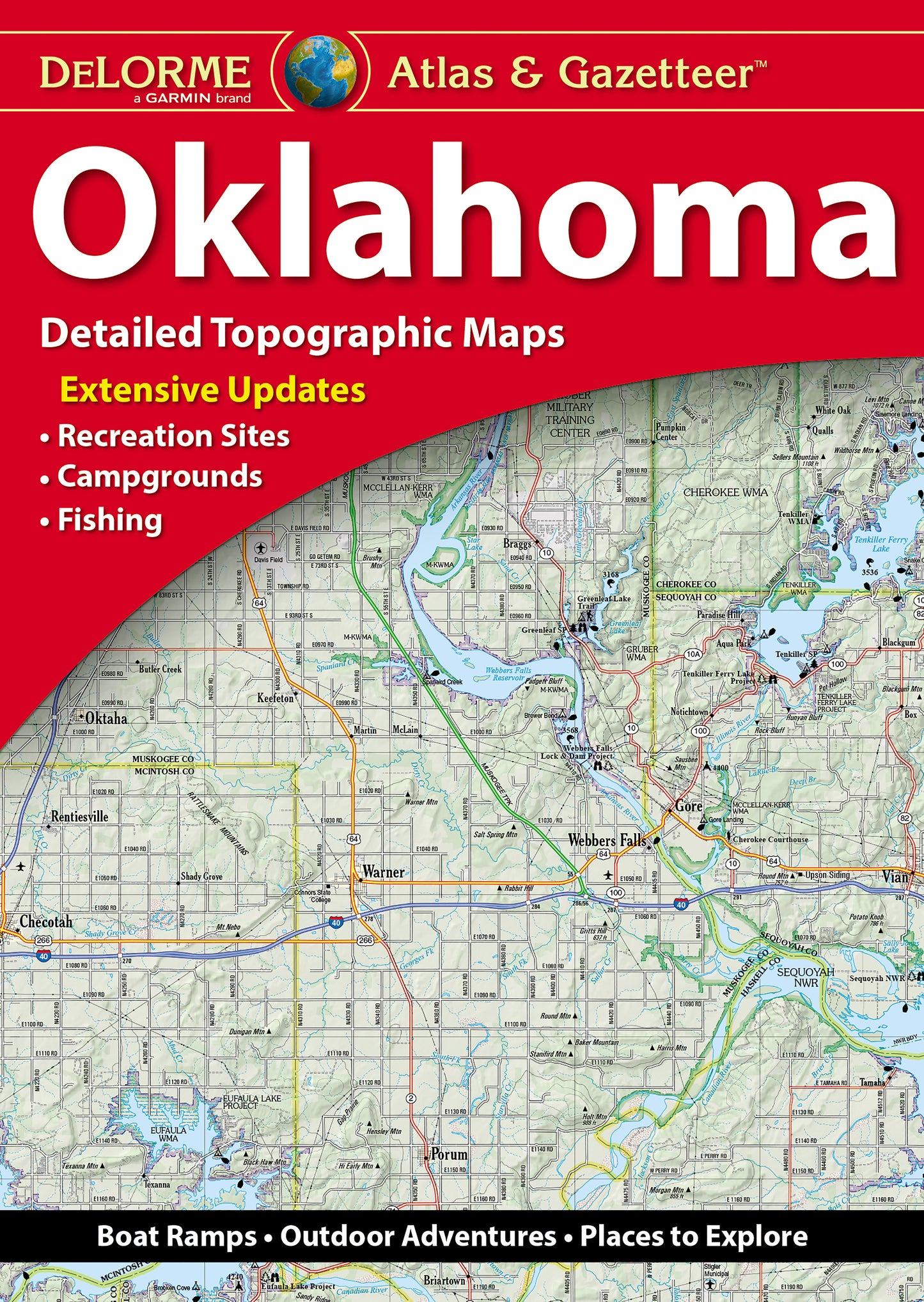
DeLorme Atlas and Gazetteer Oklahoma
Couldn't load pickup availability
Amazingly detailed and beautifully crafted, large-format paper maps (11-inches x 15.5-inches).
Topographic maps with elevation contours, major highways and roads, dirt roads, trails and land use data.
Contains information essential for any outdoor enthusiast, such as points of interest, landmarks, state and national parks, campgrounds, boat launches, golf courses, historic sites, hunting zones, canoe trips, scenic drive recommendations and more.
Perfect for sightseeing, exploring back roads, outdoor recreation and trip planning.
Features detailed topo maps of the entire state, including: Great Salt Plains State Park, Natural Falls State Park, Chickasaw National Recreation Area, Lawton, Bartlesville, Beavers Bend State Park, Wichita Mountains Wildlife Refuge, Route 66, Tulsa, Oklahoma City