MyTopo
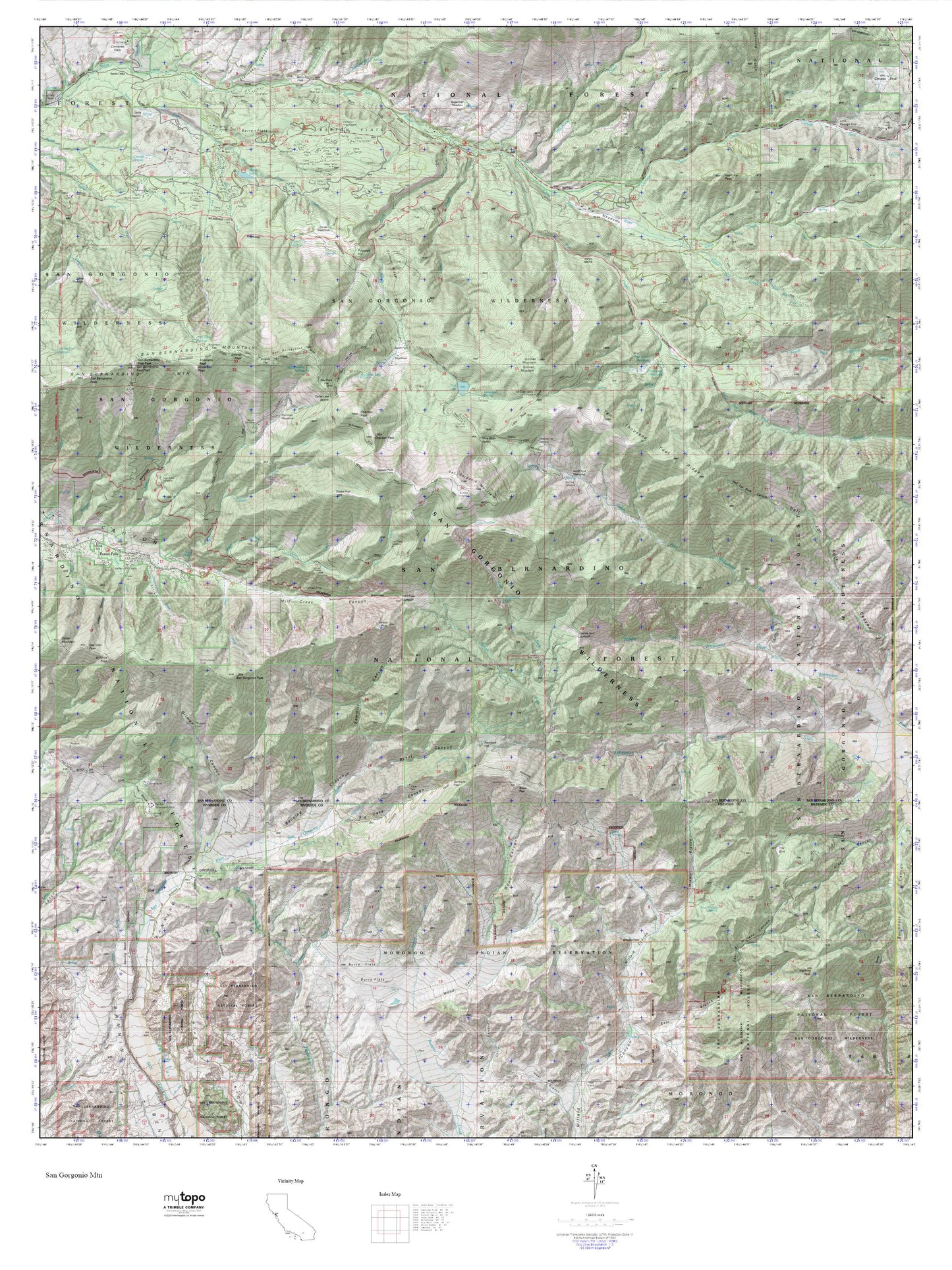
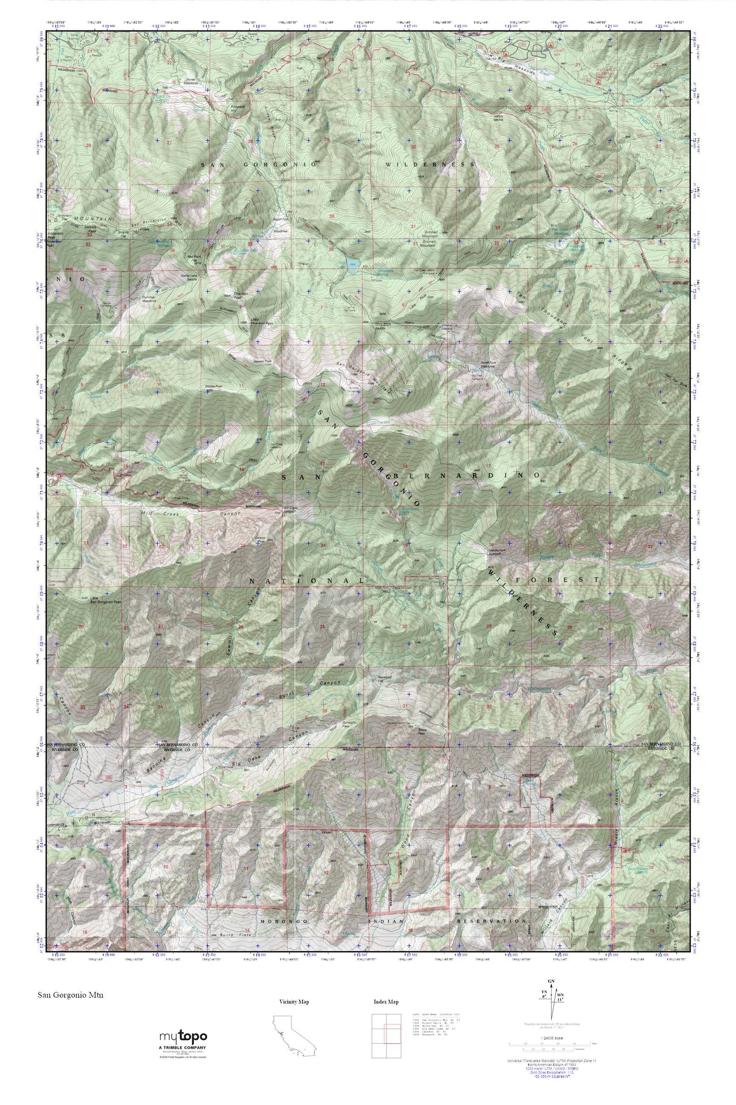
San Georgonio Mtn MyTopo Explorer Series Map
Couldn't load pickup availability
Topographic map of San Georgonio Mtn in the state of California. From the MyTopo Explorer Series.
This topo map features shaded relief and comes with UTM / MGRS and Latitude/Longitude grids.
For more than two decades, MyTopo has provided maps to the most adventurous among us.. those who love to explore our nation’s remote wilderness areas, climb our highest peaks, and trek across our vast public lands. This map is part of a curated collection of the most popular places for which MyTopo customers have designed maps. It is a “bucket list” of the most amazing places to hike, hunt, and explore.
This map contains the following named places: Alger Creek,Big Falls,Big Falls Campground,Big Falls Trailhead,Burnt Canyon,California Department of Forestry and Fire Protection Oak Glenn Conservation Camp #35,Camp Creek,Cedar Mountain,Charlton Peak,Cuchillo Peak,Dobbs Peak,Dollar Lake,Dollar Lake Saddle,Dry Lake,Dry Lake Trail,East Fork Cabin,East Fork South Fork Whitewater River,East Fork Whitewater River,Falls Creek,Falls Creek Trail,Falls Recreation Area,Fallsvale School,Fish Creek Trail,Forest Falls,Forest Falls Post Office,Forest Falls Seventh-day Adventist Church,Galena Peak,Gunsight Pass,High Creek,High Meadow Springs,Jepson Peak,KBBL-TV (Big Bear Lake),Lake Peak,Little Charlton Peak,Little San Gorgonio Peak,Lodge Canyon,Lodgepole Spring,Middle Fork Jumpoff,Middle Fork Whitewater River,Mill Creek Jumpoff,Mill Creek Mine,Mine Shaft Saddle,Mission Springs Campground,Momyer Creek,North Fork Meadows,North Fork Meadows Trail,North Fork Whitewater River,Oak Glen Conservation Camp,Oak Glen Peak,Pine Bench,Plummer Meadows,Rattlesnake Creek,Raywood Flat,Raywood Flat Trail,Red Rock Flat,San Bernardino County Fire Department Station 99 Forest Falls,San Bernardino Peak,San Gorgonio Mountain,Sawmill Canyon,Silverwood Falls,Sky High Trail,Slide Creek,Snow Creek,Snow Peak,South Fork Cabin,Ten Thousand Foot Ridge,The Tarn,Valley of the Falls,Valley of the Falls Community Church,Vivian Creek,Vivian Creek Trail,Vivian Creek Trailhead,Wanat Peak,Wilshire Peak,Wilshire Peak Trail