MyTopo
San Jacinto Peak MyTopo Explorer Series Map
Couldn't load pickup availability
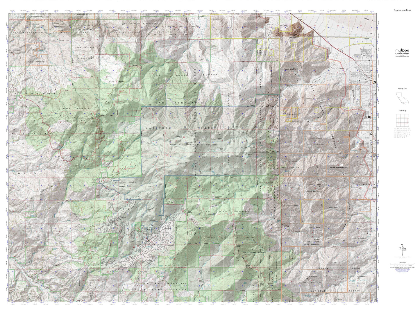
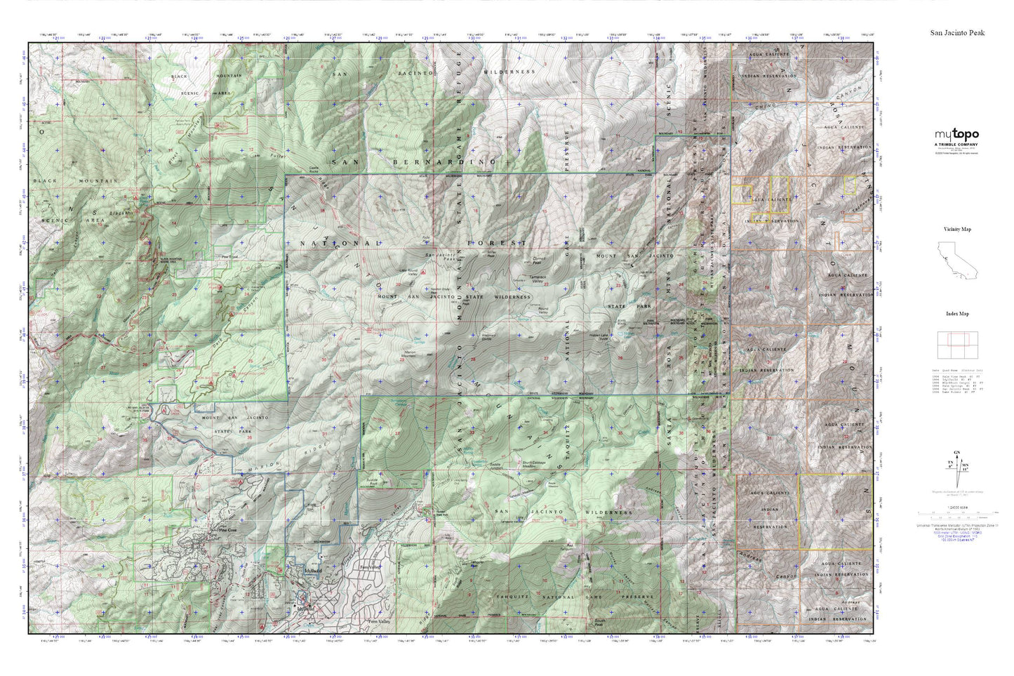
Topographic map of San Jacinto Peak in the state of California. From the MyTopo Explorer Series.
This topo map features shaded relief and comes with UTM / MGRS and Latitude/Longitude grids.
For more than two decades, MyTopo has provided maps to the most adventurous among us.. those who love to explore our nation’s remote wilderness areas, climb our highest peaks, and trek across our vast public lands. This map is part of a curated collection of the most popular places for which MyTopo customers have designed maps. It is a “bucket list” of the most amazing places to hike, hunt, and explore.
This map contains the following named places: 92549,Alandale Forest Service Facility,Andreas Falls,Black Mountain,Black Mountain Camp,Black Mountain Creek,Black Mountain Group Campground,Black Mountain Scenic Area,Black Mountain Trail,Black Mountain Truck Trail,Boulder Basin Group,Camp Azalea Trails,Caramba Camp,Castle Rocks,Chinquapin Flat,Cinco Poses Spring,Cinco Poses Trail,Cornell Peak,Dark Canyon,Dark Canyon Camp,Dark Canyon Campground,Deer Springs,Deer Springs Camp,Desert View,Dutch Flat,Evergreen Campground,Fairview Point Scenic Viewpoint,Fern Basin Campground,Fern Valley,Folly Peak,Foster 827 Dam,Foster Lake,Fuller Mill Creek,Fuller Mill Creek Camp,Fuller Mill Creek Picnic Area,Fuller Mill Creek Wild and Scenic River,Fuller Ridge,Fuller RIdge Campground,Fullermill Creek Campsite,Hall Canyon,Hall Mill 826 Dam,Halldecker Campground,Hidden Divide Natural Preserve,Hidden Fork,Hidden Lake,Hidden Lake Divide,Humber Park,Idyllwild Branch Riverside City and County Public Library,Jean Peak,Jolley Spring,KATY-FM (Idyllwild),Lake Fulmor,Lake Fulmor Picnic Area,Lawler Park,Laws Camp,Lily Rock,Little Round Valley,Little Round Valley Campground,Little Tahquitz Valley,Logan Creek,Long Valley,Long Valley Creek,Long Valley Picnic Area,Marion Creek,Marion Mountain,Marion Mountain Campground,Marion Ridge,Metate Flat,Middle Spring,Miller Peak,Mount San Jacinto State Park,Mount San Jacinto State Wilderness,Newton Drury Peak,North Fork San Jacinto Wild and Scenic River,Pine Cove,Pine Cove County Park,Pine Flat Camp,Pine Wood,Point View,Powderbox Spring,Red Tahquitz,Reeds Meadow,Riverside County Fire Department Station 23 Pine Cove,Round Valley,Round Valley Campground,Saddle Junction,San Jacinto Mountains,San Jacinto Peak,Skunk Cabbage Meadow,South Ridge,Stone Creek,Stone Creek Campground,Strawberry Cienaga,Suicide Rock,Sulphur Spring,Tahquitz Meadow,Tahquitz Peak,Tahquitz Peak Lookout,Tamarack Valley,Trailfinders Camp,Wellman Divide,Wellmans Cienaga,Wilderness Pines Campground,Willow Creek,Willow Creek Crossing