MyTopo
Mission Creek Preserve MyTopo Explorer Series Map
Couldn't load pickup availability
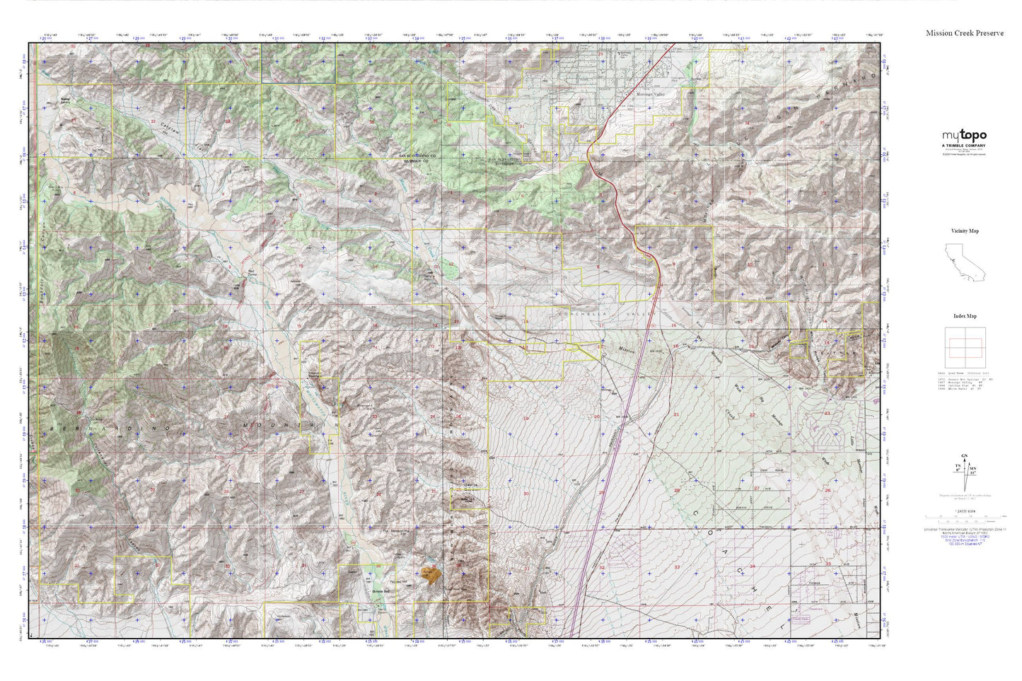
Topographic map of Mission Creek Preserve in the state of California. From the MyTopo Explorer Series.
This topo map features shaded relief and comes with UTM / MGRS and Latitude/Longitude grids.
For more than two decades, MyTopo has provided maps to the most adventurous among us.. those who love to explore our nation’s remote wilderness areas, climb our highest peaks, and trek across our vast public lands. This map is part of a curated collection of the most popular places for which MyTopo customers have designed maps. It is a “bucket list” of the most amazing places to hike, hunt, and explore.
This map contains the following named places: 92282,Big Morongo Canyon,Big Morongo Creek,Bonnie Bell,Boundary Canyon,Canyon House Ranch,Catclaw Flat,Cox Ranch,Devils Garden,Dry Morongo Creek,Dry Morongo Wash,Grape Canyon,Hog Ranch,Midway Canyon,Painted Hill,Painted Hill Quarry,Red Dome,Riverside County Fire Department Station 36 North Palm Springs Skyborne,South Fork Whitewater River,Stills Landing,Super Creek Mine,T Cross K Ranch,The Matterdome,West Fork Mission Creek,Whitewater Trout Farm