
MyTopo
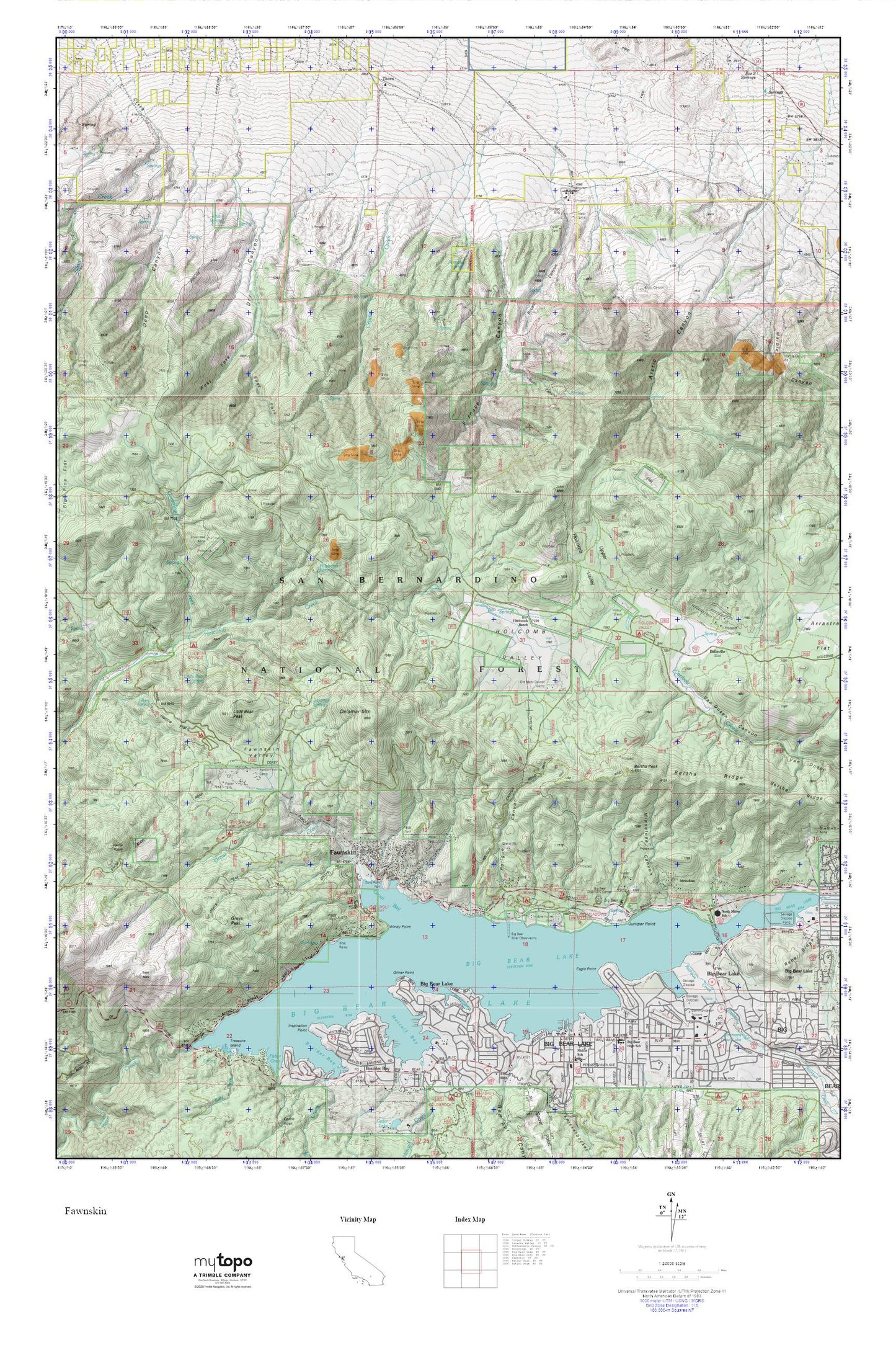
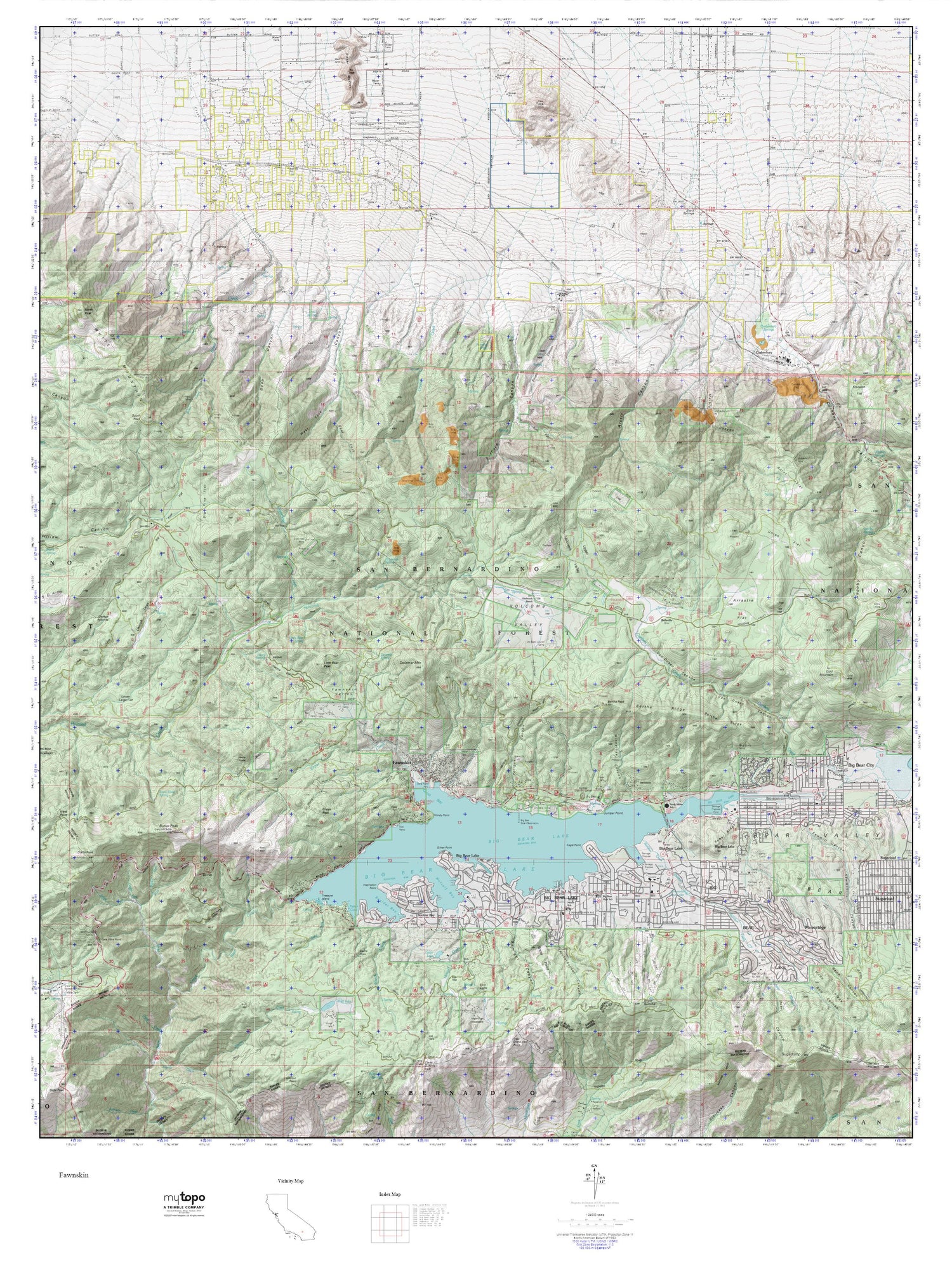
Fawnskin MyTopo Explorer Series Map
Couldn't load pickup availability
Topographic map of Fawnskin in the state of California. From the MyTopo Explorer Series.
This topo map features shaded relief and comes with UTM / MGRS and Latitude/Longitude grids.
For more than two decades, MyTopo has provided maps to the most adventurous among us.. those who love to explore our nation’s remote wilderness areas, climb our highest peaks, and trek across our vast public lands. This map is part of a curated collection of the most popular places for which MyTopo customers have designed maps. It is a “bucket list” of the most amazing places to hike, hunt, and explore.
This map contains the following named places: 92333,Arctic Canyon,Arctic Canyon Pit,Bear Valley Community Hospital,Belleville,Bertha Peak,Bertha Ridge,Big Bear Lake,Big Bear Lake Branch San Bernardino County Library,Big Bear Lake Fire Protection District Station 281,Big Bear Lake Middle School,Big Bear Lake Police Department,Big Bear Lake Post Office,Big Bear Marina,Big Bear Ranger Station,Big Bear Solar Observatory,Bousic Canyon,City of Big Bear Lake,Claudia Quarry,Cougar Crest Trailhead,Crystal Creek,Deep Canyon,Delamar Mountain,Delamar Spring,Dry Canyon,Eagle Point,East Boat Ramp,East Fork Dry Canyon,East Landing,Eastwood Landing,Fawnskin,Fawnskin Community Church,Fawnskin Post Office,Fawnskin Valley,Furnace Canyon,Furnace Spring,Gibralter Landing,Gibralter Point,Gilner Point,Grays Campsite,Grays Landing,Grays Peak,Greenland Camp,Greenlead Creek,Greenlead Mine,Grout Bay,Grout Bay Campground,Grout Bay Recreation Area,Grout Creek,Hanna Flat,Hanna Flat Campground,Hanna Rocks,Harold F Whittle Camp,Harry Spring,Harvey K Mine,Hitchcock Ranch,Hitchcock Spring,Holcomb Valley,Holcomb Valley Campground,Holloways Camp,Inspiration Point,Interlaken Shopping Center,John Bull Flat,Juniper Point,Juniper Point Marina,KBBV-AM (Big Bear Lake),Lagonita Point,Lakeview Shopping Center,Lighthouse Trailer Resort,Little Bear Peak,Little Bear Spring,Mallard Lagoon,Marble Canyon Pit,Marble Canyon Quarry,Meadow Park,Meadows Edge Picnic Area,Metcalf Bay,Metcalf Bay Landing,Minnelusa,Minnelusa Canyon,North Shore Elementary School,North Shore Landing,North Shore Recreation Area,Old Baldy Council Camp,Pine Knot Landing,Pleasure Point Landing,Poligue Canyon,Quail Spring,Rathbun Creek,Rebel Ridge,Red Ant Canyon,Red Ant Landing,San Bernardino County Fire Department Station 96 Fawnskin,Sawmill Cove Landing,Serrano Campground,Shelter Cove,Simmons Trout Lake,Thorn,Upper Holcomb Valley,West Fork Dry Canyon,West Public Boat Ramp,Wilbur Grave,Wild Rose Canyon,Windy Point,Woodland Trailhead