MyTopo
Mount of the Holy Cross MyTopo Explorer Series Map
Couldn't load pickup availability
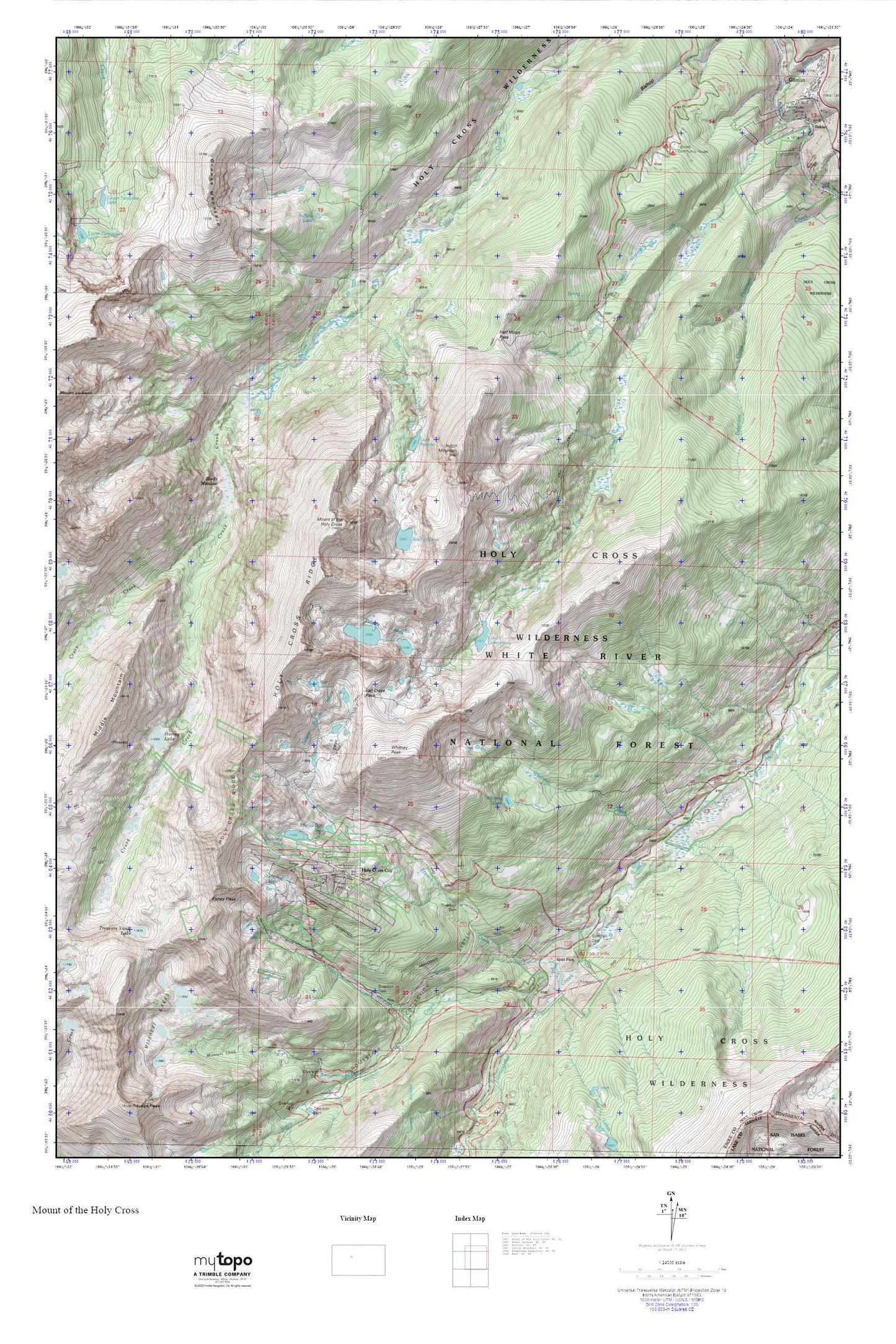
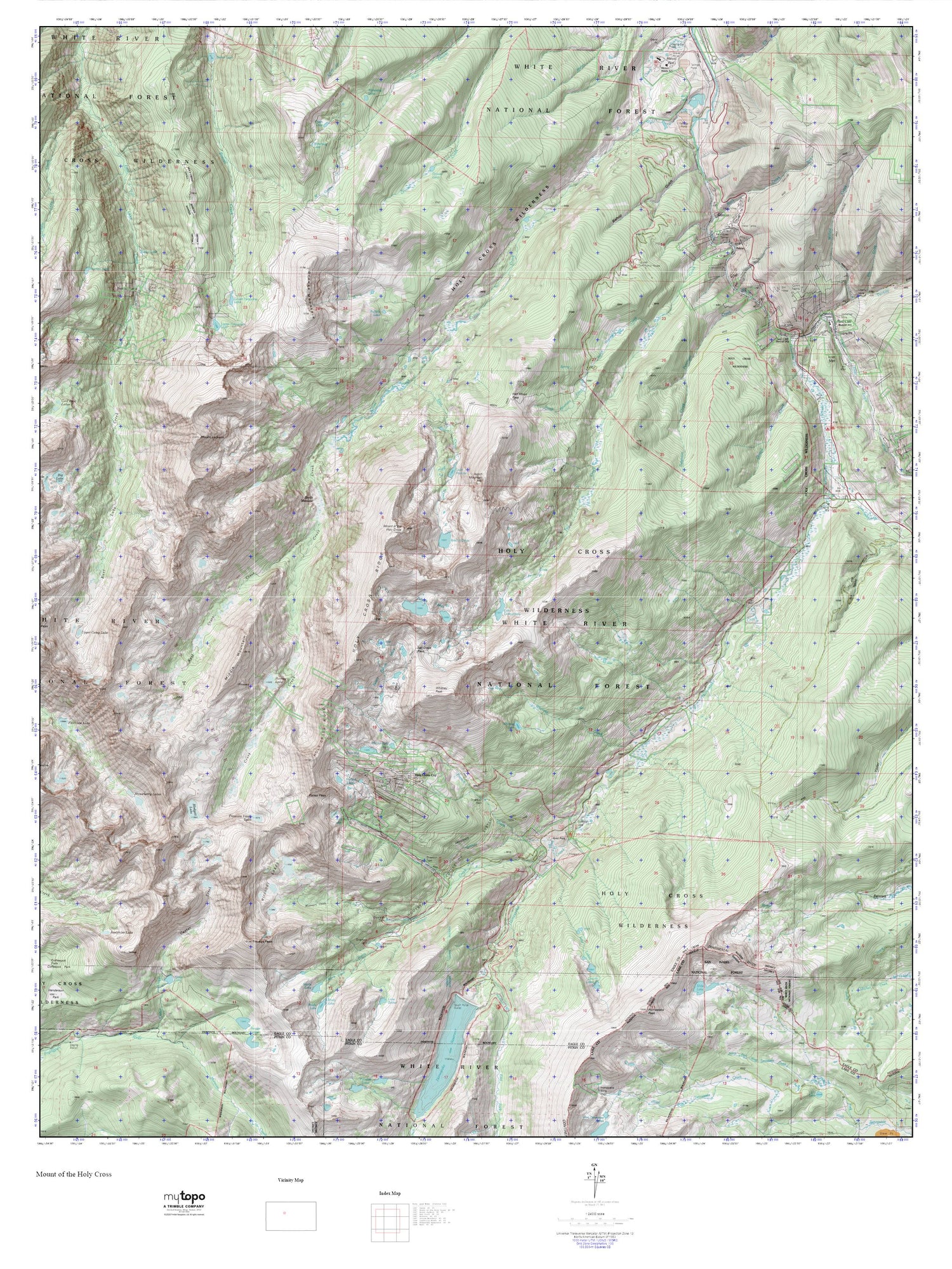
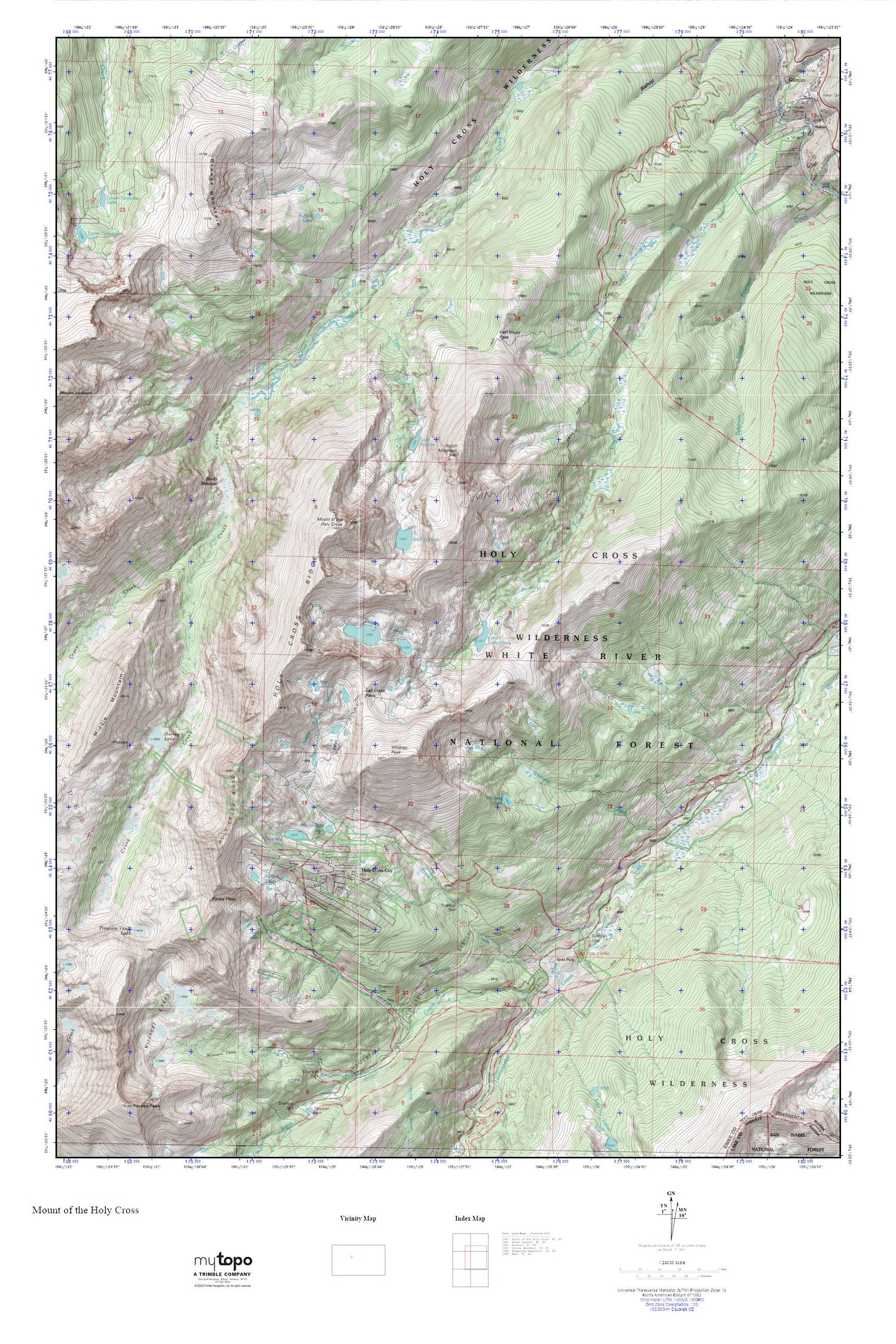
Topographic map of Mount of the Holy Cross in the state of Colorado. From the MyTopo Explorer Series.
This topo map features shaded relief and comes with UTM / MGRS and Latitude/Longitude grids.
For more than two decades, MyTopo has provided maps to the most adventurous among us.. those who love to explore our nation’s remote wilderness areas, climb our highest peaks, and trek across our vast public lands. This map is part of a curated collection of the most popular places for which MyTopo customers have designed maps. It is a “bucket list” of the most amazing places to hike, hunt, and explore.
This map contains the following named places: 81645,Bowl of Tears,Buffalo Lake,Cleveland Lake,East Cross Creek,Fall Creek,Fall Creek Pass,Fall Creek Trail,Fancy Creek,Fancy Lake,Fancy Pass,French Creek,Glengarry Mine,Gold Park,Gold Park Campground,Gold Park Cemetery,Grouse Mountain,Half Moon Campground,Half Moon Pass,Half Moon Trail,Half Moon Trailhead,Harvey Lake,Holy Cross City,Holy Cross Ridge,Holy Cross Wilderness,Hunky Dory Lake,Lake Constantine,Lake Patricia,Middle Mountain,Missouri Creek,Missouri Lakes,Missouri Pass,Morning Mine,Mount of the Holy Cross,Mulhall Lakes,Newman Mine,Notch Mountain,Notch Mountain Creek,Reeds Meadow,Rock Creek,Seven Sisters Lakes,Tigiwon Community House,Tigiwon Post Office,Treasure Vault Lake,Tuhare Lakes,West Cross Creek,Whitney Creek,Whitney Lake,Whitney Peak