MyTopo
Teneya Lake MyTopo Explorer Series Map
Couldn't load pickup availability
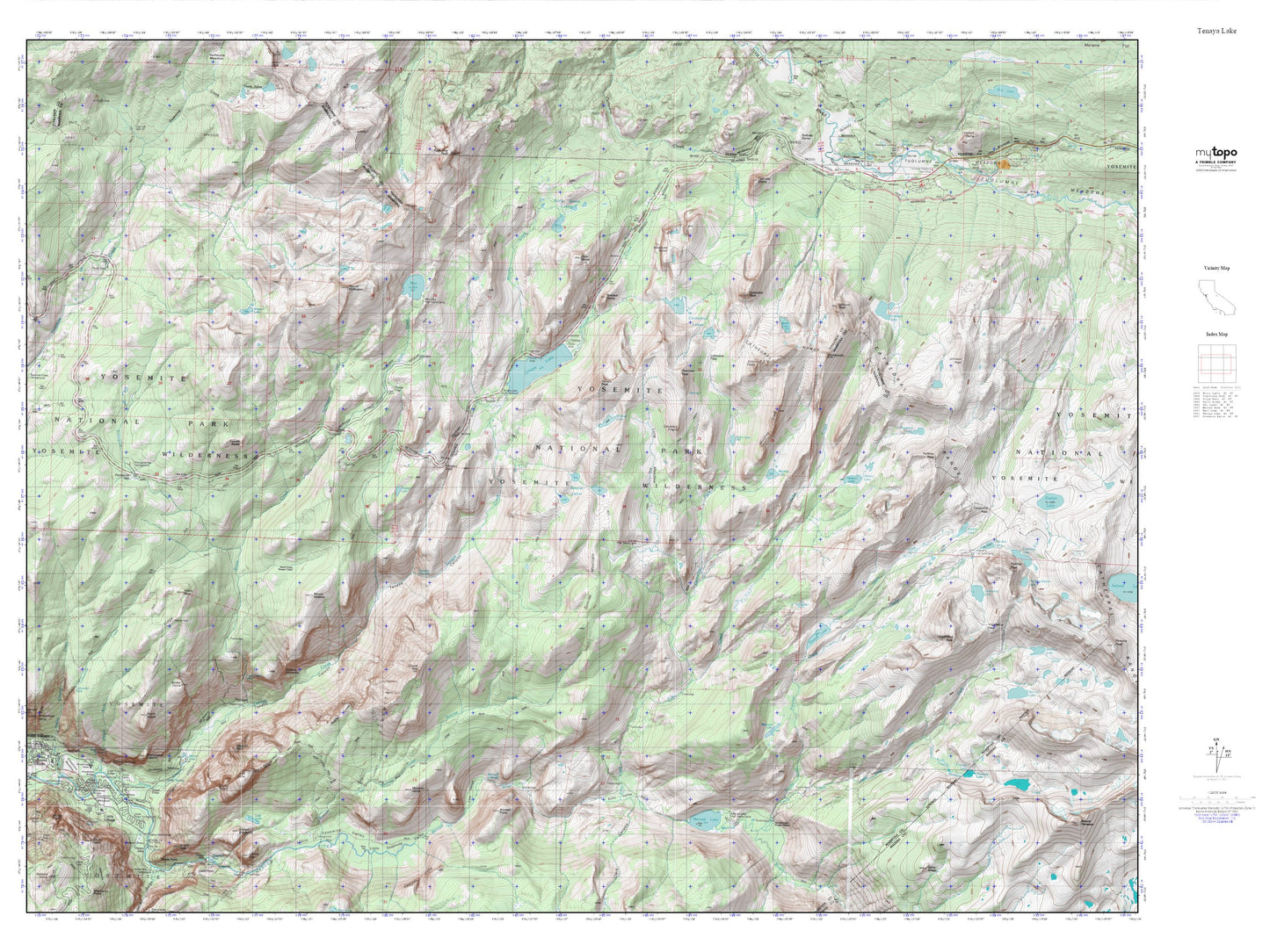
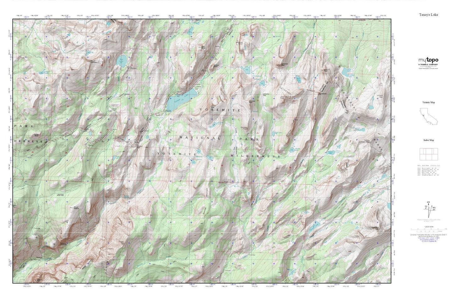
Topographic map of Teneya Lake in the state of California. From the MyTopo Explorer Series.
This topo map features shaded relief and comes with UTM / MGRS and Latitude/Longitude grids.
For more than two decades, MyTopo has provided maps to the most adventurous among us.. those who love to explore our nation’s remote wilderness areas, climb our highest peaks, and trek across our vast public lands. This map is part of a curated collection of the most popular places for which MyTopo customers have designed maps. It is a “bucket list” of the most amazing places to hike, hunt, and explore.
This map contains the following named places: Basket Dome,Budd Lake,Cathedral Fork,Cathedral Lakes,Cathedral Pass,Cathedral Peak,Clouds Rest,Cockscomb,Columbia Finger,Coyote Rocks,Echo Lake,Echo Peaks,Emeric Creek,Emeric Lake,Hidden Lake,Hoffmann Creek,Indian Ridge,Indian Rock,Long Meadow,Matthes Crest,Matthes Lake,May Lake,May Lake High Sierra Camp,Mildred Lake,Mount Hoffmann,Mount Watkins,Murphy Creek,Nelson Lake,Olmstead Point,Porcupine Creek,Pywiack Cascade,Pywiack Dome,Quarter Domes,Snow Creek Falls,Snow Creek Ranger Cabin,Snow Flat,Sunrise and Tuolumne Meadows Trail,Sunrise High Sierra Camp,Sunrise Lakes,Sunrise Mountain,Tenaya Lake,Tenaya Lake and Tuolumne Meadows Trail,Tenaya Lake Campground,Tenaya Peak,The Pinnacles,Tresidder Peak,Unicorn Peak,Watkins Pinnacles,Wegner Lake