
MyTopo
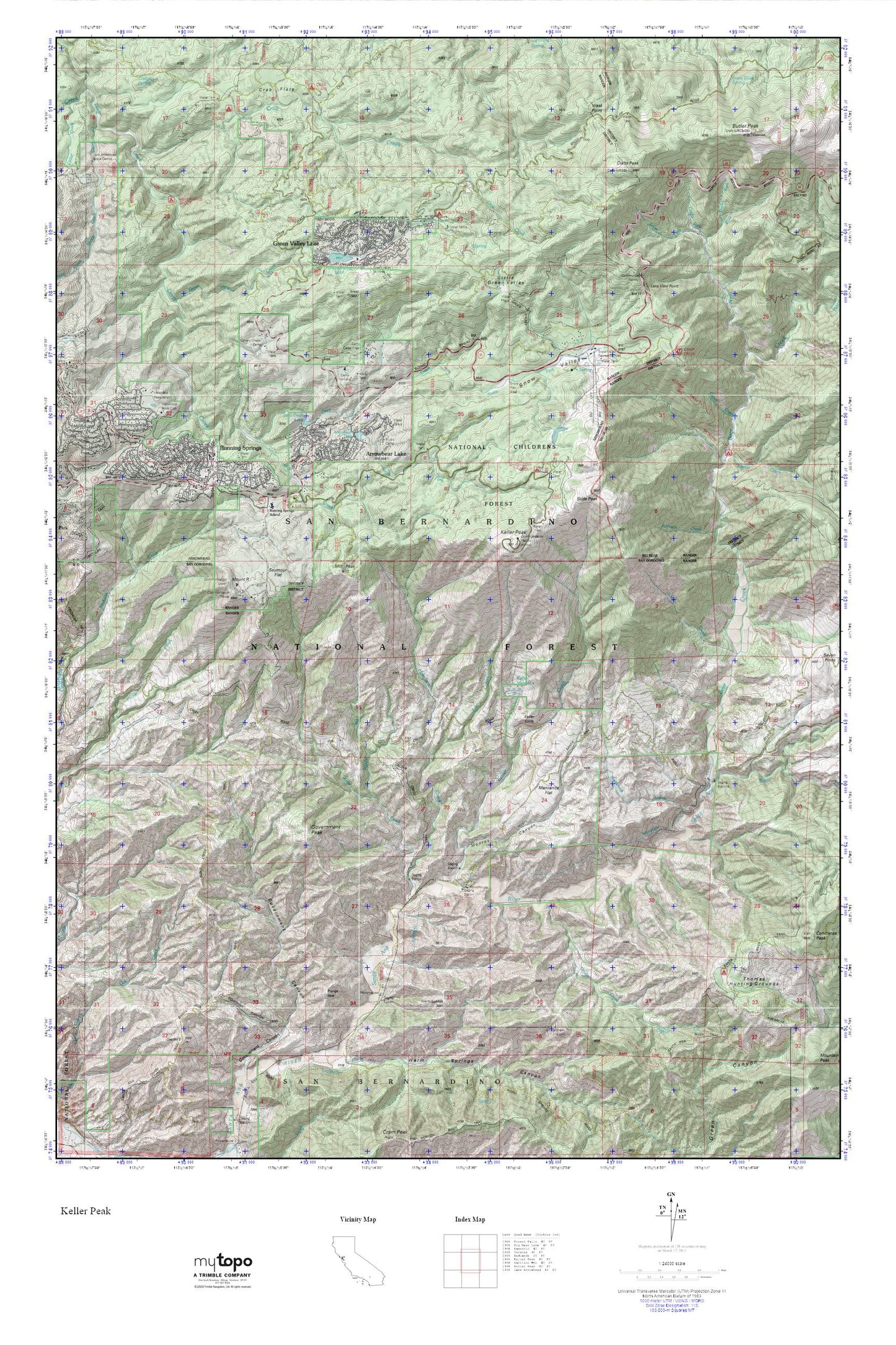
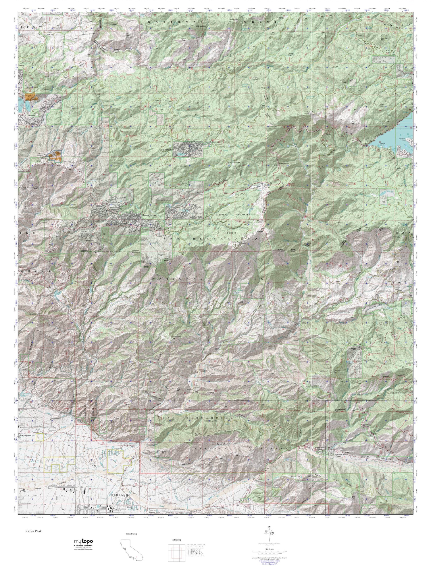
Keller Peak MyTopo Explorer Series Map
Couldn't load pickup availability
Topographic map of Keller Peak in the state of California. From the MyTopo Explorer Series.
This topo map features shaded relief and comes with UTM / MGRS and Latitude/Longitude grids.
For more than two decades, MyTopo has provided maps to the most adventurous among us.. those who love to explore our nation’s remote wilderness areas, climb our highest peaks, and trek across our vast public lands. This map is part of a curated collection of the most popular places for which MyTopo customers have designed maps. It is a “bucket list” of the most amazing places to hike, hunt, and explore.
This map contains the following named places: 92341,92382,Alder Creek,Alder Creek Trail,Arrowbear Dam,Arrowbear Lake,Arrowbear Lake Fire Department Station 271,Arrowbear Lake Post Office,Arrowbear Reservoir,Bear Creek,Bear Creek Campground,Breakneck Creek,Butler Peak,Butter Fork,California Highway Patrol - Arrowhead,Camp Awahanee,Camp Cedar Crest,Camp Conifer,Camp Creek,Camp Creek Trailhead,Camp Wintaka,Charles Hoffman Elementary School,Crab Creek,Crab Flats,Crafts Fork,Crafts Peak,Crystal Creek,Deep Creek Lake,Deer Creek,Deer Lick Station,Dishpan Spring,Dry Creek,East Fork Hemlock Creek,Fishermans Campground,Government Canyon Trail,Government Peak,Green Valley Campground,Green Valley Creek,Green Valley Lake,Green Valley Lake 804 Dam,Green Valley Lake Community Church,Green Valley Lake Post Office,Green Valley Recreation Area,Green Valley Ski Area,Green Valley Trail,Helendale Reservation,Hemlock Creek,Hollywood Boys Club,Inspiration Point,Johnson Creek,Keller Cliffs,Keller Creek,Keller Meadows,Keller Peak,Keller Peak Lookout,KUOR-FM (Redlands),Lake View Point,Little Green Valley,Manzanita Flat,Middle Fork Alder Creek,Mill Peak,Monroe Canyon,Mount R,Music Camp,National Childreaus Forest,North Fork Bear Creek,North Fork Deep Creek,Rainbow Lake,Running Springs,Running Springs Branch San Bernardino County Library,Running Springs Census Designated Place,Running Springs Fire Department Station 50,Running Springs Fire Department Station 51,Running Springs Post Office,Running Springs Station,San Bernardino County Fire Department Station 95 - Green Valley Lake,Santa Ana Divide Trail,Seymour Flat,Shady Cove Group Campground,Sheep Creek,Siberia Creek,Siberia Creek Campground,Siberia Creek Trail,Slide Creek,Slide Lake Campground,Slide Peak,Snow Fork,Snow Slide Spring,Snow Valley,Snow Valley Recreation Area,Snow Valley Ski Area,South Fork Deep Creek,Tent Peg Group,Thomas Hunting Grounds,West Point