MyTopo
Porcupine Mountains MyTopo Explorer Series Map
Couldn't load pickup availability
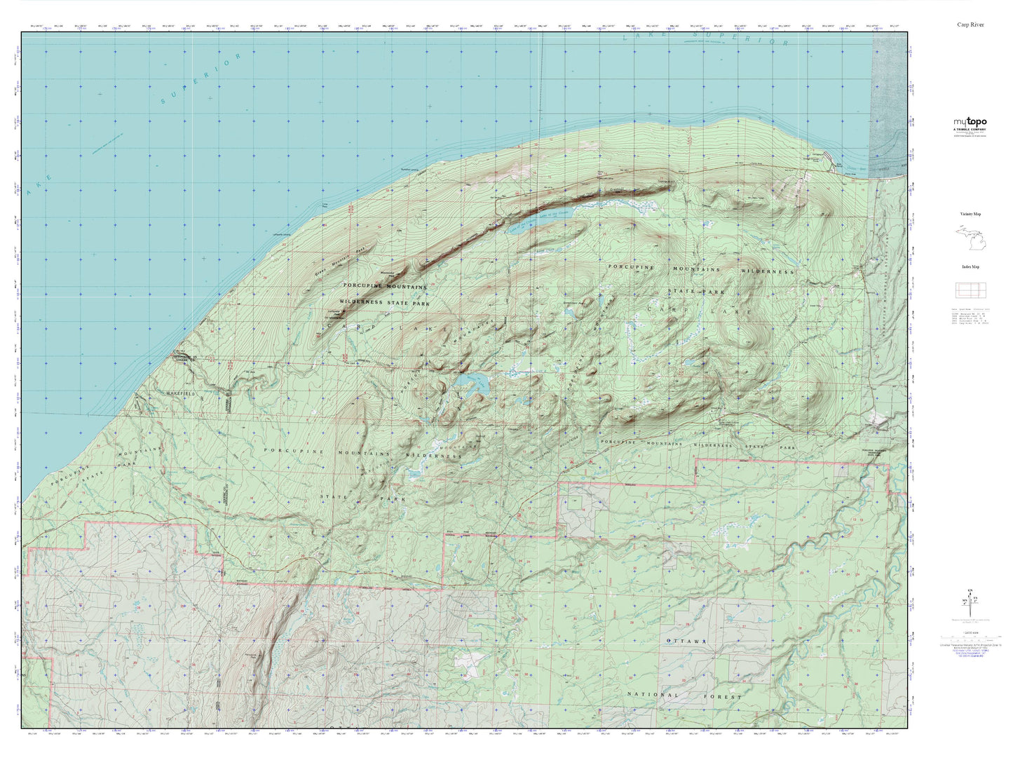
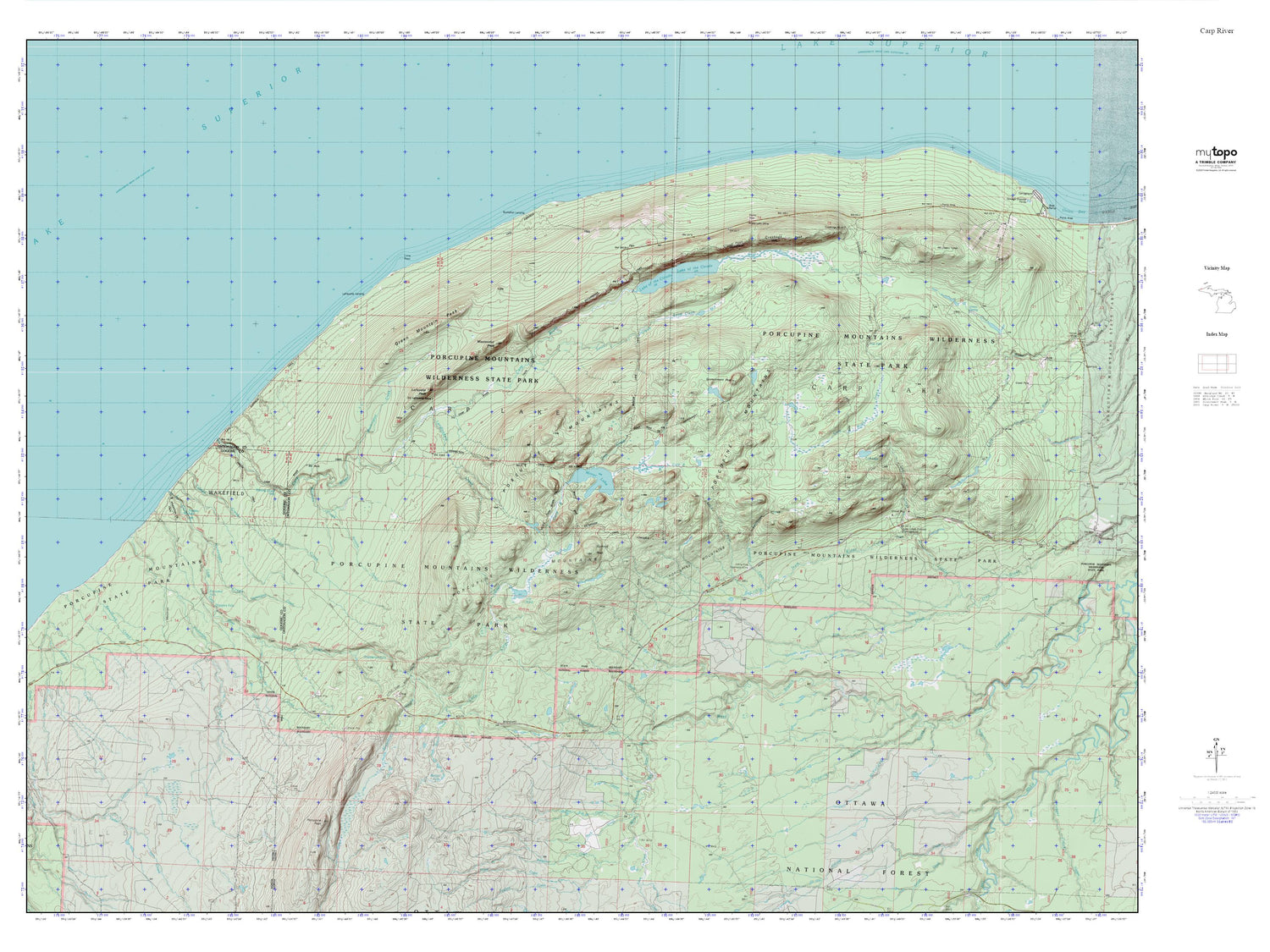
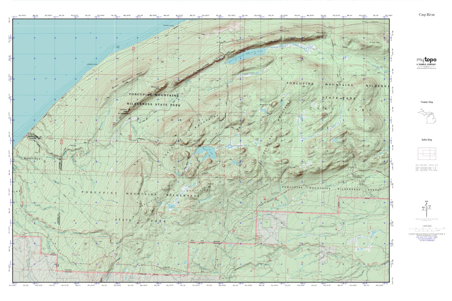
Topographic map of Porcupine Mountains in the state of Michigan. From the MyTopo Explorer Series.
This topo map features shaded relief and comes with UTM / MGRS and Latitude/Longitude grids.
For more than two decades, MyTopo has provided maps to the most adventurous among us.. those who love to explore our nation’s remote wilderness areas, climb our highest peaks, and trek across our vast public lands. This map is part of a curated collection of the most popular places for which MyTopo customers have designed maps. It is a “bucket list” of the most amazing places to hike, hunt, and explore.
This map contains the following named places: Bathtub Falls,Beaver Creek,Big Carp Falls,Blowdown Creek,Extension Creek,Government Peak,Green Mountain Peak,Greenstone Falls,Konteka Creek,LaFayette Landing,LaFayette Mine,LaFayette Peak,Lake of the Clouds,Landlookers Creek,Lily Pond,Lone Rock,Mirror Lake,Miscowawbic Peak,Porcupine Mountains,Scott Creek,Section 17 Cabin,Shining Cloud Falls,Summit Peak,Trail Creek,Wabeno Creek,Washington Creek,White Pine Camp and Picnic Area,White Pine Extension Mine