
MyTopo
Custom HH Land Nav North MyTopo Explorer Series Map
Couldn't load pickup availability
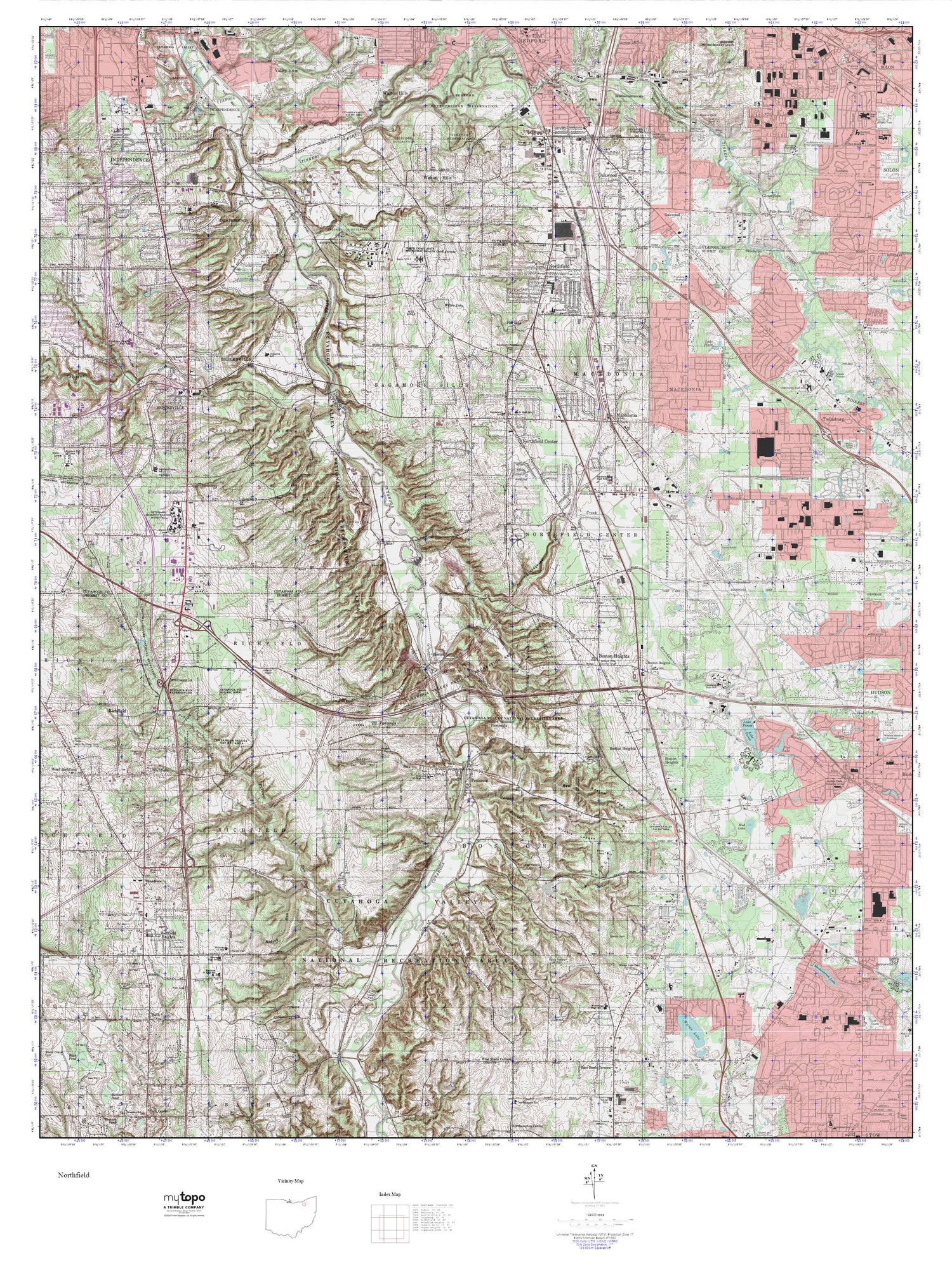
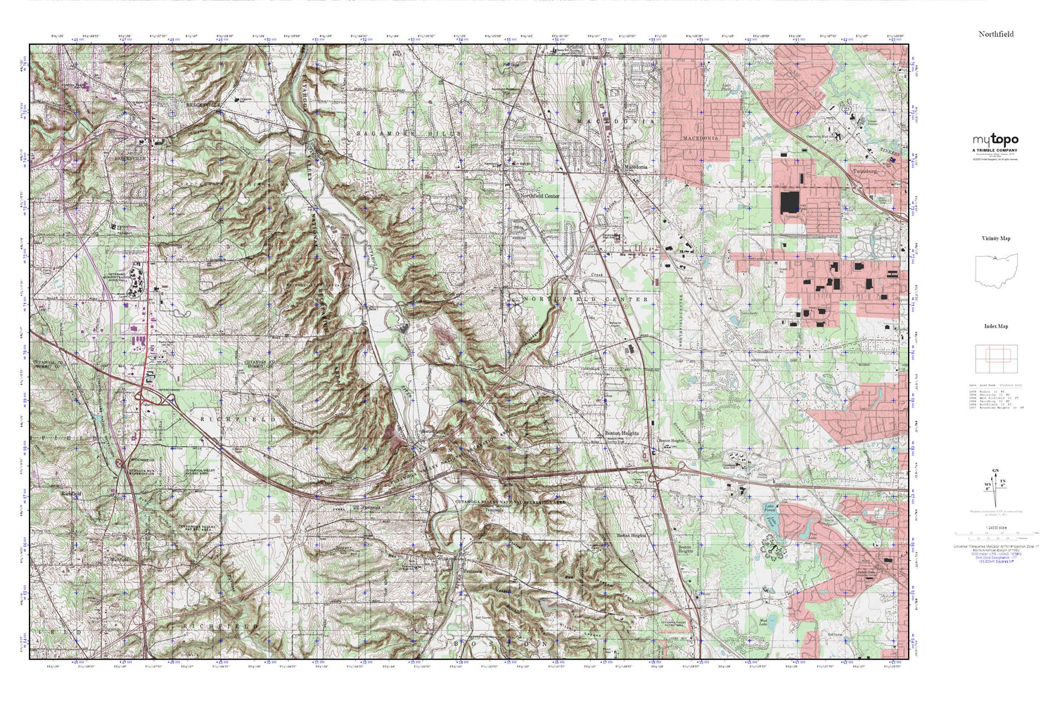
Topographic map of Custom HH Land Nav North in the state of Ohio. From the MyTopo Explorer Series.
This topo map features shaded relief and comes with UTM / MGRS and Latitude/Longitude grids.
For more than two decades, MyTopo has provided maps to the most adventurous among us.. those who love to explore our nation’s remote wilderness areas, climb our highest peaks, and trek across our vast public lands. This map is part of a curated collection of the most popular places for which MyTopo customers have designed maps. It is a “bucket list” of the most amazing places to hike, hunt, and explore.
This map contains the following named places: 44056,44067,44264,Alexander,All Saints Cemetery,Applecreek Village,Blue Hen Falls,Boston,Boston Heights,Boston Heights Fire Department,Boston Heights Police Department,Boston Hills Country Club,Boston Ledges,Boston Lock,Boston Mills Cemetery,Boston Post Office,Boston Run,Brandywine,Brandywine Creek,Brandywine Falls,Brandywine Golf Club,Brecksville Reservation,Brecksville Stables,Brecksville Station,Brecksville-Northfield High Level Bridge,Brentwood Ambulatory Care Center Heliport,Buttermilk Falls,Camp Butler Lake,Camp Butler Lake Dam,Camp Manatoc,Capital Square Industrial Park,Cedar Grove Cemetery,Chaffee,Chippewa Creek,Chippewa Elementary School,Chippewa Ford Field,Chippewa Picnic Area,Chittendens Corners,City of Macedonia,Coliseum Heliport,Cuyahoga Valley National Park,Deep Lock,Dewey Cemetery,Dickerson Run,Echo Hills Lake Number One,Echo Hills Lake Number One Dam,Emmons Corner,Fairview Cemetery,Fell Lake,Freeway Industrial Park,Grannys Run,Haskell Run,Hawthornden State Hospital,Highland Industrial Park,Highland Pointe Industrial Park,Indian Creek,Jaite,Jaite Mill Historic District,Jaite Post Office,Kendall Lake,Lake Litchfield,Lake Litchfield Dam,Langes Run,Ledgeview Elementary School,Ledgewood Camp,Ledgewood Mobile Home Park,Lee Eaton Elementary School,Little York,Macedonia,Macedonia Fire Department,Mother of Sorrows Church,Nordonia High School,Nordonia Middle School,Northcoast Behavioral Healthcare,Northfield,Northfield - Macedonia Cemetery,Northfield Center,Northfield Center Fire Department,Northfield Elementary School,Northfield Ledge Shopping Center,Northfield Park,Northfield Park Emergency Medical Services,Northfield Post Office,Northfield Square Shopping Center,Northfield Village Fire Department,Oak Grove Picnic Area,Ottawa Point Reserved Picnic Area,Peninsula,Peninsula Post Office,Peninsula United Methodist Church,Peninsula Village Historic District,Plateau Picnic Area,Richfield Coliseum,Riding Run,Ritchie Ledges,Ritchie Run,Roll and Hold Industrial Park,Rushwood Elementary School,Saalfield Pond Dam Number One,Saalfield Pond Number One,Sagamore Grove Picnic Area,Sagamore Hills,Sagamore Hills Hospital,Sagamore Hills Medical Center,Sagamore Hills Police Department,Sagamore Run,Sagamore Square Shopping Center,Salt Run,Slipper Run,Stanford Run,Station Road Bridge,Strattons Heliport,Stumpy Basin,Township of Boston,Township of Northfield Center,Township of Sagamore Hills,Valley Fire District Station 1,Village of Boston Heights,Village of Northfield,Village of Peninsula,Village of Peninsula Police Department,Virginia Kendall Park,Virginia Kendall Park Lake Dam,Wallin Creek,Wheelock,Willow Lake,Woodridge Intermediate Elementary School


