MyTopo
Snowyside Peak MyTopo Explorer Series Map
Couldn't load pickup availability
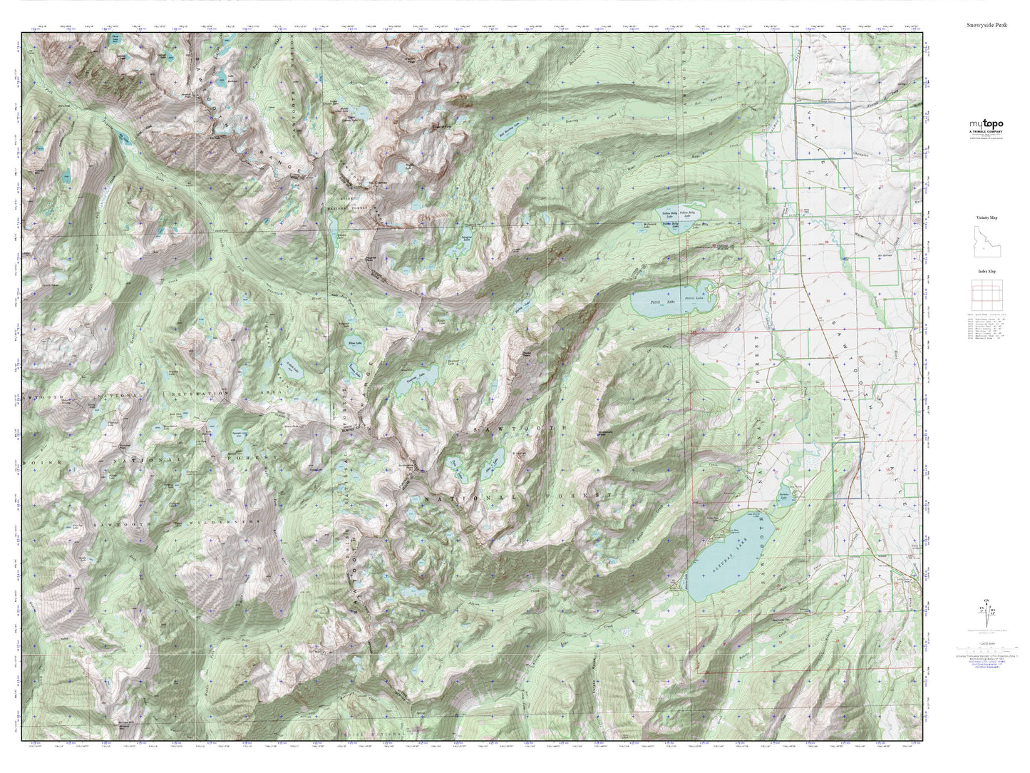
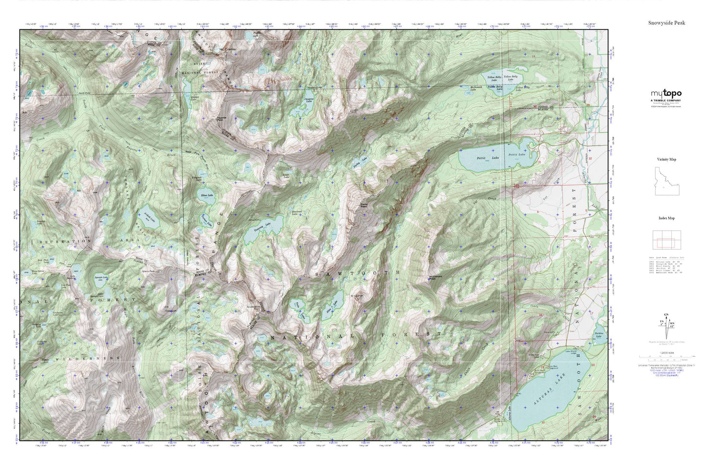
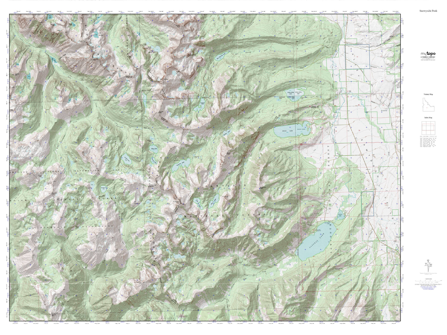
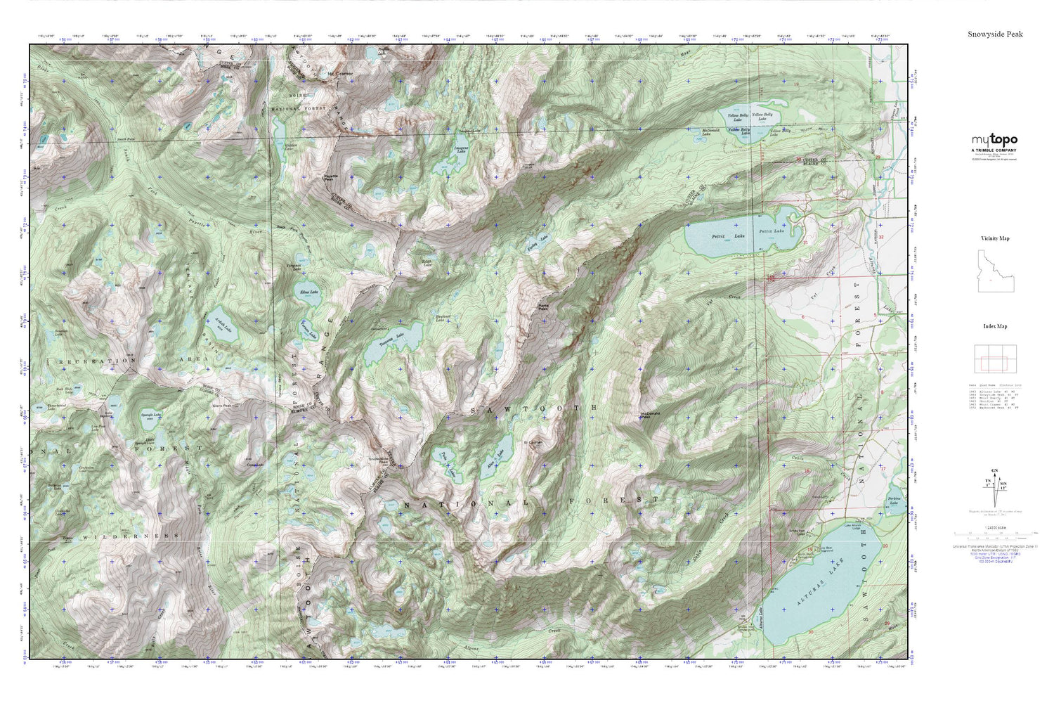
Topographic map of Snowyside Peak in the state of Idaho. From the MyTopo Explorer Series.
This topo map features shaded relief and comes with UTM / MGRS and Latitude/Longitude grids.
For more than two decades, MyTopo has provided maps to the most adventurous among us.. those who love to explore our nation’s remote wilderness areas, climb our highest peaks, and trek across our vast public lands. This map is part of a curated collection of the most popular places for which MyTopo customers have designed maps. It is a “bucket list” of the most amazing places to hike, hunt, and explore.
This map contains the following named places: Alice Lake,Ardeth Lake,Benedict Creek,Bowknot Lake,Camp Lake,Confusion Lake,Edith Lake,Edna Lake,El Capitan,Farley Lake,Flytrip Creek,Glens Peak,Heart Lake,Hidden Lake,Imogene Lake,Lake Ingeborg,Little Spangle Lake,Low Pass Lake,McDonald Lake,McDonald Peak,Parks Peak,Payette Peak,Pettit Lake,Rock Slide Lake,Smith Falls,Snowyside Peak,Spangle Lake,Spangle Lakes,Surprise Lake,Tenlake Basin,Tenlake Creek,Timpa Lake,Toxaway Lake,Twin Lakes,Vernon Lake,Virginia Lake,Yellow Belly Lake