
MyTopo
Big Marvine Peak MyTopo Explorer Series Map
Couldn't load pickup availability
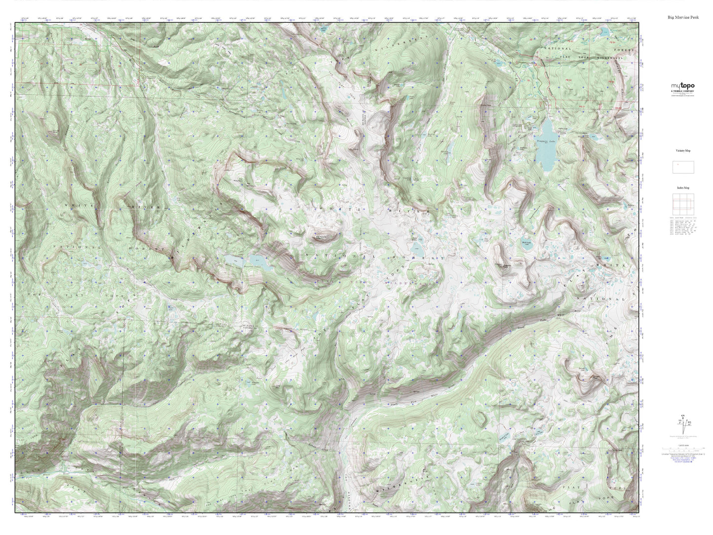
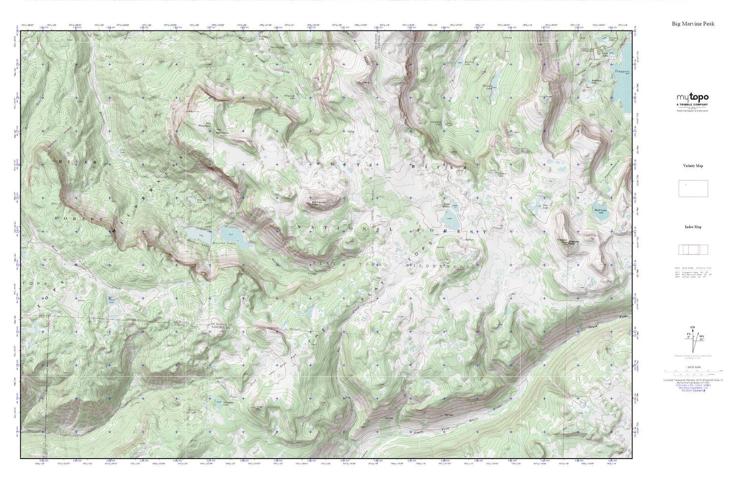
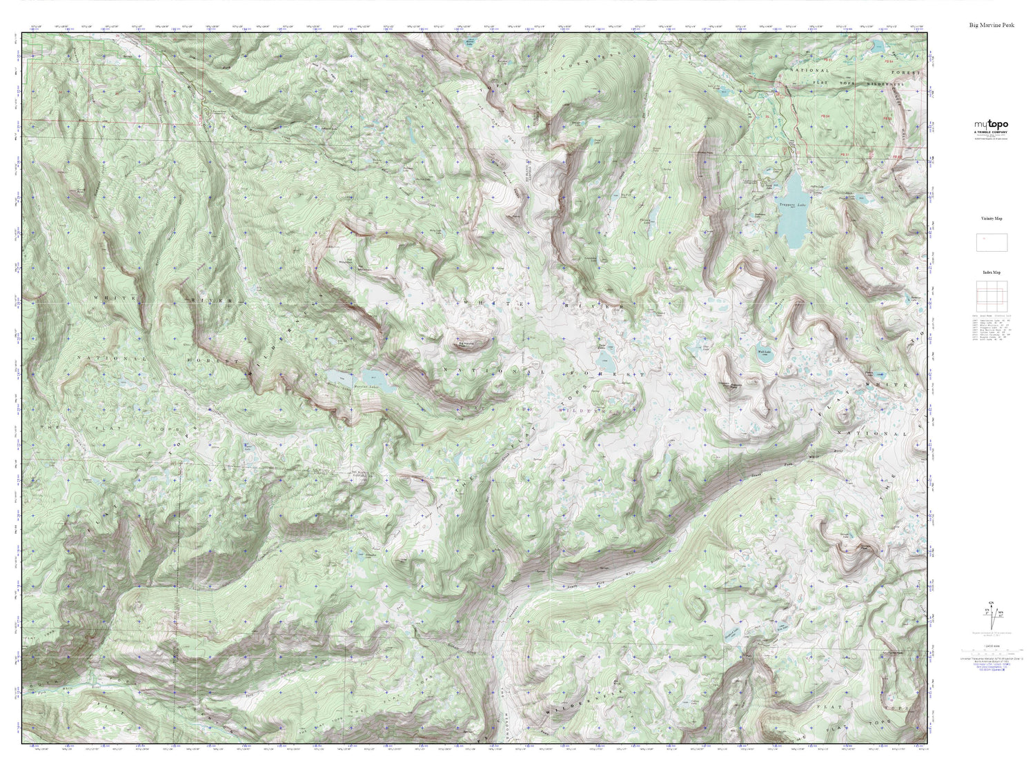
Topographic map of Big Marvine Peak in the state of Colorado. From the MyTopo Explorer Series.
This topo map features shaded relief and comes with UTM / MGRS and Latitude/Longitude grids.
For more than two decades, MyTopo has provided maps to the most adventurous among us.. those who love to explore our nation’s remote wilderness areas, climb our highest peaks, and trek across our vast public lands. This map is part of a curated collection of the most popular places for which MyTopo customers have designed maps. It is a “bucket list” of the most amazing places to hike, hunt, and explore.
This map contains the following named places: Big Marvine Peak,Clinard Lake,Flat Tops Wilderness,Florence Lake,Gwendolen Lake,Horseshoe Lake,Lost Solar Park,Marvine Lakes,Mary Loch Lake,Oyster Lake,Pine Isle Lake,Rat Mountain,Slide Lake,Star Lake,The Flat Tops,Timber Mountain,Twin Lakes