MyTopo
Mount Marcy MyTopo Explorer Series Map
Couldn't load pickup availability
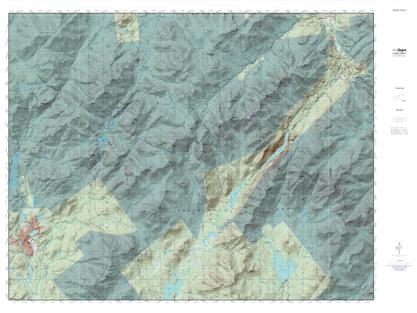
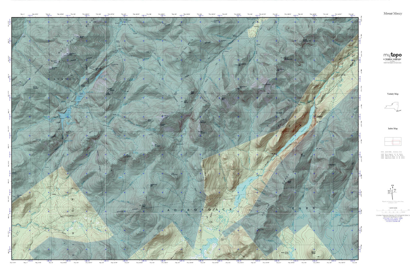
Topographic map of Mount Marcy in the state of New York. From the MyTopo Explorer Series.
This topo map features shaded relief and comes with UTM / MGRS and Latitude/Longitude grids.
For more than two decades, MyTopo has provided maps to the most adventurous among us.. those who love to explore our nation’s remote wilderness areas, climb our highest peaks, and trek across our vast public lands. This map is part of a curated collection of the most popular places for which MyTopo customers have designed maps. It is a “bucket list” of the most amazing places to hike, hunt, and explore.
This map contains the following named places: 12943,Algonquin Peak,Allen Brook,Allen Mountain,Armstrong Mountain,Avalanche Lake,Avalanche Mountain,Avalanche Pass,Bartlett Ridge,Basin Brook,Basin Mountain,Beaver Point,Blake Peak,Boundary Peak,Bushnell Falls,Calamity Mountain,Calamity Pond,Caribou Pass,Caribou Shelter,Cedar Brook,Chicken Coop Brook,Cliff Mountain,Cold Brook,Colvin Range,Crystal Brook,Cy Beedes Ledge,Dividing Ridge Trail,Elk Lake Marcy Trail,Feldspar Brook,Flowed Lands,Four Corners,Gooseberry Mountain,Gothics,Gray Peak,Hanging Spear Falls,Haystack Brook,Herbert Brook,Hopkins Trail,Indian Falls,Iroquois Peak,Lake Arnold,Lake Colden,Lake Tear of the Clouds,Little Haystack,Little Marcy,Little Nippletop,Livingston Pond,Lower Asuable Lake,Lower Twin Brook,MacIntyre Mountains,Marcy Brook,Marcy Landing,Marcy Swamp,McDonnel Mountain,Moss Pond,Mount Colden,Mount Colvin,Mount Haystack,Mount Marcy,Mount Marshall,Mount Redfield,Mount Skylight,Otis Ledge,Panorama Bluff,Panther Gorge,Phelps Trail,Pinnacle,Point Balk,Range Trail,Saddleback Mountain,Sawteeth,Schofield Cobble,Shanty Brook,Shorey Short Cut,Skylight Brook,Slant Rock,Stillwater Inlet,T R Mountain,Table Top Mountain,Teakettle Brook,The Carry,Uphill Brook,Upper Ausable Lake,Upper Twin Brook,Upper Wolfjaw Mountain,Van Hoevenberg Trail