MyTopo
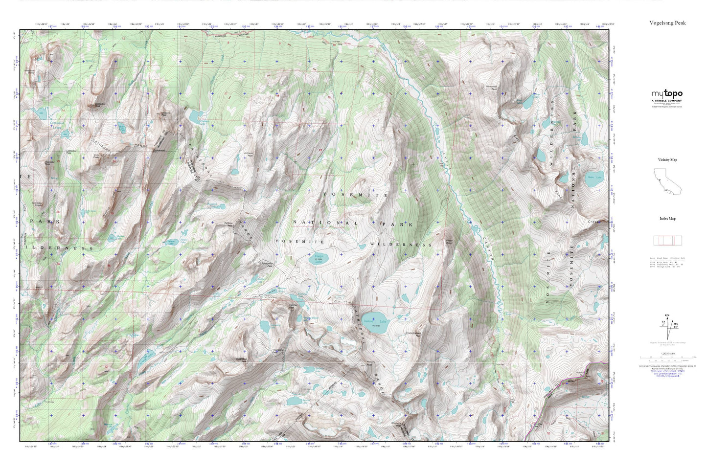
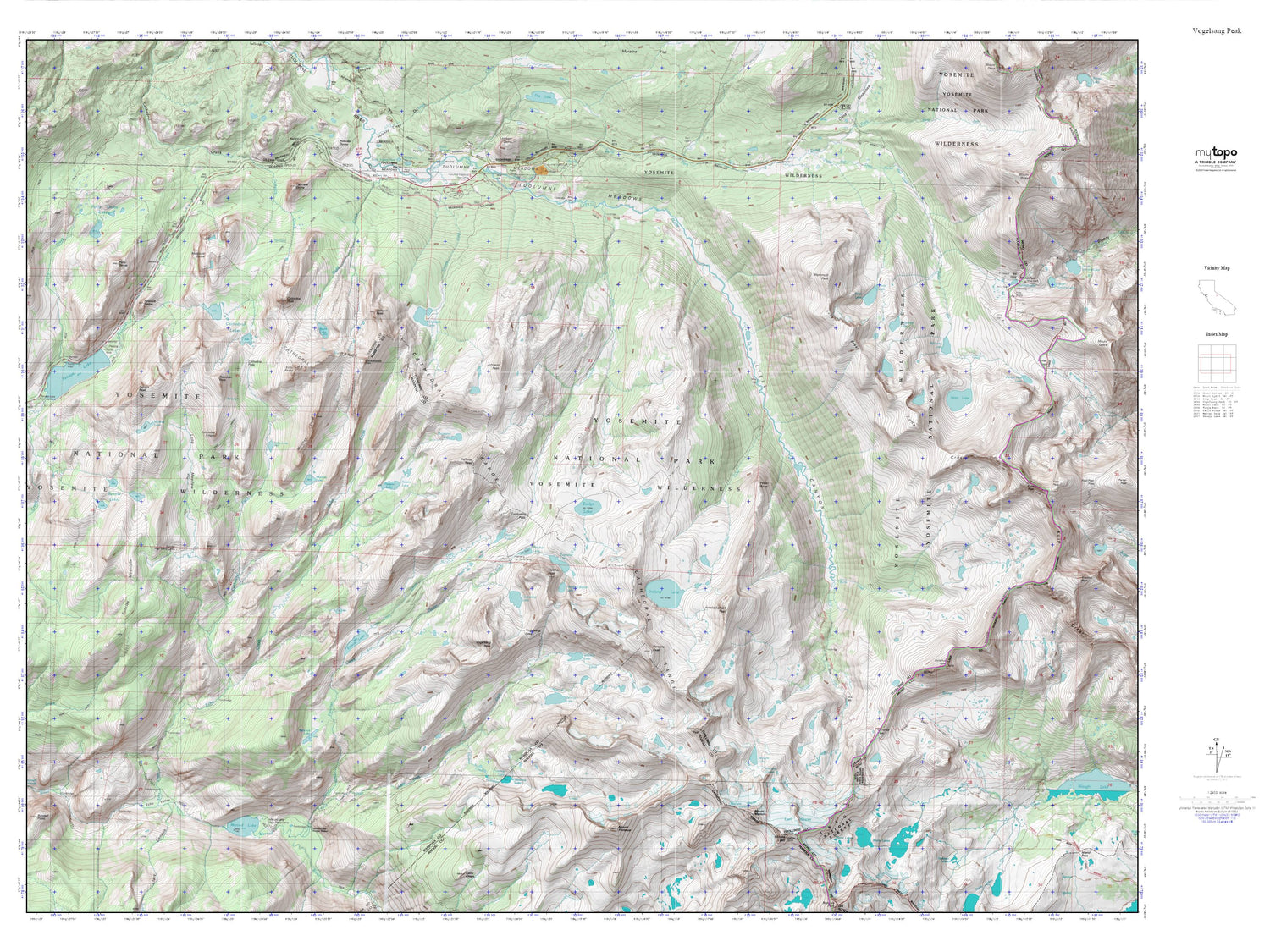
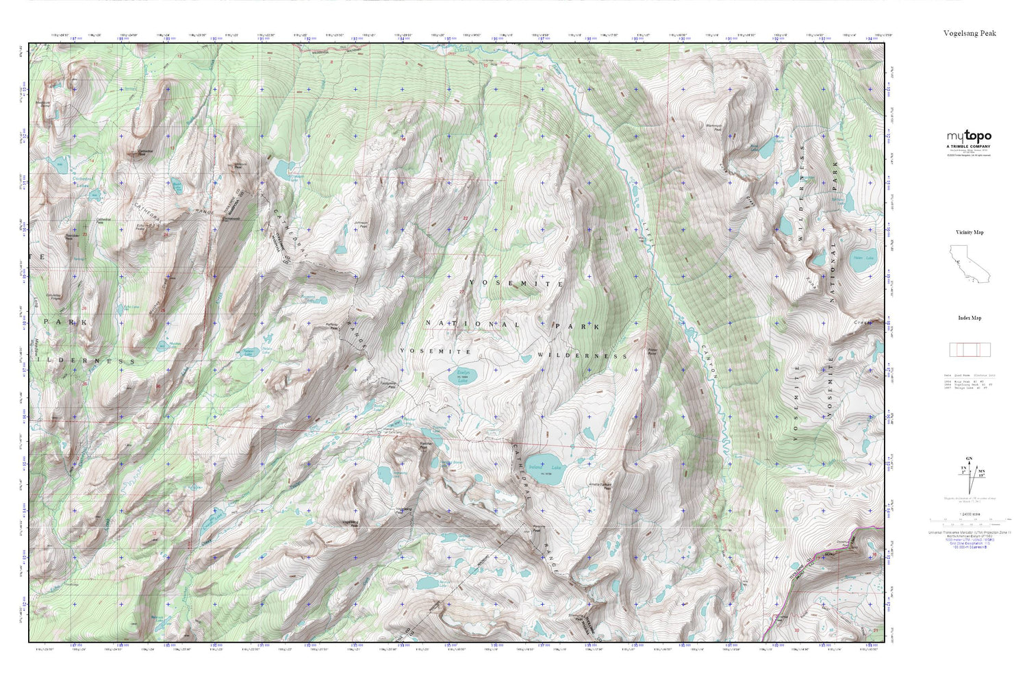
Vogelsang Peak MyTopo Explorer Series Map
Couldn't load pickup availability
Topographic map of Vogelsang Peak in the state of California. From the MyTopo Explorer Series.
This topo map features shaded relief and comes with UTM / MGRS and Latitude/Longitude grids.
For more than two decades, MyTopo has provided maps to the most adventurous among us.. those who love to explore our nation’s remote wilderness areas, climb our highest peaks, and trek across our vast public lands. This map is part of a curated collection of the most popular places for which MyTopo customers have designed maps. It is a “bucket list” of the most amazing places to hike, hunt, and explore.
This map contains the following named places: Amelia Earhart Peak,Bernice Lake,Boothe Lake,Budd Lake,Cathedral Fork,Cathedral Lakes,Cathedral Pass,Cathedral Peak,Cathedral Range,Cockscomb,Columbia Finger,Echo Lake,Echo Peaks,Elizabeth Lake,Emeric Creek,Emeric Lake,Evelyn Lake,Fletcher Lake,Fletcher Peak,Gallison Lake,Hanging Basket Lake,Ireland Creek,Ireland Lake,Johnson Peak,Kuna Creek,Kuna Lake,Long Meadow,Maclure Creek,Mammoth Peak,Matthes Crest,Matthes Lake,Medlicott Dome,Nelson Lake,Parsons Peak,Potter Point,Rafferty Peak,Reymann Lake,Sunrise High Sierra Camp,Townsley Lake,Tresidder Peak,Tuolumne Pass,Unicorn Peak,Upper Fletcher Lake,Vogelsang High Sierra Camp,Vogelsang Lake,Vogelsang Pass,Vogelsang Peak