
MyTopo
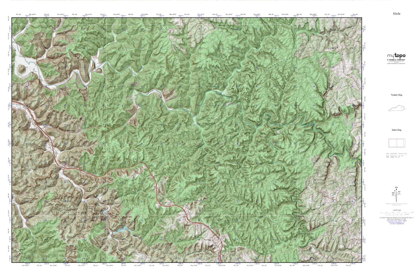
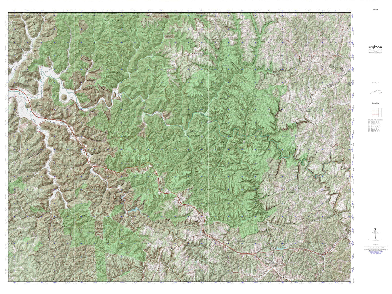
Red River Gorge MyTopo Explorer Series Map
Couldn't load pickup availability
Topographic map of Red River Gorge in the state of Kentucky. From the MyTopo Explorer Series.
This topo map features shaded relief and comes with UTM / MGRS and Latitude/Longitude grids.
For more than two decades, MyTopo has provided maps to the most adventurous among us.. those who love to explore our nation’s remote wilderness areas, climb our highest peaks, and trek across our vast public lands. This map is part of a curated collection of the most popular places for which MyTopo customers have designed maps. It is a “bucket list” of the most amazing places to hike, hunt, and explore.
This map contains the following named places: 40376,41360,Adena Arch,Amburgy Hollow,Amphitheater Trail,Angel Windows,Auxier Branch,Auxier Branch Trail,Auxier Ridge,Auxier Ridge Trail,Balanced Rock,Battleship Rock,Bearpen Branch,Beasley Hollow,Bell Branch,Black John Creek,Blackinghouse Branch,Boling Branch,Bowen Hollow,Boyd Hollow,Bragg Post Office,Buck Trail,Campbell Ridge,Castle Arch,Cave Branch,Chestnut Log Branch,Chimney Top Creek,Chimney Top Railroad Station,Chimney Top Rock,Clear Branch,Clifty Creek,Clifty Wilderness,Cloud Splitter,Cloud Splitter Rock,Cold Spring Hollow,Copperas Creek,Courthouse Rock,Courthouse Rock Trail,Dark Hollow,DeHart Hollow,Dessie Scott Childrens Home,Dog Fork,Double Arch,Double Arch Trail,Double Cave Branch,Dunkan Branch,Dunkan Branch Hill,Edward Branch,Fish Trap Branch,Fortner,Garrett Branch,Gibson Branch,Gladie Creek,Glencairn,Glencairn Post Office,Glencairn Railroad Station,Glencairn School,Glendive Post Office,Granny Townsend Branch,Graveyard Branch,Grays Arch,Grays Arch Picnic Area,Grays Arch Trail,Grays Branch,Graysarch Trail,Greasy Branch,Green Garret Railroad Siding,Hale Branch,Half Moon Arch,Half Moon Rock,Halsey Branch,Haystack Post Office,Haystack Rock,Hells Kitchen,Hens Nest Rock,Henson Cave Arch,Hidden Arch,Hoedown Island,Indian Creek,Indian Stairway,John Knox Hollow,Judy Ann Branch,Junior Williamson Rest Area,King Branch,Klaber Branch,Koomer Ridge,Koomer Ridge Camping and Picnic Area,Koomer Ridge Trail,Landsome Branch,Laurel Branch,Lookout Point,Lovers Leap,Lower Hood Branch,Martin Fork,Middle Fork Campground,Middle Fork Church,Middlefork Fire Department,Mill Creek,Mill Creek Lake,Moonshiner Arch,Moreland Branch,Moreland Branch Church,Mountain Top Railroad Station,Nada Arches,Nada Lombard Post Office,Nada Railroad Station,Nada Tunnel,Natural Bridge,Natural Bridge Post Office,Natural Bridge State Park,Natural Bridge Station,Needle Eye,Old Lombard,Osborne Bend Ridge,Owl Hollow Branch,Owls Window,Parched Corn Creek,Pinch-Em Tight Gap,Pinch-Em Tight Ridge,Pinch-Em Tight Trail,Pine Ridge,Pine Ridge Lookout Tower,Pine Ridge Post Office,Pine Ridge Railroad Station,Pine Ridge Visitor Center,Powell Branch,Princess Arch,Railroad Hollow,Ravens Rock,Ravens Window,Red Wild and Scenic River,Reffits Branch,Right Fork Chimney Top Creek,Rock Bridge Arch,Rock Bridge Falls,Rock Bridge Picnic Area,Rock Bridge Trail,Rockbridge Fork,Rocky Branch,Rose Drake Branch,Rough Trail,Rush Branch,Rush Ridge,Rush Ridge Trail,Sal Branch,Sand Gap Arch,Sand Lick Fork,Sargent Branch,Schoolhouse Branch,Shed Hollow,Short Creek,Silvermine Arch,Silvermine Arch Trail,Silvermine Branch,Sky Bridge,Sky Bridge Recreation Site,Slade,Slade Hill,Slade Post Office,Slade Railroad Station,Slade Twin Arches,Sons Branch,South Fork Twin Arches,Spaas Creek,Star Gap Arch,Star Gap Branch,Swift Camp Creek,Swiftcamp Creek Trail,Tarr Ridge Picnic Area,The Devils Pulpit,The Silver Bridge,Timmons Arch,Timothy Branch,Tin Town Church,Tom Chrisp Hollow,Tower Rock,Tunnel Ridge,Turtle Back Arch,Upper Hood Branch,Whistling Arch,Whites Branch,Whittleton Arch,Whittleton Branch,Whittleton Branch Trail,Whittleton Campground,Whittleton Ridge,Wildcat Creek,Wildcat Trail,Wolfpen Creek