
MyTopo
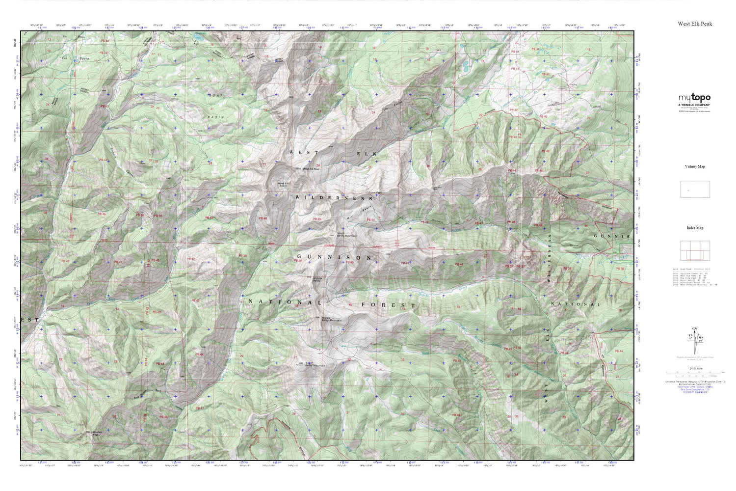
West Elk Peak MyTopo Explorer Series Map
Couldn't load pickup availability
Topographic map of West Elk Peak in the state of Colorado. From the MyTopo Explorer Series.
This topo map features shaded relief and comes with UTM / MGRS and Latitude/Longitude grids.
For more than two decades, MyTopo has provided maps to the most adventurous among us.. those who love to explore our nation’s remote wilderness areas, climb our highest peaks, and trek across our vast public lands. This map is part of a curated collection of the most popular places for which MyTopo customers have designed maps. It is a “bucket list” of the most amazing places to hike, hunt, and explore.
This map contains the following named places: Buck Hollow,Coffeepot Creek,East Soap Creek,Middle Baldy,Middle Baldy Mountain,Mill Basin,Mill-Castle Trail,North Baldy Mountain,Smooth Canyon,Soap Basin,South Baldy Mountain,Storm Pass,The Castles,West Elk Basin,West Elk Peak,West Elk Wilderness


