MyTopo
Columbine Pass MyTopo Explorer Series Map
Couldn't load pickup availability
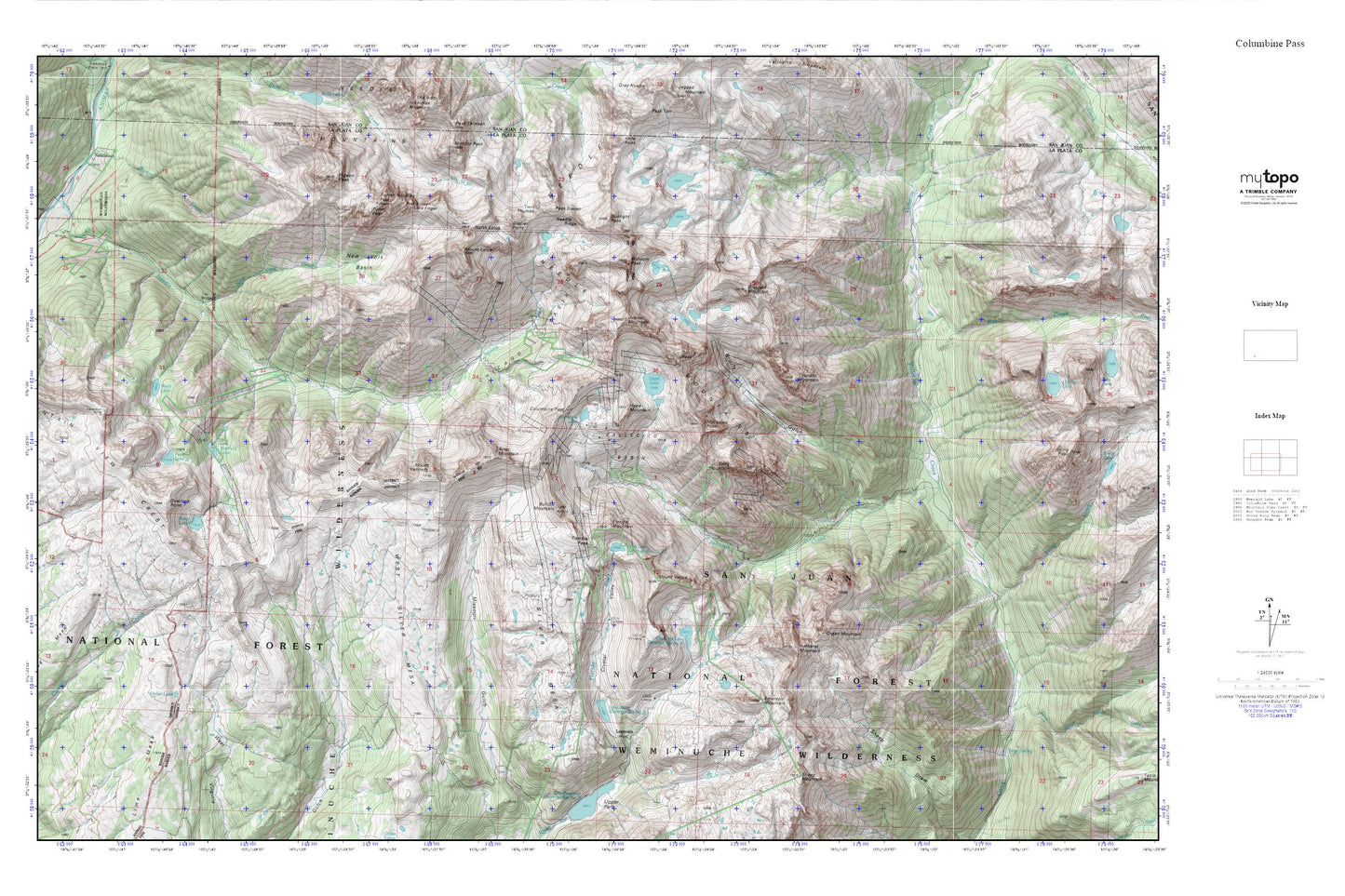
Topographic map of Columbine Pass in the state of Colorado. From the MyTopo Explorer Series.
This topo map features shaded relief and comes with UTM / MGRS and Latitude/Longitude grids.
For more than two decades, MyTopo has provided maps to the most adventurous among us.. those who love to explore our nation’s remote wilderness areas, climb our highest peaks, and trek across our vast public lands. This map is part of a curated collection of the most popular places for which MyTopo customers have designed maps. It is a “bucket list” of the most amazing places to hike, hunt, and explore.
This map contains the following named places: Aetna Mine,Amherst Mountain,Aztec Mountain,Brooklyn Mine,Bullion Mountain,Castilleja Lake,Chicago Basin,Columbine Lake,Columbine Pass,Crystal Valley,Dead Horse Creek,Dollar Lake,Echo Mountain,Emerald Lake,Emerson Mountain,Florida Mountain,Glacier Point,Greylock Mountain,Grizzly Gulch,Grizzly Peak,Hazel Lake,Homestake Tunnel Mine,Hope Mountain,Irving Creek,Johnson Creek,Jupiter Mountain,Lake Marie,Lillie Lake,Lime Mesa,Little Finger,Logtown,Mastodon Mine,McCauley Peak,Mount Eolus,Mount Kennedy,Mount Valois,Mountain View Crest,Needle Creek,Needle Mountains,Needle Ridge,New York Basin,New York Creek,North Eolus,Organ Mountain,Overlook Point,Peak Eleven,Peak Fifteen,Peak Sixteen,Pear Lake,Pigeon Creek,Pigeon Peak,Pittsburg Mine,Roell Creek,Ruby Lake,Sheep Mountain,Silver Mesa,Soda Spring,Stag Mesa,Sunlight Creek,Sunlight Lake,Sunlight Peak,Thunder Mountain,Trimble Pass,Turret Needles,Turret Peak,Twin Thumbs,Vallecito Basin,Vallecito Group Mine,Webb Lake,West Silver Mesa,Windom Peak