
MyTopo
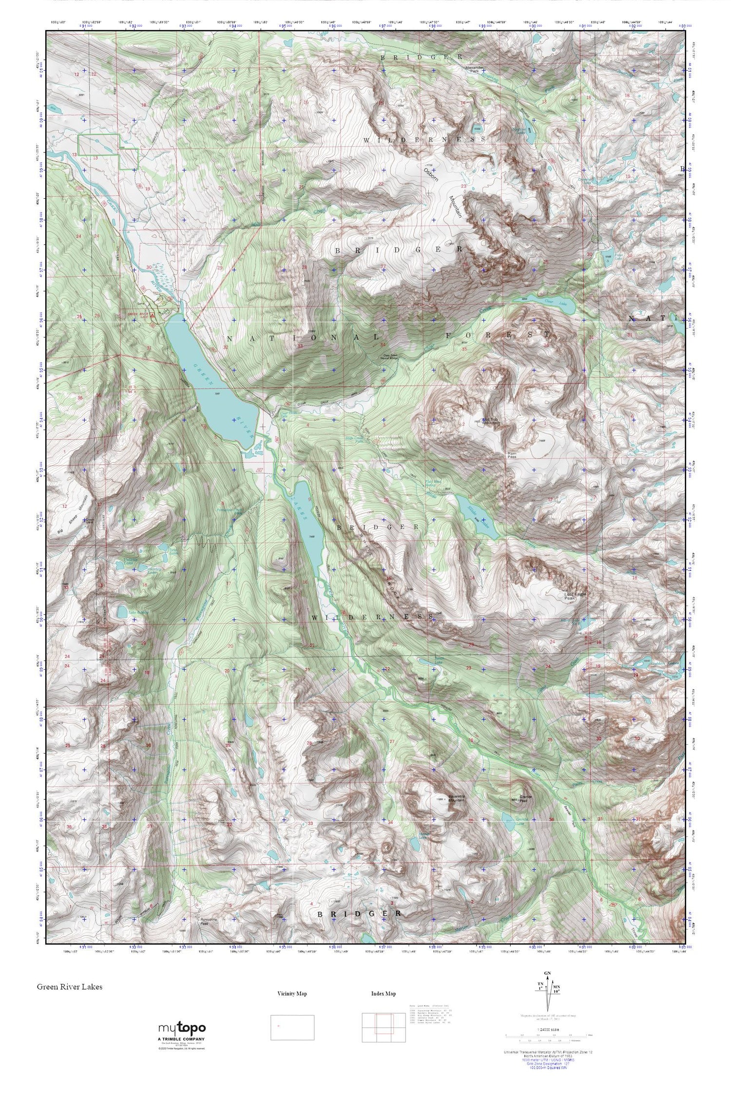
Green River Lakes MyTopo Explorer Series Map
Couldn't load pickup availability
Topographic map of Green River Lakes in the state of Wyoming. From the MyTopo Explorer Series.
This topo map features shaded relief and comes with UTM / MGRS and Latitude/Longitude grids.
For more than two decades, MyTopo has provided maps to the most adventurous among us.. those who love to explore our nation’s remote wilderness areas, climb our highest peaks, and trek across our vast public lands. This map is part of a curated collection of the most popular places for which MyTopo customers have designed maps. It is a “bucket list” of the most amazing places to hike, hunt, and explore.
This map contains the following named places: Alexander Park,Beaver Park,Bench Lake,Clear Creek,Clear Creek Falls,Clear Creek Natural Bridge,Clear Creek Trail,Clear Lake,Crescent Lake,Elbow Creek,Elbow Lake Number 2,Faler Lake,Fish Bowl Spring,Flat Top Mountain,G P Bar Ranch,Granite Lake,Granite Peak,Green River Lake Campground,Green River Lakes,Lake Gadsby,Lakeside Trail,Lost Eagle Peak,Mill Creek,Native Lake,Osborn Mountain,Pixley Creek,Porcupine Creek,Porcupine Creek Falls,Porcupine Trail,Ram Pass,Shirley Lake,Slide Creek,Slide Creek Falls,Slide Falls,Slide Lake,Slide Lake Trail,Squaretop Mountain,Twin Lakes,Valaite Lake,White Rock


