MyTopo
McCormick Wilderness MyTopo Explorer Series Map
Couldn't load pickup availability
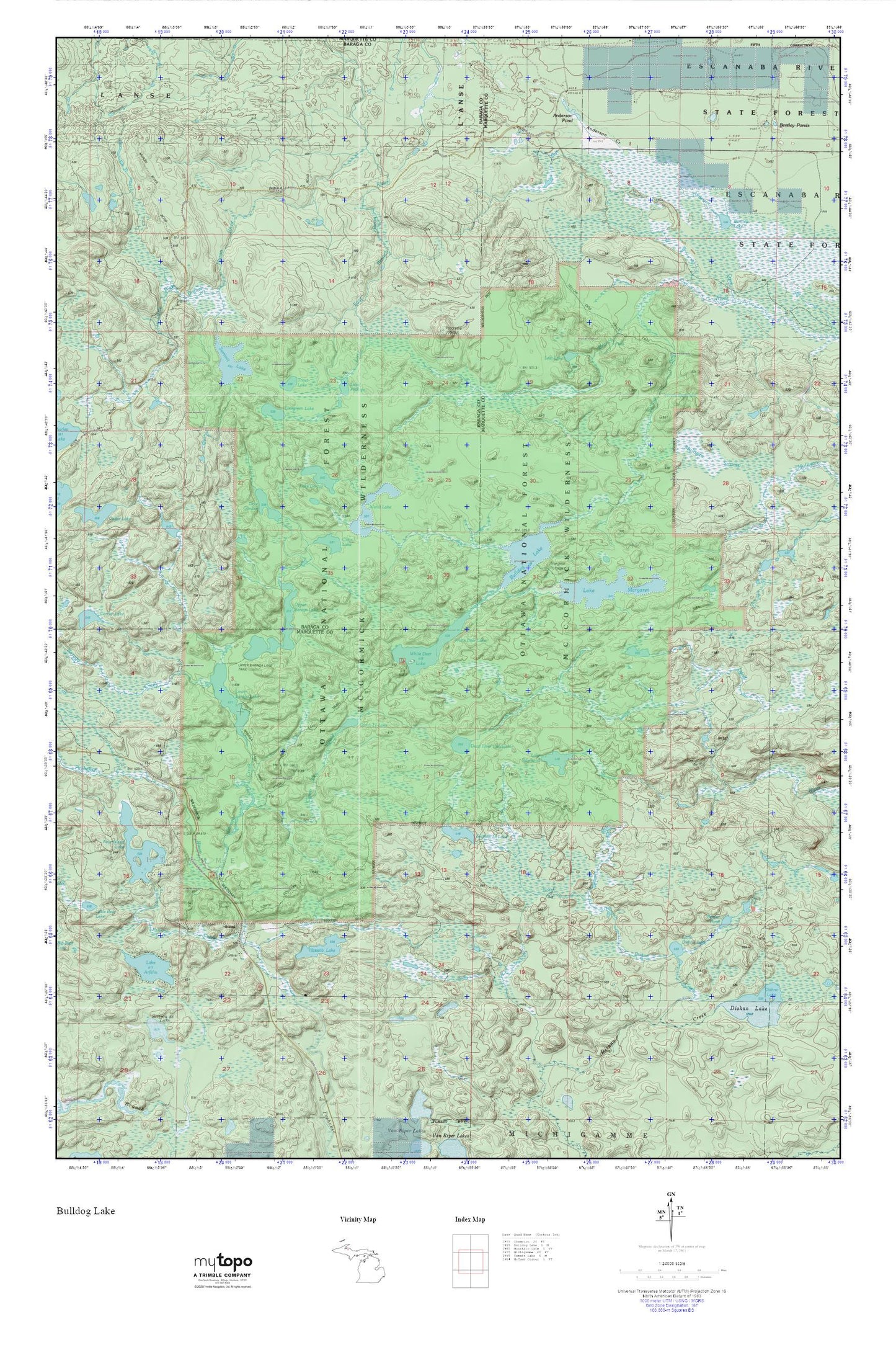
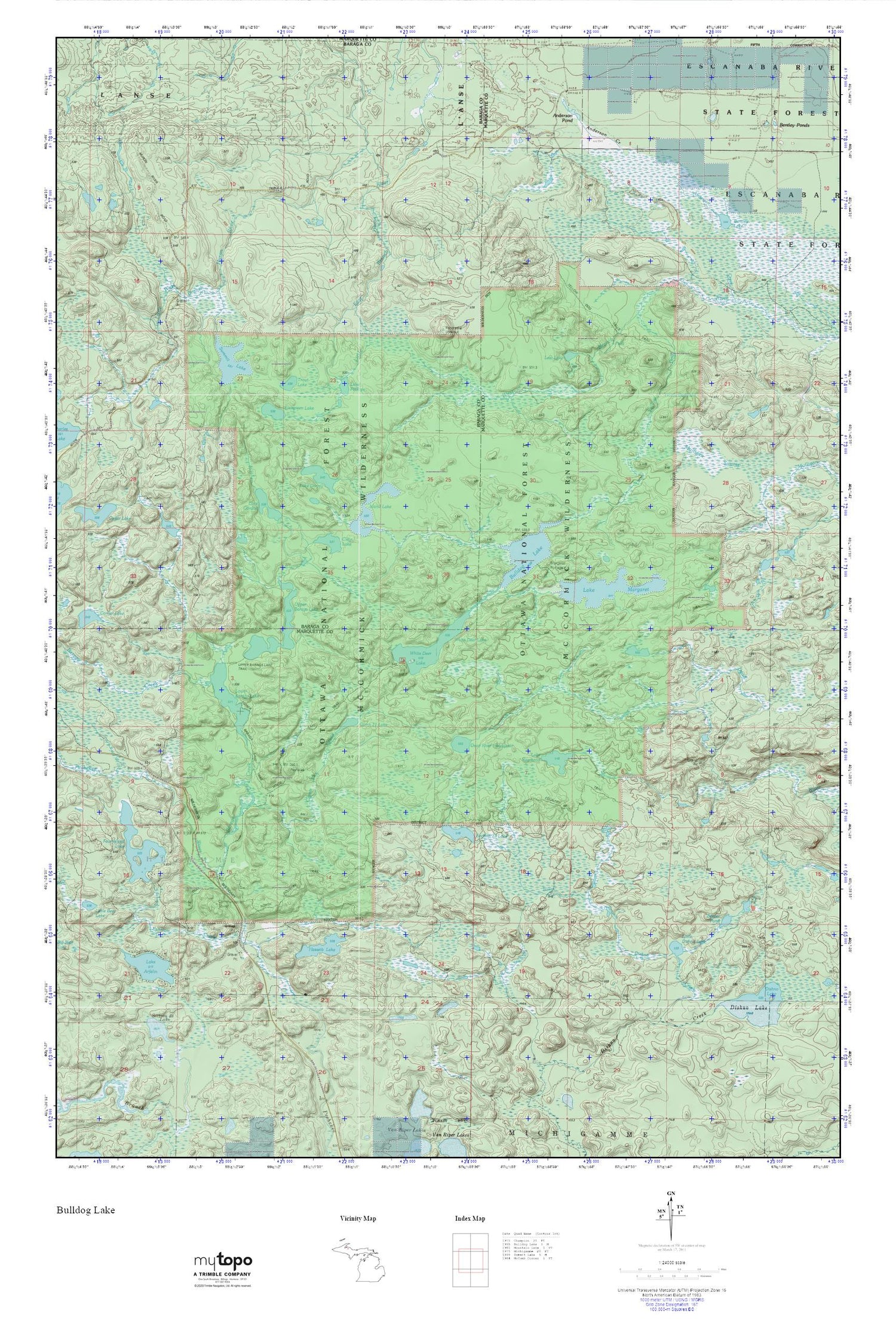
Topographic map of McCormick Wilderness in the state of Michigan. From the MyTopo Explorer Series.
This topo map features shaded relief and comes with UTM / MGRS and Latitude/Longitude grids.
For more than two decades, MyTopo has provided maps to the most adventurous among us.. those who love to explore our nation’s remote wilderness areas, climb our highest peaks, and trek across our vast public lands. This map is part of a curated collection of the most popular places for which MyTopo customers have designed maps. It is a “bucket list” of the most amazing places to hike, hunt, and explore.
This map contains the following named places: Anderson Creek,Anderson Pond,Baraga Creek,Beaver Pond,Bentley Lake,Bulldog Lake,Camp Eleven Creek,Camp Eleven Lake,Clear Lake,Dead River Headwater,Ephriam Creek,Evergreen Lake,Hasseib Lake,Island Lake,Lake Arfelin,Lake Dortay,Lake Gordon,Lake Margaret,Lake Phillips,Lake Raymond,Little Dishno Lake,Little East Branch Huron River,Little West Branch Huron River,Lost Lake,Lower Baraga Lake,Lower Baraga Lake Trail,McCormick Wilderness,North Country Trail,Sawyer Lake County Park,Section Thirteen Lake,Section Twenty-eight Lake,Summit Lake,Township of Michigamme,Trout Lake,Upper Baraga Lake,Upper Baraga Lake Trail,West Branch Yellow Dog Falls,White Deer Lake,White Deer Lake Trail,Yellow Dog Falls,Yellow Dog Wild and Scenic River