
MyTopo
Modern Day Sniper MyTopo Explorer Series Map
Couldn't load pickup availability
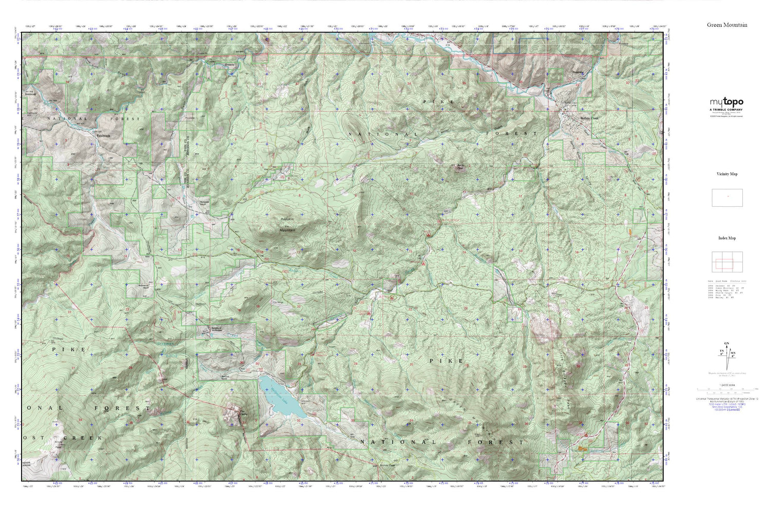
Topographic map of Modern Day Sniper in the state of Colorado. From the MyTopo Explorer Series.
This topo map features shaded relief and comes with UTM / MGRS and Latitude/Longitude grids.
For more than two decades, MyTopo has provided maps to the most adventurous among us.. those who love to explore our nation’s remote wilderness areas, climb our highest peaks, and trek across our vast public lands. This map is part of a curated collection of the most popular places for which MyTopo customers have designed maps. It is a “bucket list” of the most amazing places to hike, hunt, and explore.
This map contains the following named places: 80470,Aspen Lode Pegmatite Mine,Baldy Peak,Bancroft Ranch,Buffalo Creek,Buffalo Creek Campground,Buffalo Creek Cemetery,Buffalo Creek Post Office,Buffalo Creek Work Center,Craig Creek,Deep Gulch,Estabrook,Freeman Creek,Green Mountain,Green Mountain Creek,Green Mountain Picnic Ground,Insmont Hill,Little Scraggy Peak,Lone and Lonesome Lodes Pegmatite Mine,Maxwell Ditch,Miller Gulch,Morrison Creek,North Rolling Creek,Osirio Mine,Quiner Gulch,Redskin Creek,Redskin Mountain,Rolling Creek,Sand Draw,Shinglemill Creek,Soderstrom Ranch,South Fork Buffalo Creek,Spring Gulch,Sunnyside Ranch,Sylvania of the Rockies,The Castle,Tramway Campground,Tramway Creek,Upper Craig Creek Ditch,Wellington Dam,Wellington Lake,Windy Peak


