MyTopo
Snowmass Mountain MyTopo Explorer Series Map
Couldn't load pickup availability
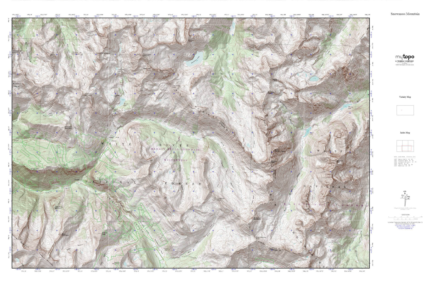
Topographic map of Snowmass Mountain in the state of Colorado. From the MyTopo Explorer Series.
This topo map features shaded relief and comes with UTM / MGRS and Latitude/Longitude grids.
For more than two decades, MyTopo has provided maps to the most adventurous among us.. those who love to explore our nation’s remote wilderness areas, climb our highest peaks, and trek across our vast public lands. This map is part of a curated collection of the most popular places for which MyTopo customers have designed maps. It is a “bucket list” of the most amazing places to hike, hunt, and explore.
This map contains the following named places: Arkansas Mountain,Baroni Mine,Bear Basin,Bear Mountain,Belleview Mountain,Black Queen Shaft,Bonton Mine,Buckskin Basin,Buckskin Pass,Catalpa Mine,Chimneys of Treasure Mountain,Crater Lake,Crystal,Crystal Canyon,Crystal Peak,Crystal Tunnel Mine,Devils Rockpile,Disc Shaft Mine,Don Number Two Mine,Elk Mountains,Fravert Basin,Frigid Air Pass,Geneva Lake,Hagerman Peak,Harris Fairly Mine,Hasley Basin,High Tide Tunnel Mine,Lead King Basin,Lead King Mine,Len Shoemaker Ridge,Little Bear Mountain,Little Gem Lake,Low Tide Mine,Lucky Boy Mine,Maroon Bells,Maroon Bells-Snowmass Wilderness,Maroon Peak,McVey Tunnel Mine,Meadow Mountain,Mineral Point,Minnehaha Gulch,Mount Richey,North Fork Crystal River,North Maroon Peak,North Pole Mine,Puritan Group Mine,Schofield,Schofield Mine,Schofield Park,Sheep Mountain,Sheep Mountain Tunnel Mine,Siberia Lake,Silver Creek,Sleeping Sexton,Snowfield Lake,Snowmass Lake,Snowmass Mountain,Snowmass Peak,South Fork Crystal River,Trail Rider Pass,West Maroon Pass,Willow Lake,Willow Pass