MyTopo
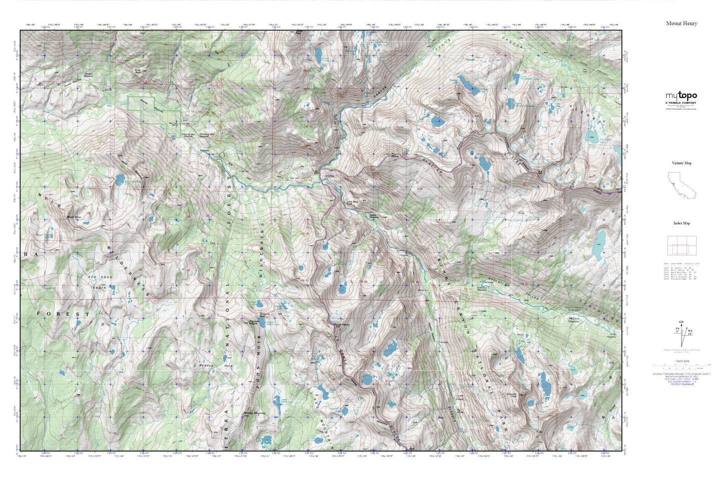
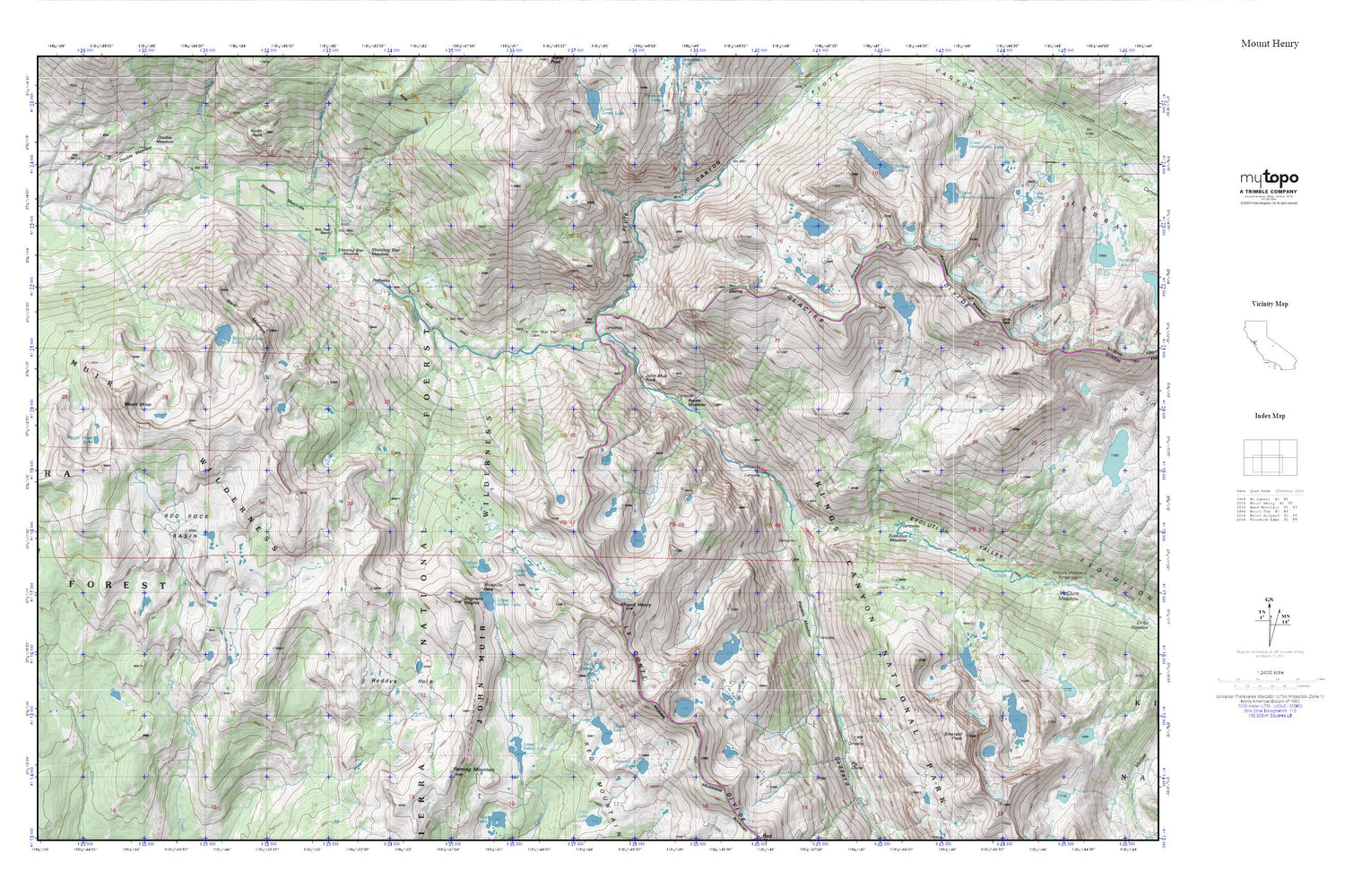
Mount Henry MyTopo Explorer Series Map
Couldn't load pickup availability
Topographic map of Mount Henry in the state of California. From the MyTopo Explorer Series.
This topo map features shaded relief and comes with UTM / MGRS and Latitude/Longitude grids.
For more than two decades, MyTopo has provided maps to the most adventurous among us.. those who love to explore our nation’s remote wilderness areas, climb our highest peaks, and trek across our vast public lands. This map is part of a curated collection of the most popular places for which MyTopo customers have designed maps. It is a “bucket list” of the most amazing places to hike, hunt, and explore.
This map contains the following named places: Aspen Meadow,Blayney Meadows,Bonita Lake,Davis Lake,Diamond-X Lake,Double Meadow,Emerald Peak,Evolution Creek,Evolution Meadow,Evolution Valley,Fleming Mountain,Franklin Meadow,Goddard Canyon,Heather Lake,Hot Springs,John Muir Rock,John Muir Trail Cabin,John Muir Wilderness,Lobe Lakes,Lower Blayney Campground,Lower Indian Lake,Matthes Glaciers,Mosquito Pass,Mount Henry,Mount Shinn,Mount Shinn Lake,Muir Trail Ranch,Pavilion Dome,Pig Chute,Piute Canyon,Piute Creek,Potholes,Ramona Lake,Red Rock Basin,Reddys Hole,Sallie Keyes Creek,Senger Creek,Shooting Star Meadow,Tule Lake,Turf Lakes,Turret Creek,Upper Honeymoon Lake,Upper Indian Lake,Ward Mountain,Ward Mountain Lake,West Pinnacles Creek,Zingheim Heights