
MyTopo
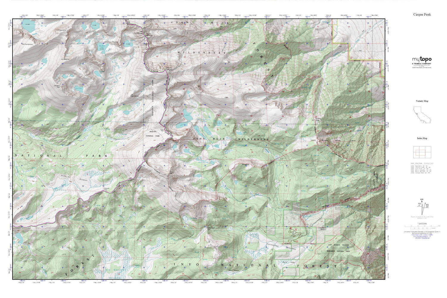
Cottonwood Lakes MyTopo Explorer Series Map
Couldn't load pickup availability
Topographic map of Cottonwood Lakes in the state of California. From the MyTopo Explorer Series.
This topo map features shaded relief and comes with UTM / MGRS and Latitude/Longitude grids.
For more than two decades, MyTopo has provided maps to the most adventurous among us.. those who love to explore our nation’s remote wilderness areas, climb our highest peaks, and trek across our vast public lands. This map is part of a curated collection of the most popular places for which MyTopo customers have designed maps. It is a “bucket list” of the most amazing places to hike, hunt, and explore.
This map contains the following named places: Army Pass,Big Cottonwood Meadows,Chicken Spring Lake,Cirque Lake,Cirque Peak,Cottonwood Lake Number Five,Cottonwood Lake Number Four,Cottonwood Lake Number One,Cottonwood Lake Number Six,Cottonwood Lake Number Three,Cottonwood Lake Number Two,Cottonwood Lakes,Cottonwood Pass,Cottonwood Sawmill,Erin Lake,Golden Trout Camp,Hidden Lake,High Lake,Horseshoe Meadow,Joe Devel Peak,Last Chance Meadow,Last Chance Meadow Research Natural Area,Long Lake,Mount Langley,Mount Pickering,Muir Lake,New Army Pass,Owens Point,Primrose Lake,Rocky Basin Lakes,Siberian Outpost,Siberian Pass,South Fork Cottonwood Creek,South Fork Lakes,The Major General


