MyTopo
Morrow Mountain MyTopo Explorer Series Map
Couldn't load pickup availability
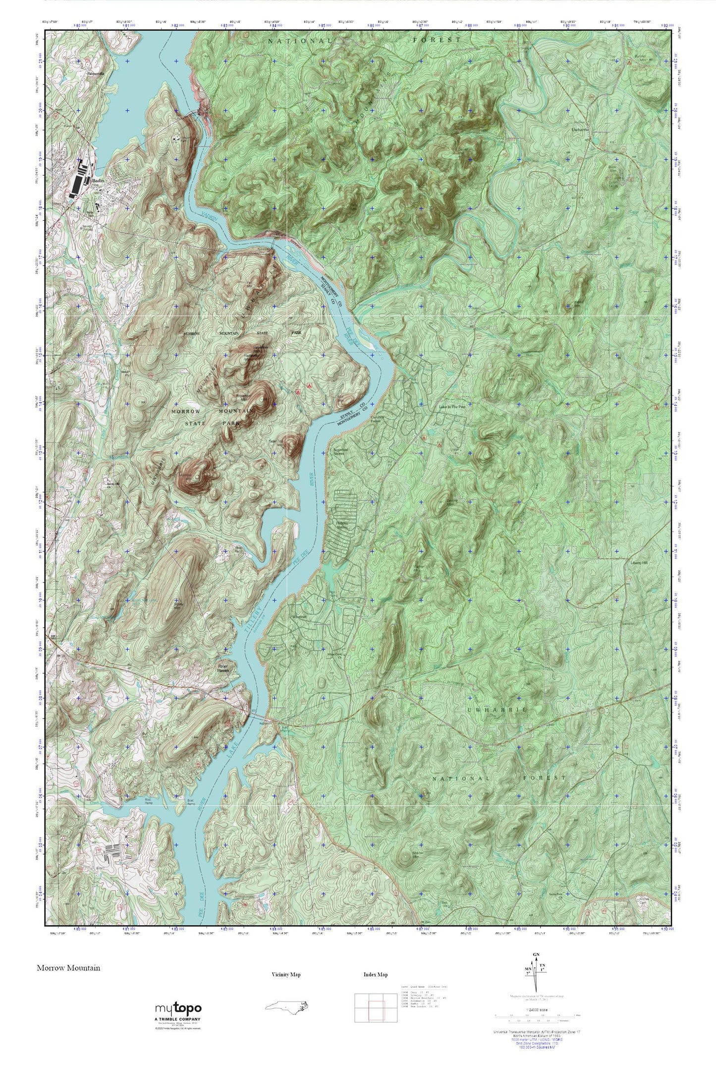
Topographic map of Morrow Mountain in the state of North Carolina. From the MyTopo Explorer Series.
This topo map features shaded relief and comes with UTM / MGRS and Latitude/Longitude grids.
For more than two decades, MyTopo has provided maps to the most adventurous among us.. those who love to explore our nation’s remote wilderness areas, climb our highest peaks, and trek across our vast public lands. This map is part of a curated collection of the most popular places for which MyTopo customers have designed maps. It is a “bucket list” of the most amazing places to hike, hunt, and explore.
This map contains the following named places: 28009,Alcoa Plant,Badin,Badin Dam,Badin Police Department,Badin Post Office,Badin School,Badin Volunteer Fire Department,Badin Waterworks,Bethany Church,Big Island Creek,Buck Mountain,Buck Mountain Lookout Tower,Buzzard Mountain,Carolina Forest,Cattail Creek,Cedar Creek,Daniel Mountain,Dennis Mountain,Dumas Creek,Dutch John Creek,Dutchmans Creek,Fall Mountain,Falls Dam,Falls Mountain,Falls Reservoir,Gold Mine Branch,Hall Branch,Hattaway Mountain,Holiday Shores,Horse Trough Mountain,Jacobs Creek,Lake in the Pine,Lake Tillery Volunteer Fire Department and Rescue Squad 10,Lawrenceville,Liberty Hill,Liberty Hill Church,Lick Mountain,Little Island Creek,Little Mountain Creek,Mill Mountain,Moccasin Creek,Morrow Mountain,Morrow Mountain State Park,Mountain Creek,Narrous Dam,Narrows of the Yadkin,Palmerville,Prospect Baptist Church,Prospect Cemetery,Rabbit Mountain,River Haven,Rocky Creek,Rocky Hill Church,Shiloh Church,Shingle Trap Mountain,Spencer Creek,Stanly County Country Club,Stony Hill Church,Stony Mountain,Stony Mountain Lake Number One,Stony Mountain Lake Number Two,Stony Mountain Number One Dam,Stony Mountain Number Two Dam,Sugarloaf Creek,Sugarloaf Mountain,Sugarloaf Shores,Swift Island,Tater Top Mountain,Tindalsville,Town of Badin,Township of Uwharrie,Upper Wood Run,Uwharrie,Uwharrie Methodist Church,Uwharrie Mountains,Uwharrie National Recreation Trail,Uwharrie River,Uwharrie School,Uwharrie Volunteer Fire Department,Uwharrie Wildlife Area,Walker Mountain,Watery Branch,White Crest Church,Wood Run,Woodrun,Yadkin Falls Dam,Yadkin River,Zoar Cemetery,Zoar Church