MyTopo
Telegraph Peak MyTopo Explorer Series Map
Couldn't load pickup availability
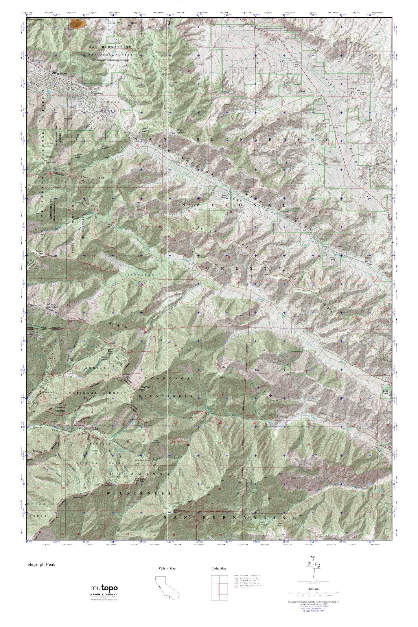
Topographic map of Telegraph Peak in the state of California. From the MyTopo Explorer Series.
This topo map features shaded relief and comes with UTM / MGRS and Latitude/Longitude grids.
For more than two decades, MyTopo has provided maps to the most adventurous among us.. those who love to explore our nation’s remote wilderness areas, climb our highest peaks, and trek across our vast public lands. This map is part of a curated collection of the most popular places for which MyTopo customers have designed maps. It is a “bucket list” of the most amazing places to hike, hunt, and explore.
This map contains the following named places: 92358,Acorn Canyon,Big Horn Campground,Bighorn Peak,Blue Ridge,Camp San Antonio,Cedar Canyon,Clyde Ranch,Coldwater Campground,Coldwater Canyon,Columbine Spring,Commanche Camp,Cucamonga Peak Trail,Cucamonga Wilderness,Delker Canyon,Devils Backbone,Dog Bone Canyon,East Table Mountain,Falling Rock Canyon,Fir Draw,Gold Ridge,Heath Canyon,Horse Target Shooting Area,Icehouse Saddle,Kelly Camp,Lost Creek,Manker Campground,Manker Canyon,Manker Flat,Miners Bowl,Mount Baldy Notch,Mount Baldy Post Office,Mount Baldy-Wrightwood Division,Mount Harwood,Nielson Ranch,Nuss Ranch,Ontario Peak Trail,Pauite Campground,Pioneer Historic Marker,Prudhon Ranch,San Antonio Falls,San Bernardino County Fire Department Station 14 Wrightwood,Sharpless Ranch,Sheep Canyon,Sheep Flat,Shortcut Ridge,Slover Canyon,Stockton Flat,Stone Basin,Stone House Crossing Campground,Sugarloaf Peak,Swarthout Valley,Telegraph Peak,Telegraph Wash,Thunder Mountain,Timber Mountain,Twin Lakes,Upper Lytle Creek Ridge,Wright Mountain,Wrightwood,Wrightwood Census Designated Place,Wrightwood Post Office