MyTopo
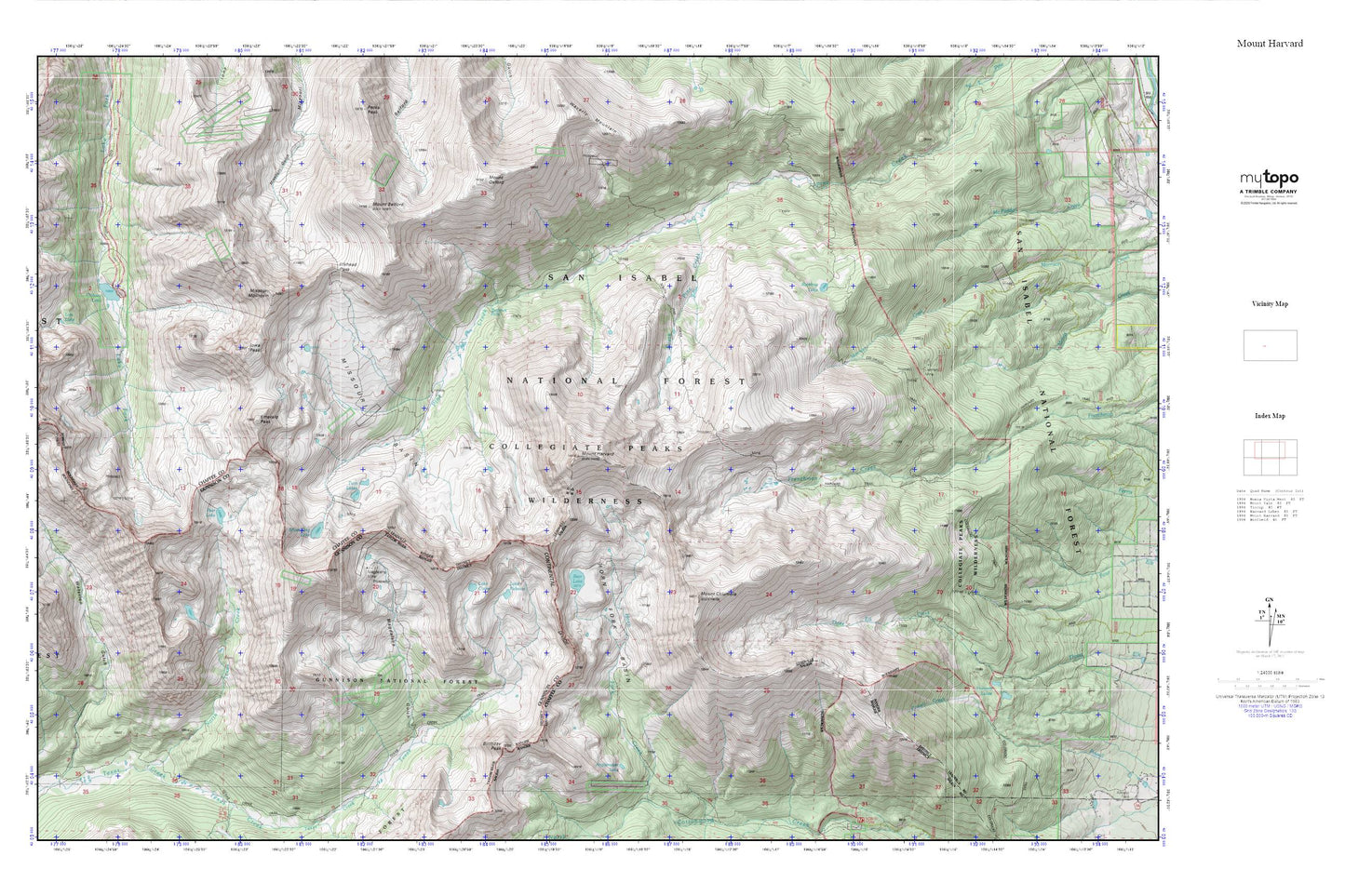
Mount Harvard MyTopo Explorer Series Map
Couldn't load pickup availability
Topographic map of Mount Harvard in the state of Colorado. From the MyTopo Explorer Series.
This topo map features shaded relief and comes with UTM / MGRS and Latitude/Longitude grids.
For more than two decades, MyTopo has provided maps to the most adventurous among us.. those who love to explore our nation’s remote wilderness areas, climb our highest peaks, and trek across our vast public lands. This map is part of a curated collection of the most popular places for which MyTopo customers have designed maps. It is a “bucket list” of the most amazing places to hike, hunt, and explore.
This map contains the following named places: Anglemeyer Lake,Bear Lake,Bedrock Falls,Birthday Peak,Buena Vista Division,Clohesy Lake,Collegiate Peaks,Elkhead Pass,Emerald Peak,Harvard Lakes,Horn Fork Basin,Horn Fork Trail,Iowa Peak,Lake Claire,Lake Rebecca,Lienhart Mine,Little Johns Cabin,Lois Lake,Madeline Mine,Magdalene Gulch,Magdalene Mine,Missouri Mountain,Mount Belford,Mount Columbia,Mount Harvard,Mount Oxford,North Texas Creek,Pear Lake,Pine Creek Trail,Rainbow Lake,Silver King Lake,Silver King Mine,South Pine Creek,South Pine Creek Trail,Tamarack Mine,T-Cross Ranch,Twin Lakes,Wapaca Trail