
MyTopo
Capitol Peak MyTopo Explorer Series Map
Couldn't load pickup availability
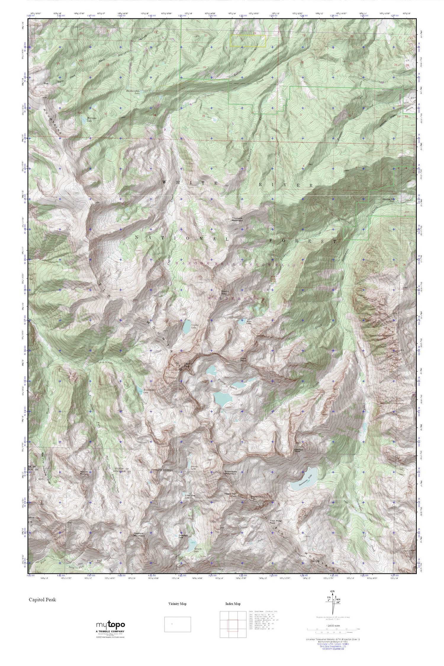
Topographic map of Capitol Peak in the state of Colorado. From the MyTopo Explorer Series.
This topo map features shaded relief and comes with UTM / MGRS and Latitude/Longitude grids.
For more than two decades, MyTopo has provided maps to the most adventurous among us.. those who love to explore our nation’s remote wilderness areas, climb our highest peaks, and trek across our vast public lands. This map is part of a curated collection of the most popular places for which MyTopo customers have designed maps. It is a “bucket list” of the most amazing places to hike, hunt, and explore.
This map contains the following named places: 81654,Avalanche Lake,Avalanche Mine,Bear Creek,Capitol Creek Guard Station,Capitol Lake,Capitol Peak,Clark Peak,Copper Creek,East Fork Avalanche Creek,Elk Creek Number 2 Dam,Elk Creek Reservoir Number 2,Hagerman Peak,Hardscrabble Lake,Haystack Mountain,Heckert Pass,Little Gem Lake,Maroon Bells-Snowmass Wilderness,Mount Daly,Mount Richey,Nickelson Creek,Pierre Lakes,Siberia Lake,Snowmass Lake,Snowmass Mountain,Snowmass Peak,West Snowmass Creek,Williams Lake


