MyTopo
Davis Peak MyTopo Explorer Series Map
Couldn't load pickup availability
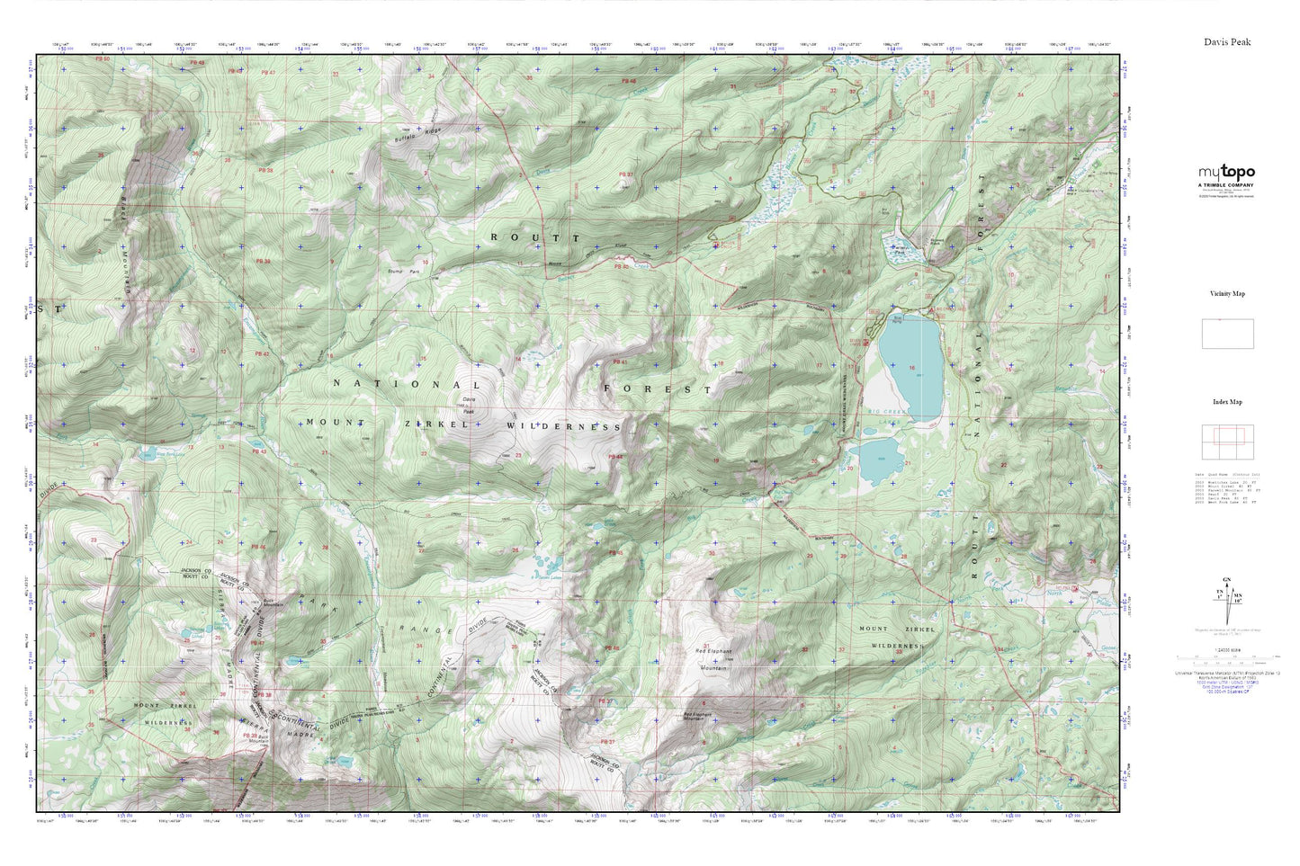
Topographic map of Davis Peak in the state of Colorado. From the MyTopo Explorer Series.
This topo map features shaded relief and comes with UTM / MGRS and Latitude/Longitude grids.
For more than two decades, MyTopo has provided maps to the most adventurous among us.. those who love to explore our nation’s remote wilderness areas, climb our highest peaks, and trek across our vast public lands. This map is part of a curated collection of the most popular places for which MyTopo customers have designed maps. It is a “bucket list” of the most amazing places to hike, hunt, and explore.
This map contains the following named places: Beaver Creek Campground,Beaver Creek Stump Park Trail,Big Creek Campground,Big Creek Falls,Big Creek Lakes,Big Creek Lakes Campground,Big Creek Trail,Black Mountain,Buck Mountain,Buffalo Ridge Trail,Davis Peak,Encampment Meadows,Gem Lake,Gem Lake Trail,Hayward Ranch,Lake Eileen,Lakeside Campground,Lower Big Creek Dam,Lower Big Creek Reservoir,Main Fork Trail,Red Elephant Mountain,Sanchez Lakes,Seven Lakes,Stump Park,Stump Park Trail,Twisty Park,West Fork Lake,West Fork Trail