MyTopo
Cucamonga Peak MyTopo Explorer Series Map
Couldn't load pickup availability
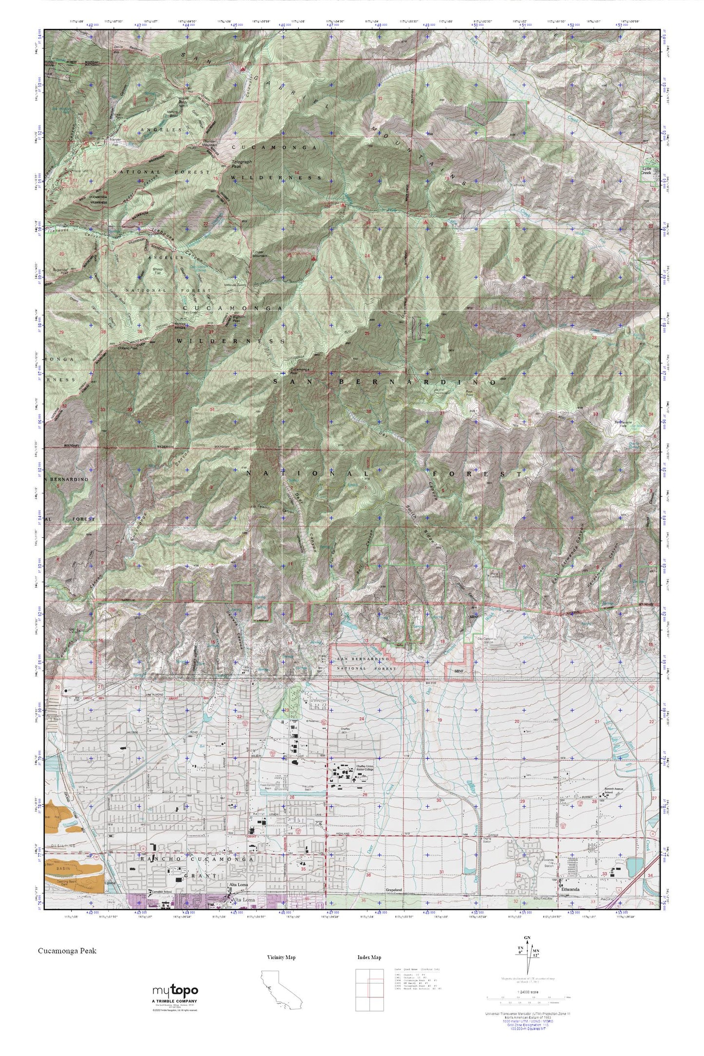
Topographic map of Cucamonga Peak in the state of California. From the MyTopo Explorer Series.
This topo map features shaded relief and comes with UTM / MGRS and Latitude/Longitude grids.
For more than two decades, MyTopo has provided maps to the most adventurous among us.. those who love to explore our nation’s remote wilderness areas, climb our highest peaks, and trek across our vast public lands. This map is part of a curated collection of the most popular places for which MyTopo customers have designed maps. It is a “bucket list” of the most amazing places to hike, hunt, and explore.
This map contains the following named places: 91737,91739,92358,Alta Loma Basin Number 1 87-006 Dam,Alta Loma Basin Number 2 87-007 Dam,Alta Loma Junior High School,Angalls Canyon,Bighorn Peak,Buck Point,Bull Canyon,Calamity Canyon,Camp San Antonio,Caryn Elementary School,Cedar Canyon,Chaffey College,Coldwater Campground,Columbine Spring,Commanche Camp,Confluence Park,Cucamonga,Cucamonga Peak,Cucamonga Peak Trail,Cucamonga Wilderness,Day Canyon,Day Canyon Station,Day Canyon Wash,Deer Canyon,Deer Canyon Wash,Delker Canyon,Demens Canyon,Demens Channel,Dustin Spring,Earl Sicosky Gymnasium,East Avenue Special School,East Etiwanda Canyon,Falling Rock Canyon,Fan Canyon,Fir Draw,Floyd M Stork Elementary School,Gold Ridge,Grace Fellowship Church,Grigsby Field,Henderson Canyon,Heritage Community Park,Hermosa Elementary School,Icehouse Saddle,Inland Quarry,Joe Elliot Tree Memorial,Kelly Camp,KRZE-FM (Ontario),Lost Creek,Lowder Baseball Field,Manker Campground,Manker Canyon,Manker Flat,Miners Bowl,Mount Baldy Notch,Mount Baldy Post Office,Mount Baldy-Wrightwood Division,North East Community Park,Ontario Peak,Ontario Peak Trail,Rancho Cucamonga Fire Department Station 175,Rancho Cucamonga Fire Protection District Station 176,San Sevaine Flats,San Sevaine Well,Sheep Canyon,Sheep Flat,Shortcut Ridge,Smith Canyon,Smith Ridge,Stone House Crossing Campground,Summit Elementary School,Telegraph Peak,Telegraph Wash,Thorpe Canyon,Thunder Mountain,Timber Mountain,Wargin Hall,West Fork Trail