MyTopo
Platoro MyTopo Explorer Series Map
Couldn't load pickup availability
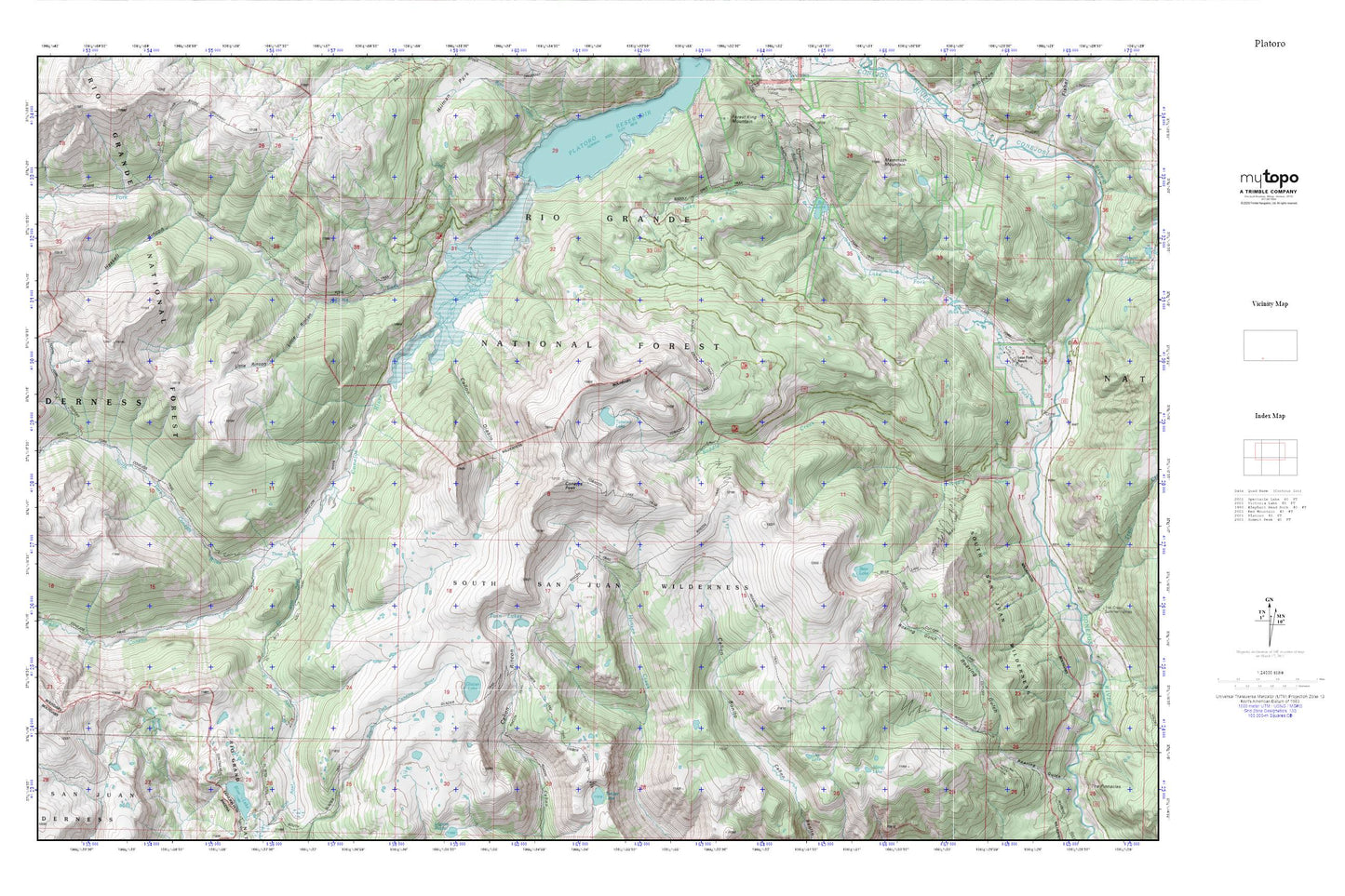
Topographic map of Platoro in the state of Colorado. From the MyTopo Explorer Series.
This topo map features shaded relief and comes with UTM / MGRS and Latitude/Longitude grids.
For more than two decades, MyTopo has provided maps to the most adventurous among us.. those who love to explore our nation’s remote wilderness areas, climb our highest peaks, and trek across our vast public lands. This map is part of a curated collection of the most popular places for which MyTopo customers have designed maps. It is a “bucket list” of the most amazing places to hike, hunt, and explore.
This map contains the following named places: Adams Fork Conejos River,Bear Lake,Bear Lake Trail,Big Lake,Canon Diablo,Coal Creek,Conejos Peak,Conejos Trail,Congress Mine,El Rito Azul,Glacier Lake,Haskell Rincon,Lake Fork Ranch,Lake Fork Trail,Lisa Lake,Little Rincon,Mammoth Mountain,Margo Lake,Middle Fork Conejos River,North Fork Conejos River,Rock Lake,Shortys Cabin,South San Juan Wilderness,Three Forks,Tobacco Lake,Twin Lakes