MyTopo
Breckenridge MyTopo Explorer Series Map
Couldn't load pickup availability
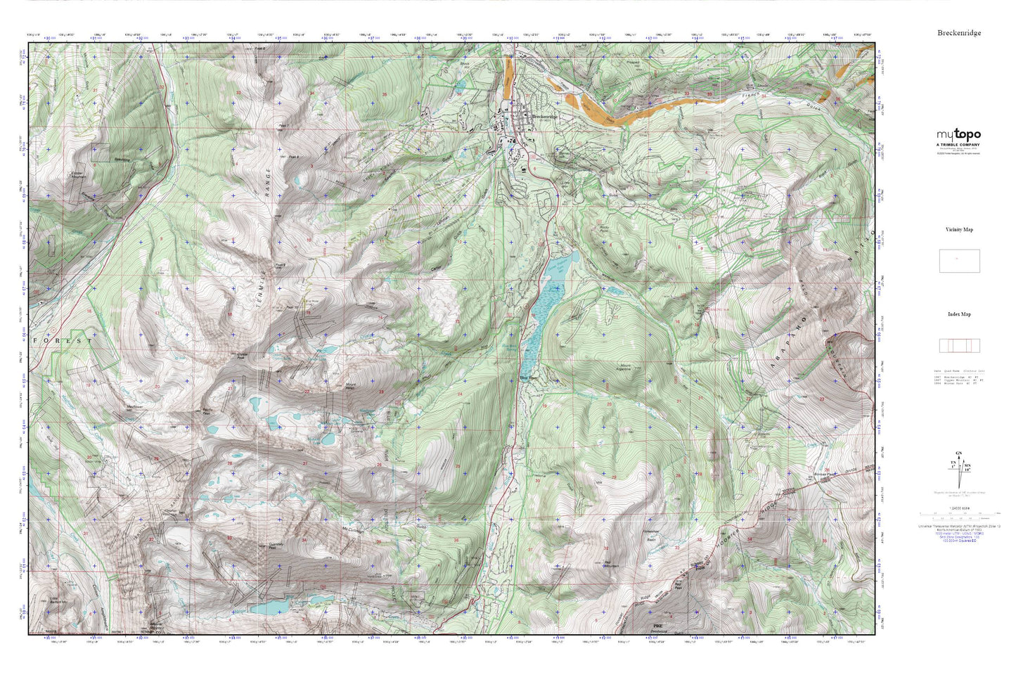
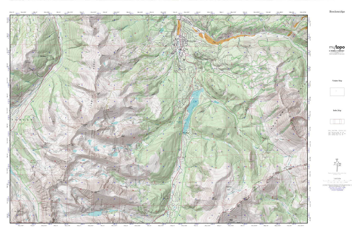
Topographic map of Breckenridge in the state of Colorado. From the MyTopo Explorer Series.
This topo map features shaded relief and comes with UTM / MGRS and Latitude/Longitude grids.
For more than two decades, MyTopo has provided maps to the most adventurous among us.. those who love to explore our nation’s remote wilderness areas, climb our highest peaks, and trek across our vast public lands. This map is part of a curated collection of the most popular places for which MyTopo customers have designed maps. It is a “bucket list” of the most amazing places to hike, hunt, and explore.
This map contains the following named places: 80424,Atlantic Peak,Bakers Tank Picnic Ground,Bankers Tank,Barney Ford Hill,Big Sally Barber F7T Mine,Blue River,Blue Rock Spring,Boston Mine,Breckenridge,Breckenridge Mine,Breckenridge Post Office,Breckenridge Ski Area,Briar Rose Mine,Burro Trail,Cally Mine,Carter Gulch,Commodore Placer Mine,Copper Creek,Copper Mountain,Corporal Mine,Crystal Creek,Crystal Peak,Dewey Mine,Dry Gulch,Dyersville,Edna Mine,Excelsior Mine,Father Dyer Peak,Fletcher Mountain,Ford Gulch,Fredonia Gulch,Gold Bell Mine,Gold Edge Mine,Gold Hill,Gold Nugget Placer Mine,Goose Pasture,Goose Pasture Dam,Goose Pasture Tarn,Governor Mine,Graveline Gulch,Harrison Tunnel Mine,Horseshoe Basin,Humbug Creek,Hunter Mine,Illinois Gulch,Indiana Creek,Lehman Gulch,Leona Mine,Little Mountain,Little Sally Barber Mine,Lone Bug Mine,Lower Crystal Lake,Lower Mohawk Lake,Maxwell Mine,Mayflower Hill,Mayflower Lakes,McCullough Gulch,McCullough Tunnel,Mohawk Lake,Monte Cristo Creek,Mount Argentine,Mount Helen,Overlook Athletic Club Heliport,Pacific Creek,Pacific Peak,Pacific Tarn,Pacific-Gold Dust Mine,Palmer Pit,Peak Eight,Peak Nine,Peak Seven,Peak Ten,Pennsylvania Creek,Player Mine,Puzzle Ouray Mine,Quandary Creek,Quandary Peak,Quandary Tunnel,Red Mountain,Red Peak,Red White and Blue Fire District Station 7,Red Wing Mine,Reliance Place Shopping Center,Rocky Point,Saint Anthony Breckenridge Community Clinic Emergency Center,Sally Barber Mine,Sawmill Dam,Sawmill Gulch,Sawmill Reservoir,Silence Mine,Spaulding Gulch,Spruce Creek,Streng Mine,Tenmile Range,Tommy Mine,Town of Blue River,Tucker Gulch,Upper Crystal Lake,Warriors Mark Mine,Wheeler Trail,Willard Mine