MyTopo
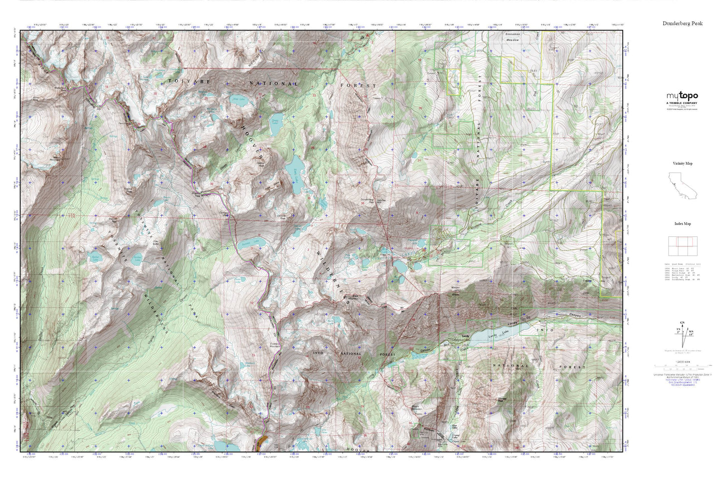
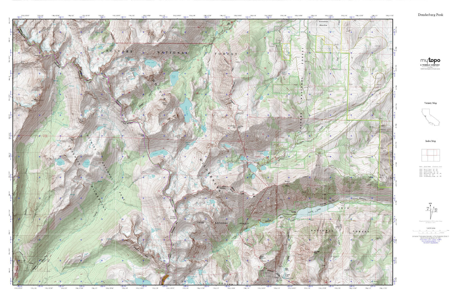
Dunderberg Peak MyTopo Explorer Series Map
Couldn't load pickup availability
Topographic map of Dunderberg Peak in the state of California. From the MyTopo Explorer Series.
This topo map features shaded relief and comes with UTM / MGRS and Latitude/Longitude grids.
For more than two decades, MyTopo has provided maps to the most adventurous among us.. those who love to explore our nation’s remote wilderness areas, climb our highest peaks, and trek across our vast public lands. This map is part of a curated collection of the most popular places for which MyTopo customers have designed maps. It is a “bucket list” of the most amazing places to hike, hunt, and explore.
This map contains the following named places: Bergona Lake,Big Valley Lake,Black Mountain,Blue Lake,Burro Lake,Burro Pass,Camiaca Peak,Cooney Lake,Deer Creek,Dunderberg Peak,East Fork Green Creek,East Lake,Epidote Peak,Excelsior Mountain,Frog Lakes,Gabbro Peak,Gilcrest Peak,Gilman Lake,Glines Canyon,Green Lake,Grey Butte,Hoover Lakes,Kavanaugh Ridge,Lake Canyon,Lake Frances,Lakes Canyon Trailhead,Little Valley,Lundy,Lundy Canyon Trailhead,Lundy Lake,Lundy Lake 104-035 Dam,Matterhorn Peak,McCabe Creek,Moat Lake,Mount Olsen,Mount Scowden,Nutter Lake,Onion Lake,Page Peaks,Par Value Lakes,Red Lake,Return Lake,Sawtooth Ridge,Shepherd Crest,Shepherd Lake,Soldier Lake,South Fork Mill Creek,Spiller Lake,Stanton Peak,Summit Lake,Trumbull Campground,Trumbull Lake,Trumbull Lake Campground,Twin Peaks,Virginia Lakes,Virginia Lakes Census Designated Place,Virginia Lakes Pack Outfit,Virginia Lakes Resort,Virginia Pass,Virginia Peak,West Fork Green Creek,West Lake,Whorl Mountain