MyTopo
Bright Angel Point MyTopo Explorer Series Map
Couldn't load pickup availability
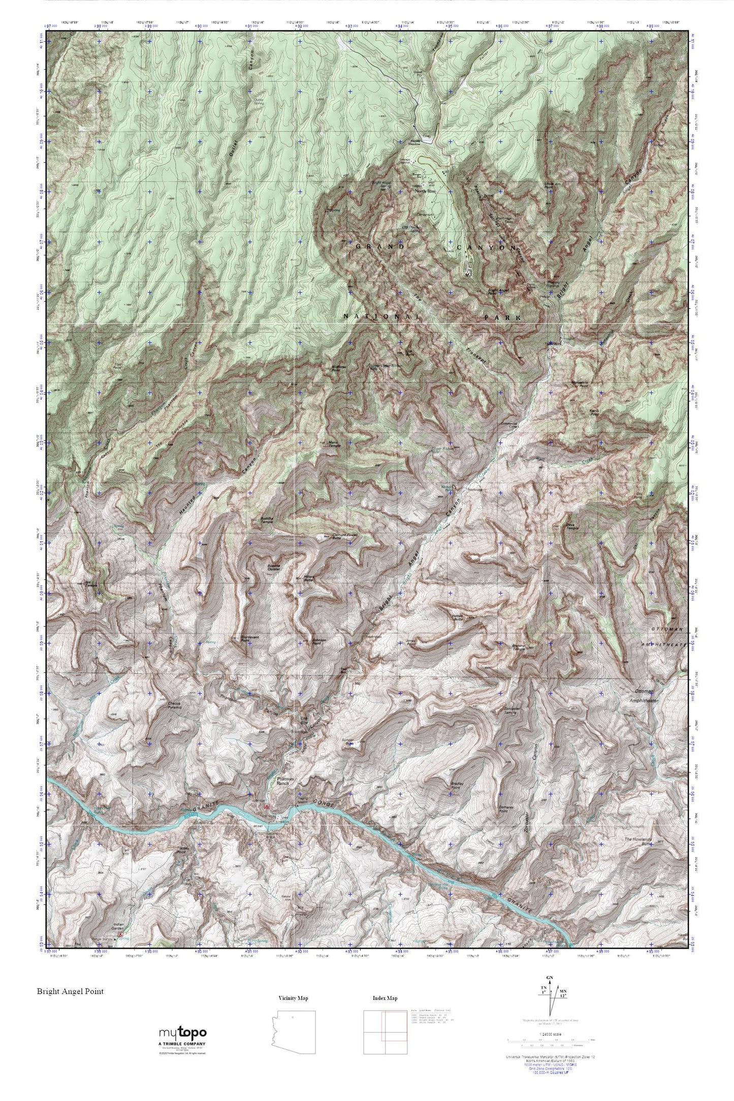
Topographic map of Bright Angel Point in the state of Arizona. From the MyTopo Explorer Series.
This topo map features shaded relief and comes with UTM / MGRS and Latitude/Longitude grids.
For more than two decades, MyTopo has provided maps to the most adventurous among us.. those who love to explore our nation’s remote wilderness areas, climb our highest peaks, and trek across our vast public lands. This map is part of a curated collection of the most popular places for which MyTopo customers have designed maps. It is a “bucket list” of the most amazing places to hike, hunt, and explore.
This map contains the following named places: 86052,Bradley Point,Brahma Temple,Bright Angel Canyon,Bright Angel Creek,Bright Angel Point,Bright Angel Spring,Buddha Cloister,Buddha Temple,Cheops Pyramid,Clear Creek Trail,Clement Powell Butte,Cliff Dweller Spring,Cottonwood Camp,Demaray Point,Deva Temple,Fuller Canyon,Grand Canyon Lodge,Harvey Meadow,Hattan Butte,Haunted Canyon,Hillers Butte,Holloway Tank,Horn Creek,Horn Creek Rapids,Isis Temple,Johnson Point,Jones Point,Kaibab Suspension Bridge,Komo Point,Manu Temple,Manzanita Creek,Manzanita Point,Marble Flats,North Kaibab Trail,North Rim,North Rim Inn,North Rim Post Office,Obi Point,Old Kaibab Trail,Ottoman Amphitheater,Outlet Canyon,Outlet Spring,Oza Butte,Phantom Canyon,Phantom Creek,Phantom Ranch,Phantom Ranger Station,Pipe Creek,Ribbon Falls,River Trail,Roaring Springs,Roaring Springs Campground,Roaring Springs Canyon,Schellbach Butte,Silver Bridge,South Kaibab Trail,Sturdevant Point,Sumner Point,Suspension Bridge Campground,The Box,The Colonnade,The Transept,Thompson Canyon,Tiyo Point,Tiyo Point Trail,Transept Trail,Transept Trail Campgrounds,Uncle Jim Point,Wall Creek,Widforss Point,Zoroaster Temple