MyTopo
Mount Evans MyTopo Explorer Series Map
Couldn't load pickup availability
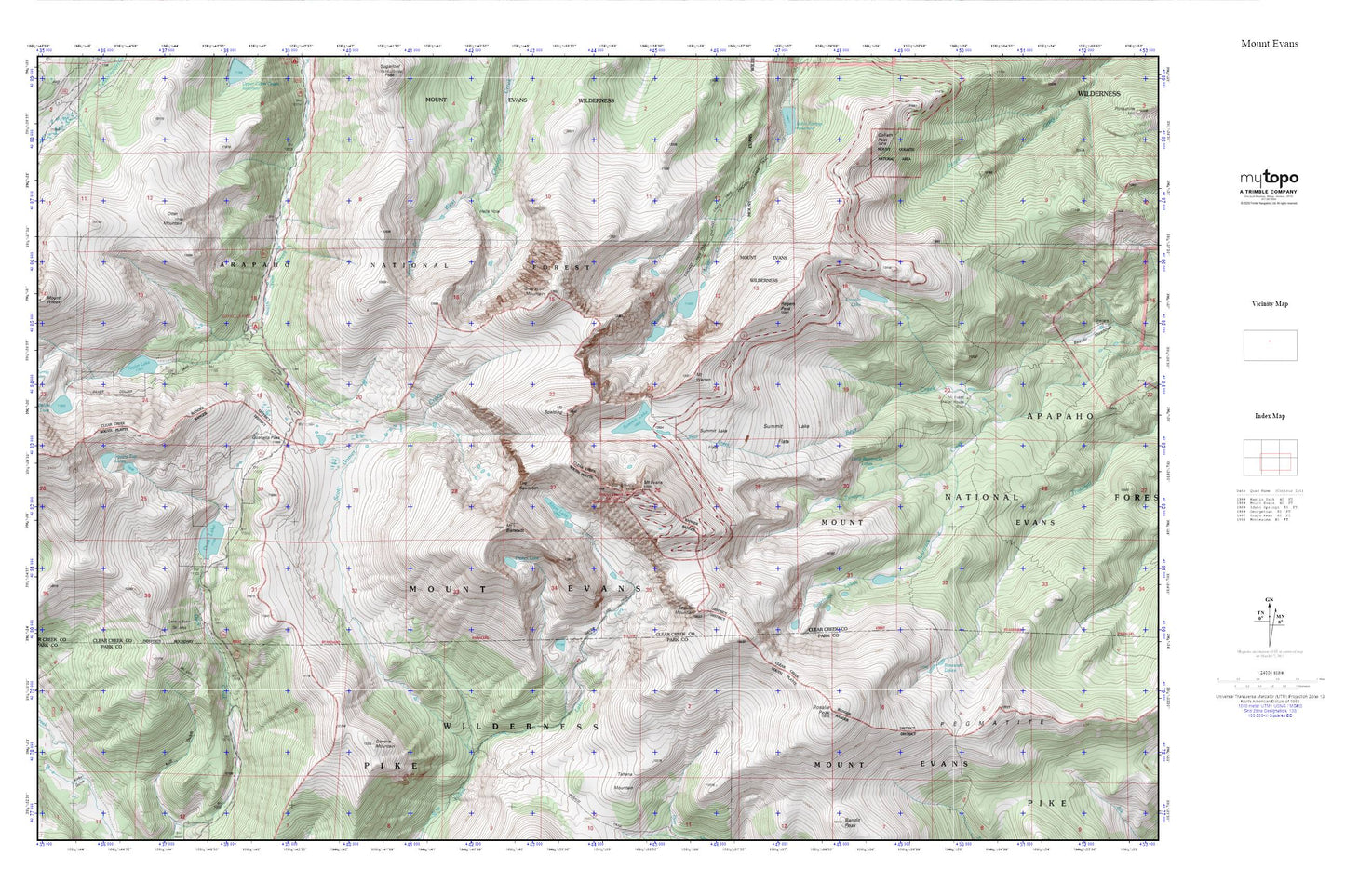
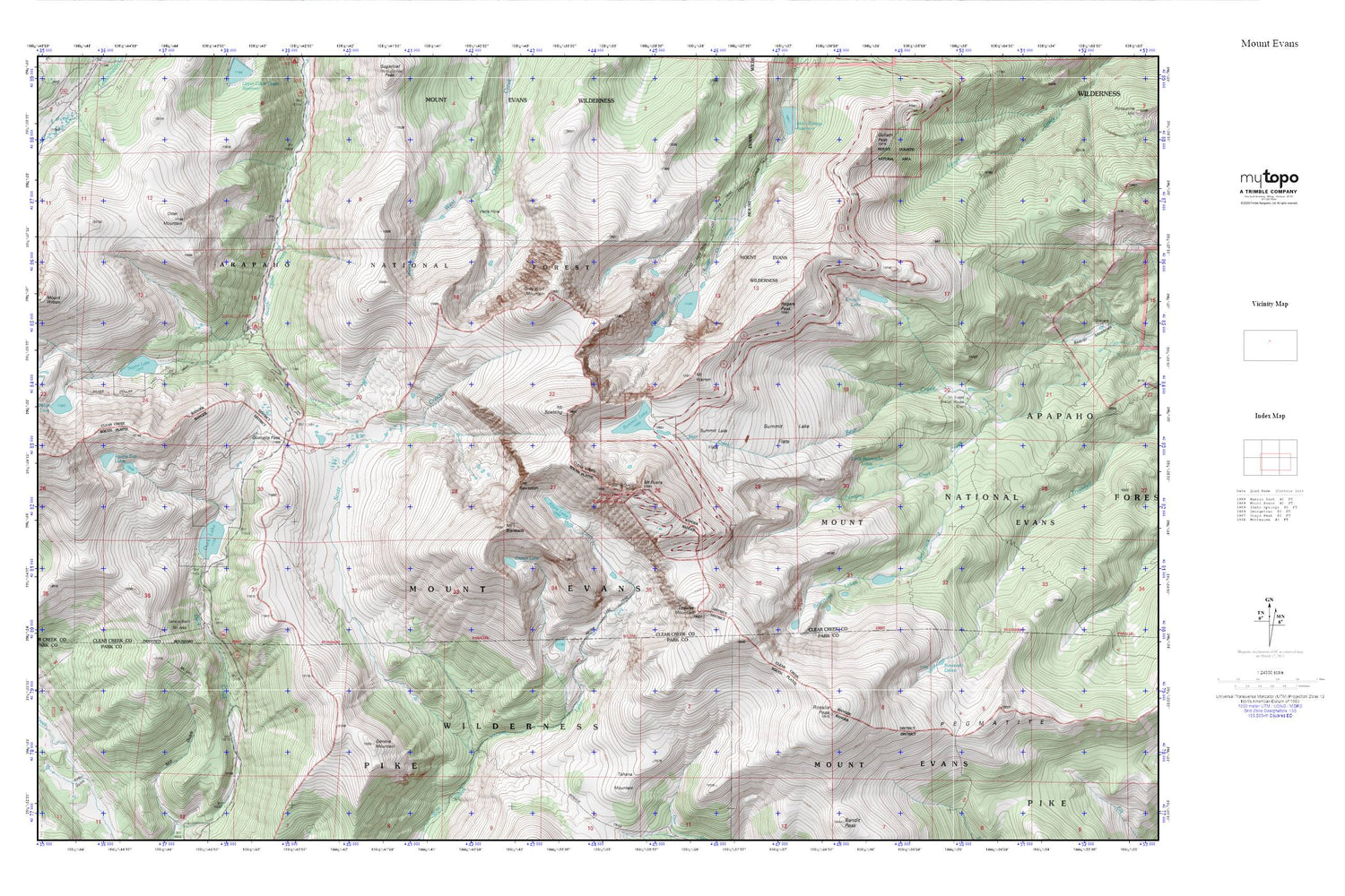
Topographic map of Mount Evans in the state of Colorado. From the MyTopo Explorer Series.
This topo map features shaded relief and comes with UTM / MGRS and Latitude/Longitude grids.
For more than two decades, MyTopo has provided maps to the most adventurous among us.. those who love to explore our nation’s remote wilderness areas, climb our highest peaks, and trek across our vast public lands. This map is part of a curated collection of the most popular places for which MyTopo customers have designed maps. It is a “bucket list” of the most amazing places to hike, hunt, and explore.
This map contains the following named places: 80444,Abyss Lake,Abyss Lake Scenic Area,Abyss Trail,Altura Dam,Beartrack Campground,Beartrack Lakes,Chicago Lakes,Chicago Lakes Trail,Colorado Game and Fish Reserve,Duck Lake,Epaulet Mountain,Frozen Lake,Geneva Basin Ski Area,Geneva Mountain,Gray Wolf Mountain,Guanella Pass,Guanella Pass Campground,Hells Hole,Kirby Gulch,Lake Fork,Lincoln Lake,Little Beartrack Lakes,Mount Bierstadt,Mount Evans,Mount Evans Shelter House,Mount Evans Wilderness,Mount Goliath Natural Area,Mount Spalding,Mount Warren,Naylor Lake,Otter Mountain,Pegmatite Points,Rogers Peak,Roosevelt Lakes,Rosalie Peak,Shelter Cabin,Silver Dollar Lake,Silver Dollar Lake Trail,Square Top Lakes,Summit Lake,Summit Lake Flats,The Sawtooth,Tumbling Creek