MyTopo
Kearsarge Peak MyTopo Explorer Series Map
Couldn't load pickup availability
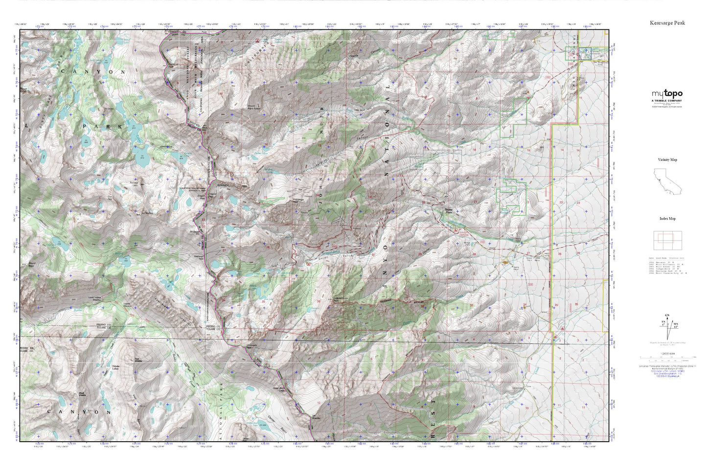
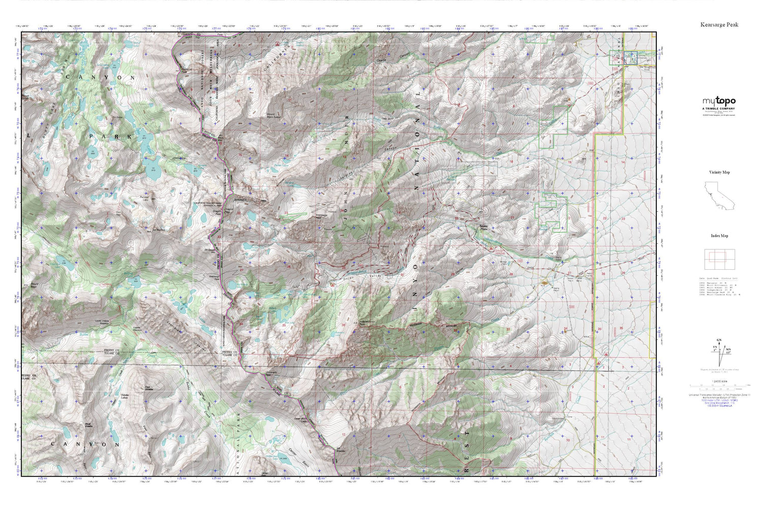
Topographic map of Kearsarge Peak in the state of California. From the MyTopo Explorer Series.
This topo map features shaded relief and comes with UTM / MGRS and Latitude/Longitude grids.
For more than two decades, MyTopo has provided maps to the most adventurous among us.. those who love to explore our nation’s remote wilderness areas, climb our highest peaks, and trek across our vast public lands. This map is part of a curated collection of the most popular places for which MyTopo customers have designed maps. It is a “bucket list” of the most amazing places to hike, hunt, and explore.
This map contains the following named places: Bench Lake,Big Pothole Lake,Black Mountain,Boron Springs,Bullfrog Lake,Center Basin Crags,Charlotte Lake,Declaration Mine,Dragon Lake,Dragon Peak,East Creek,East Vidette,Fin Dome,Flower Lake,Gilbert Lake,Glen Pass,Golden Trout Lake,Grand Group,Grays Meadow,Grays Meadow Campground,Heart Lake,Independence Peak,Junction Meadow,Kearsarge Group,Kearsarge Pass,Kearsarge Peak,Kearsarge Pinnacles,Lime Canyon,Little Onion,Little Pothole Lake,Lower Grays Meadow,Lower Vidette Meadow,Matlock Lake,Mount Bago,Mount Cotter,Mount Gould,Mount Mary Austin,Mount Rixford,Onion Valley,Onion Valley Campground,Onion Valley Trailhead,Painted Lady,Parker Lakes,Parker Ranch,Phoenix Group,Pinyon Creek,Rae Lakes,Rex Montis Mine,Robinson Lake,Sardine Canyon,Sardine Lake,Seven Pines,Slim Lake,Tub Springs,University Peak,Vidette Creek,Vidette Lakes,Vidette Meadow,Virginia Group,West Vidette