MyTopo
South Sister MyTopo Explorer Series Map
Couldn't load pickup availability
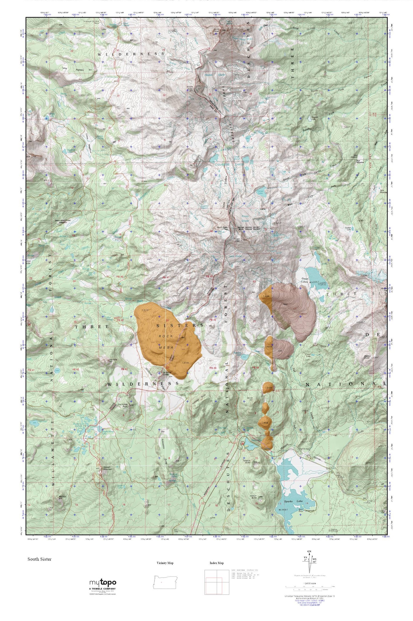
Topographic map of South Sister in the state of Oregon. From the MyTopo Explorer Series.
This topo map features shaded relief and comes with UTM / MGRS and Latitude/Longitude grids.
For more than two decades, MyTopo has provided maps to the most adventurous among us.. those who love to explore our nation’s remote wilderness areas, climb our highest peaks, and trek across our vast public lands. This map is part of a curated collection of the most popular places for which MyTopo customers have designed maps. It is a “bucket list” of the most amazing places to hike, hunt, and explore.
This map contains the following named places: Blacktail Spring,Bounty Lake,Camelot Lake,Camp Lake,Carver Glacier,Carver Lake,Chambers Lakes,Clark Glacier,Collier Glacier,Corral Lake,Demaris Lake,Denude Lake,Devils Garden Forest Camp,Devils Hill,Devils Lake,Devils Lake Recreation Site,Dew Lake,Diller Glacier,Eugene Glacier,Fall Creek Cabin,Frazier Upland,Goose Creek,Green Lakes,Hayden Glacier,Hell Creek,Hodge Crest,Husband Lake,Irving Glacier,James Creek Shelter,Kaleetan Butte,Kokostick Butte,Koosah Mountain,Lancelot Lake,Lane Plateau,Le Conte Crater,Lewis Glacier,Linton Meadows,Linton Spring,Lost Creek Glacier,Mesa Springs,Middle Sister,Mirror Lake Trail,Moraine Lake,Moraine Lake Trail,Prouty Glacier,Reese Lake,Renfrew Glacier,Rock Mesa,Satan Creek,Satan Creek Forest Camp,Separation Creek Meadow,Sisters Mirror Lake,Skinner Glacier,Soda Creek,Soda Creek Recreation Site,South Sister,Talapus Butte,Teardrop Pool,Thayer Glacier,The House Rock,The Wife,Three Sisters,Tyee Creek,Wickiup Plain,Wickiup Plain Trail