
MyTopo
Uncompahgre Peak MyTopo Explorer Series Map
Couldn't load pickup availability
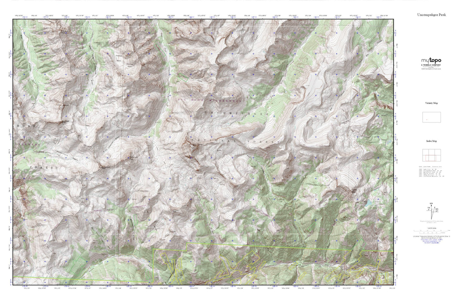
Topographic map of Uncompahgre Peak in the state of Colorado. From the MyTopo Explorer Series.
This topo map features shaded relief and comes with UTM / MGRS and Latitude/Longitude grids.
For more than two decades, MyTopo has provided maps to the most adventurous among us.. those who love to explore our nation’s remote wilderness areas, climb our highest peaks, and trek across our vast public lands. This map is part of a curated collection of the most popular places for which MyTopo customers have designed maps. It is a “bucket list” of the most amazing places to hike, hunt, and explore.
This map contains the following named places: Beth Number One Mine,Big Blue Trail,Big Blue Wilderness,Broken Hill,Chord Mine,Coxcomb Peak,Gallic-Vulcan Mine,Iron Beds,Mary Alice Creek,Matterhorn Creek,Matterhorn Peak,Middle Canyon,Modoc Creek,Nellie Creek,Owl Gulch,Pole Creek,Porphyry Basin,Redcliff,Silver Creek,Silver Jack Mine,Silver Mountain,Uncompahgre Peak,Uncompahgre Wilderness,West Fork Trail,Wetterhorn Basin,Wetterhorn Peak,Woodstock Mine,Yellow Medicine Mine


