MyTopo
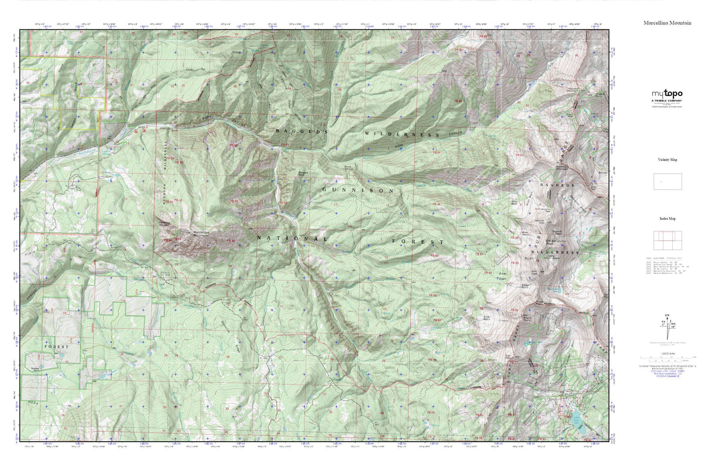
Marcellina Mountain MyTopo Explorer Series Map
Couldn't load pickup availability
Topographic map of Marcellina Mountain in the state of Colorado. From the MyTopo Explorer Series.
This topo map features shaded relief and comes with UTM / MGRS and Latitude/Longitude grids.
For more than two decades, MyTopo has provided maps to the most adventurous among us.. those who love to explore our nation’s remote wilderness areas, climb our highest peaks, and trek across our vast public lands. This map is part of a curated collection of the most popular places for which MyTopo customers have designed maps. It is a “bucket list” of the most amazing places to hike, hunt, and explore.
This map contains the following named places: Ant Creek,Anthracite Creek Guard Station,Bear Gulch,Beckwith Reservoir,Belcher Mine,Buck Basin,Buck Creek,Dark Canyon,Devils Stairway,Dyke Creek,Erickson Springs,Gold Basin,Gold Creek,Green Lake,Grouse Spring Creek,Hell Creek,Hotchkiss Ranch,Layton Gulch,Marcellina Mountain,Middle Anthracite Creek,Middle Creek,Mount Owen,Munsey Creek,Norris Ditch,North Anthracite Creek,Prospect Point,Ruby Anthracite Creek,Ruby Peak,Ruby Range,Sardine Creek,Schaefer Creek,Silver Basin,Silver Creek,Snowline Ridge,Snowshoe Cow Camp,South Snowshoe Creek,Swan Basin,The Dyke,Trout Creek,Vogel Creek