MyTopo
Squaretop Mountain MyTopo Explorer Series Map
Couldn't load pickup availability
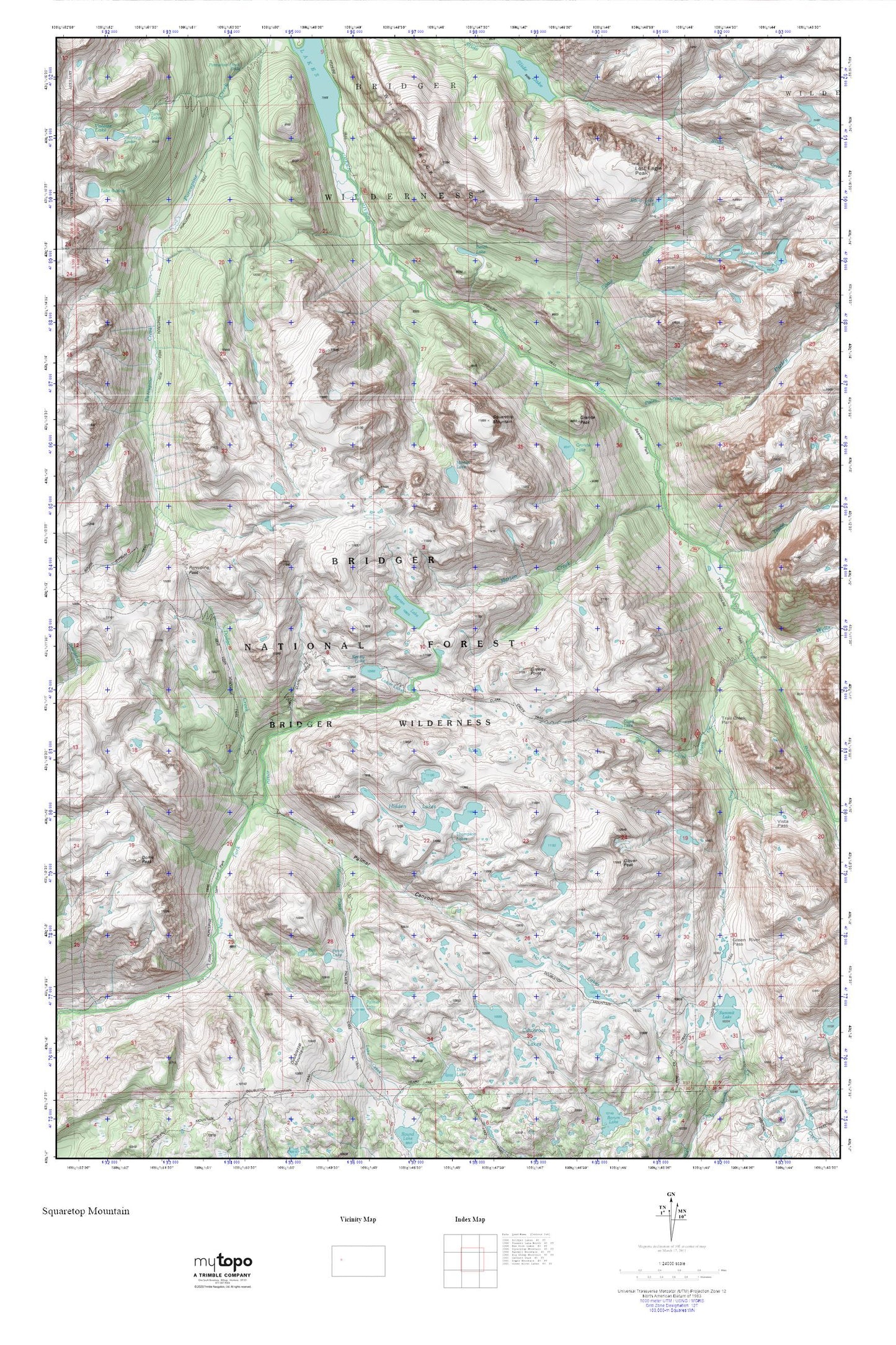
Topographic map of Squaretop Mountain in the state of Wyoming. From the MyTopo Explorer Series.
This topo map features shaded relief and comes with UTM / MGRS and Latitude/Longitude grids.
For more than two decades, MyTopo has provided maps to the most adventurous among us.. those who love to explore our nation’s remote wilderness areas, climb our highest peaks, and trek across our vast public lands. This map is part of a curated collection of the most popular places for which MyTopo customers have designed maps. It is a “bucket list” of the most amazing places to hike, hunt, and explore.
This map contains the following named places: Beaver Park,Bench Lake,Clark Creek,Clark Lake,Cutthroat Lakes,Dodge Creek,Dome Peak,Elbow Creek,Elbow Lake Number 2,Glover Peak,Granite Lake,Granite Peak,Greeley Point,Green River Lakes,Green River Pass,Hidden Lakes,Kenny Lake,Lost Eagle Peak,Lozier Lakes,Marten Creek,Marten Lake,New Fork Park,New Fork Trail,No Name Lakes,Palmer Canyon,Palmer Lake,Penny Lake,Pixley Creek,Porcupine Pass,Porcupine Trail,Reynolds Creek,Rim Lake,Slide Lake,Squaretop Mountain,Summit Lake,Thomson Lakes,Three Forks Park,Tourist Creek,Trail Creek,Trail Creek Park,Twin Lakes,Wells Creek,White Rock