MyTopo
Courtright Reservoir MyTopo Explorer Series Map
Couldn't load pickup availability
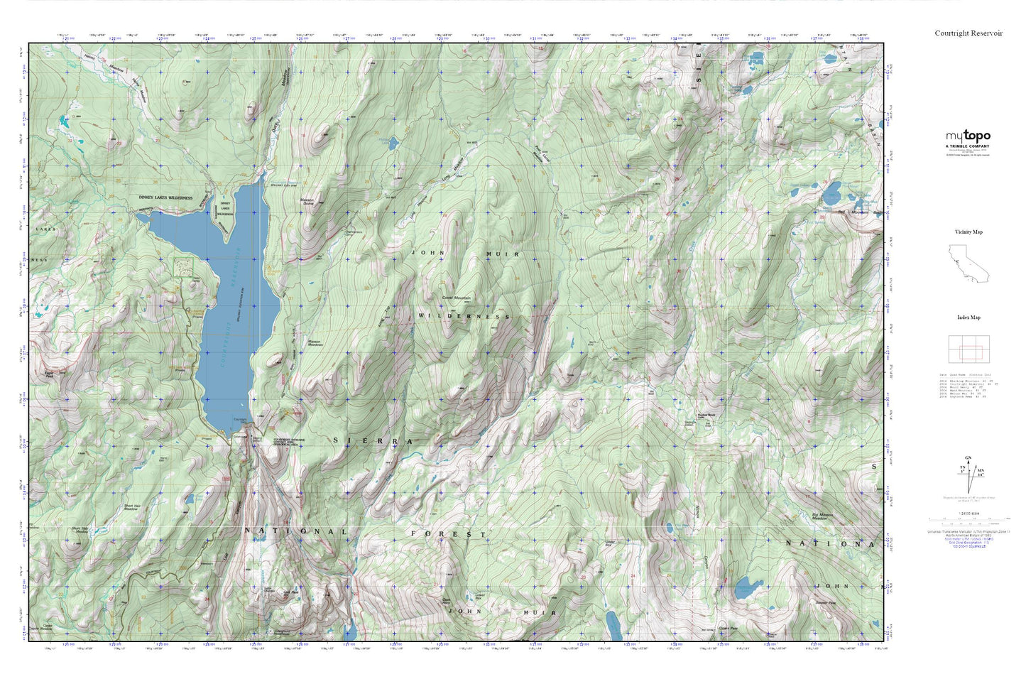
Topographic map of Courtright Reservoir in the state of California. From the MyTopo Explorer Series.
This topo map features shaded relief and comes with UTM / MGRS and Latitude/Longitude grids.
For more than two decades, MyTopo has provided maps to the most adventurous among us.. those who love to explore our nation’s remote wilderness areas, climb our highest peaks, and trek across our vast public lands. This map is part of a curated collection of the most popular places for which MyTopo customers have designed maps. It is a “bucket list” of the most amazing places to hike, hunt, and explore.
This map contains the following named places: Burnt Corral Creek,Chamberlains Camp,Clear Lake,Corral Mountain,Courtright Dam,Courtright Intrusive Contact Zone Geological Area,Courtright Reservoir,Courtwright 97-119 Dam,Dusy Creek,Eagle Peak,Fleming Creek,Halfmoon Lake,Helms Creek,Hobler Lake,Log Meadow,Long Meadow,Long Top,Lost Peak,Marmot Rock Campground,Maxson Dome,Maxson Meadows,Meadow Brook,Meadow Brook Cabin,Nichols Canyon,Old Pipe Lake,Post Corral Creek,Post Corral Meadows,Short Hair Meadow,Trapper Springs Campground,Upper Box,Voyager Rock Campground