MyTopo
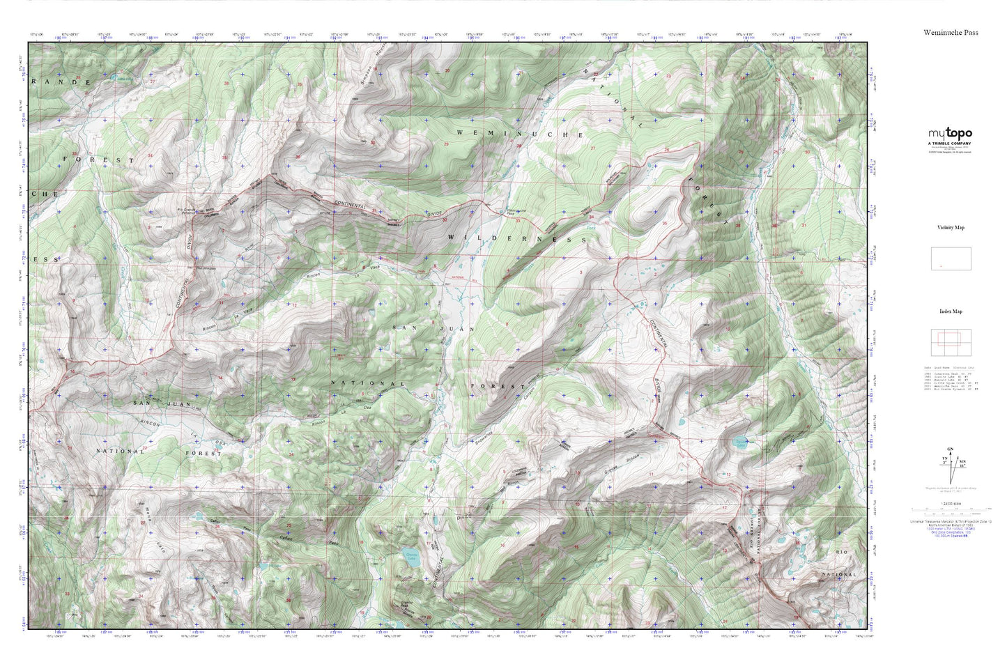
Weminuche Pass MyTopo Explorer Series Map
Couldn't load pickup availability
Topographic map of Weminuche Pass in the state of Colorado. From the MyTopo Explorer Series.
This topo map features shaded relief and comes with UTM / MGRS and Latitude/Longitude grids.
For more than two decades, MyTopo has provided maps to the most adventurous among us.. those who love to explore our nation’s remote wilderness areas, climb our highest peaks, and trek across our vast public lands. This map is part of a curated collection of the most popular places for which MyTopo customers have designed maps. It is a “bucket list” of the most amazing places to hike, hunt, and explore.
This map contains the following named places: Blue Lake,Canon Paso,Dog Rincon,East Ute Creek,Elk Lake,Fuchs Ditch,Granite Lake,Grouse Rincon,Mesa Lato,Middle Ute Creek,North Fork Los Pinos River,Raber Lohr Ditch,Rincon La Osa,Rincon La Vaca,Rio Grande Pyramid,Snowslide Canyon,Squaw Lake,Squaw Lake Dam,Sullivan Ditch,The Window,Weminuche Pass,West Ute Creek