MyTopo
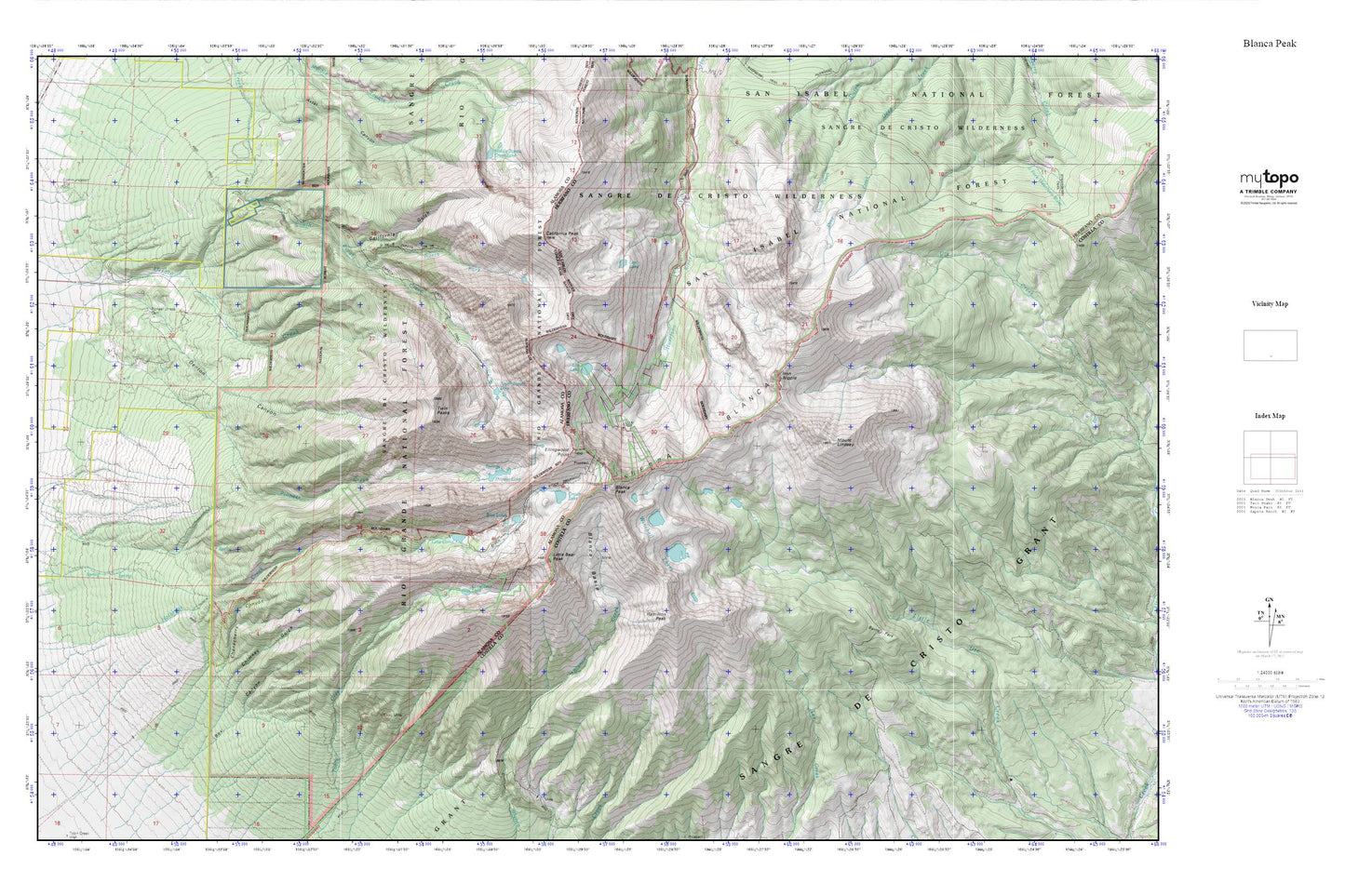
Blanca Peak MyTopo Explorer Series Map
Couldn't load pickup availability
Topographic map of Blanca Peak in the state of Colorado. From the MyTopo Explorer Series.
This topo map features shaded relief and comes with UTM / MGRS and Latitude/Longitude grids.
For more than two decades, MyTopo has provided maps to the most adventurous among us.. those who love to explore our nation’s remote wilderness areas, climb our highest peaks, and trek across our vast public lands. This map is part of a curated collection of the most popular places for which MyTopo customers have designed maps. It is a “bucket list” of the most amazing places to hike, hunt, and explore.
This map contains the following named places: Blanca Basin,Blanca Mine,Blanca Peak,Blue Lakes,Box Canyon,Burro Park,California Gulch,California Peak,Chimney Gulch,Chokecherry Canyon,Crater Lake,Denton Canyon,Ellingwood Point,Hamilton Peak,Iron Nipple,Lake Como,Lily Lake,Little Bear Lake,Little Bear Peak,Lost Lake,Middle Zapata Creek Lake,Mount Blanca Well,Mount Lindsey,North Fork South Zapata Creek,Pioneer Lake,Pioneer Urraca Cemetery,Sierra Blanca,South Zapata Lake,Swab Mine,Twin Peaks,Winchell Lakes,Zapata Falls