
MyTopo
Wind River Range MyTopo Explorer Series Map
Couldn't load pickup availability
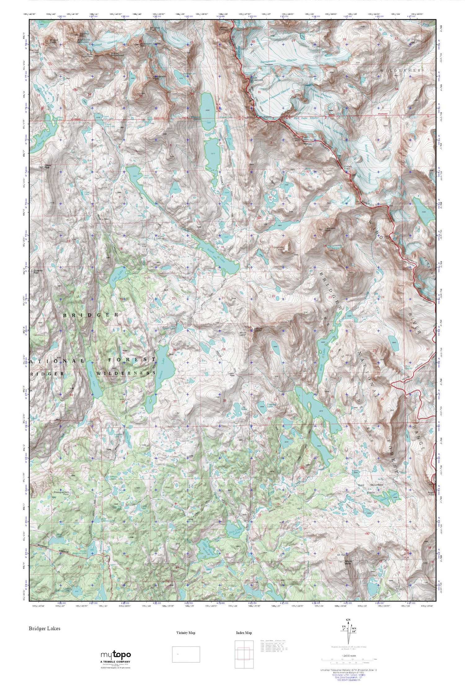
Topographic map of Wind River Range in the state of Wyoming. From the MyTopo Explorer Series.
This topo map features shaded relief and comes with UTM / MGRS and Latitude/Longitude grids.
For more than two decades, MyTopo has provided maps to the most adventurous among us.. those who love to explore our nation’s remote wilderness areas, climb our highest peaks, and trek across our vast public lands. This map is part of a curated collection of the most popular places for which MyTopo customers have designed maps. It is a “bucket list” of the most amazing places to hike, hunt, and explore.
This map contains the following named places: American Legion Peak,Bald Mountain Basin,Barbara Lake,Big Water Slide,Bow Mountain,Bull Lake Glacier,Cook Lake Trail,Cook Lakes,Eklund Lake,Elephant Head,Fremont Crossing,Fremont Glaciers,Fremont Peak,Gorge Lake,Harrower Glacier,Harrower Peak,Henderson Peak,Hobbs Lake,Indian Basin,Indian Pass,Indian Pass Trail,Island Lake,Jackson Peak,Knife Point Glacier,Knife Point Mountain,Lake Nelson,Lester Pass,Little Seneca Lake,Lost Lake,Lower Fremont Glacier,Lower Jean Lake,Marys Lake,Miner Lake,Mistake Lake,Monument Creek,Mount Arrowhead,Mount Lester,Mount Sacagawea,Moya Canyon,Photographers Point,Pole Creek Lakes,Sacagawea Glacier,Sapphire Lake,Seneca Lake,Seneca Lake Trail,Spider Lake,Stroud Glacier,Suicide Lake,Summer Ice Lake,Titcomb Basin Trail,Titcomb Lakes,Tommy Lake,Two Top Lakes,Upper Fremont Glacier,Upper Jean Lake,Upper Sweeney Lake,Wall Lake


