MyTopo
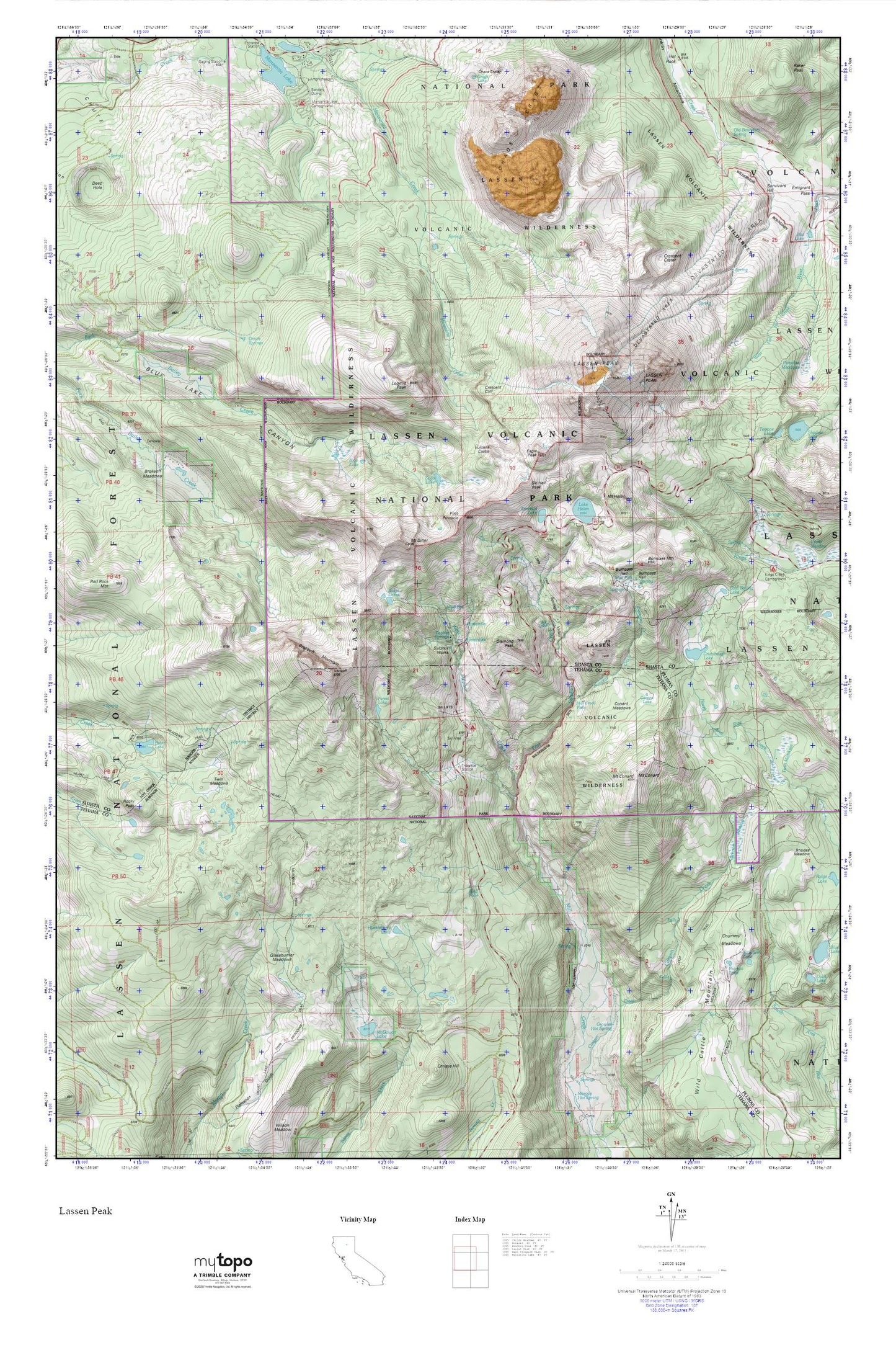
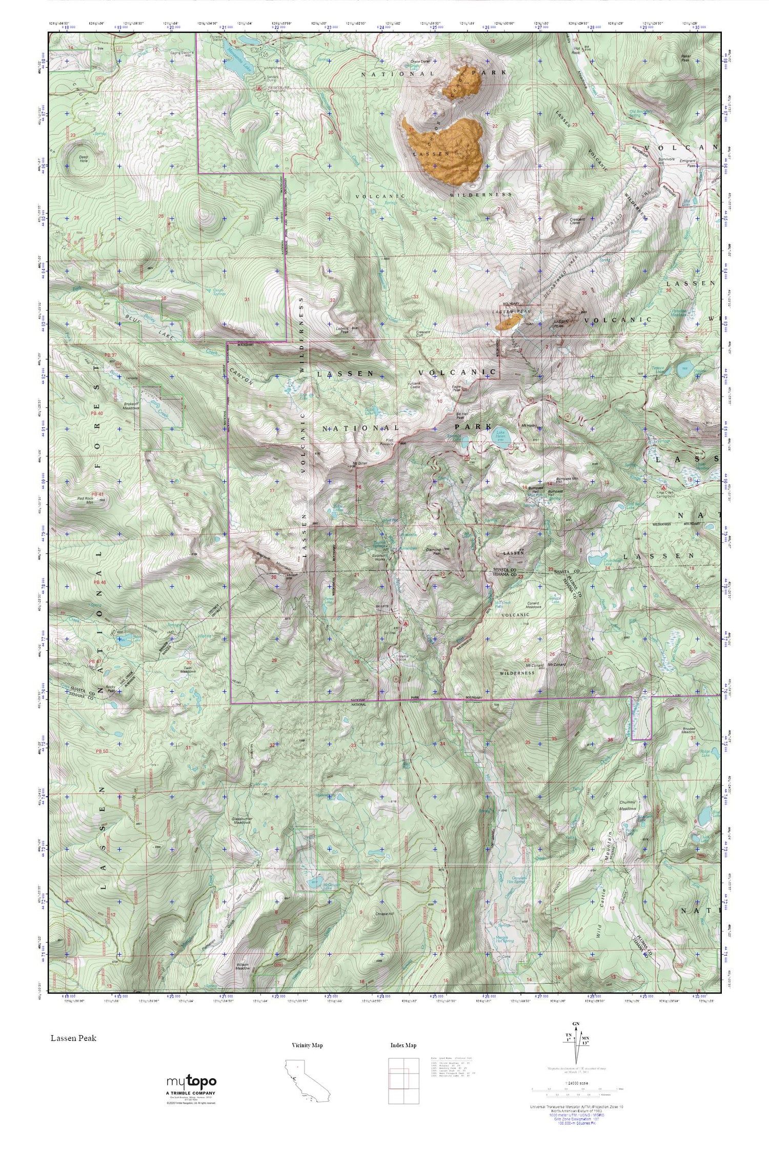
Lassen Peak MyTopo Explorer Series Map
Couldn't load pickup availability
Topographic map of Lassen Peak in the state of California. From the MyTopo Explorer Series.
This topo map features shaded relief and comes with UTM / MGRS and Latitude/Longitude grids.
For more than two decades, MyTopo has provided maps to the most adventurous among us.. those who love to explore our nation’s remote wilderness areas, climb our highest peaks, and trek across our vast public lands. This map is part of a curated collection of the most popular places for which MyTopo customers have designed maps. It is a “bucket list” of the most amazing places to hike, hunt, and explore.
This map contains the following named places: Blue Lake,Bluff Falls,Bluff Falls Campground,Brokeoff Meadows,Brokeoff Mountain,Bumpass Hell,Bumpass Hot Springs,Bumpass Mountain,Chaos Crags,Chummy Meadows,Cold Boiling Lake,Conard Lake,Conard Meadows,Crags Lake,Crescent Cliff,Crescent Crater,Crumbaugh Lake,Diamond Peak,Eagle Peak,East Sulphur Creek,Elizabeth Lake,Emerald Lake,Forest Lake,Glassburner Meadows,Growler Hot Spring,Growler Trail,Hanna Trail,Heart Lake,Huckleberry Lake,Ink Lake,Kings Creek Campground,Lake Helen,Lassen Peak,Little Hot Springs Valley,Loomis Peak,Manzanita Lake Campground,McGowan Lake,Mill Creek Falls,Mount Conard,Mount Diller,Mount Helen,Old Boundary Spring,Onion Springs,Patricia Lake,Pilot Pinnacle,Ridge Lakes,Rocky Peak,Ski Heil Peak,Soda Lake,Spencer Meadow,Spencer Meadow Trail,Sulphur Works,Sulphur Works Checking Station,Supans Springs,Tophet Springs,Twin Meadows,Vulcans Castle,West Sulphur Creek,Wild Cattle Mountain