MyTopo
Triple Divide Peak MyTopo Explorer Series Map
Couldn't load pickup availability
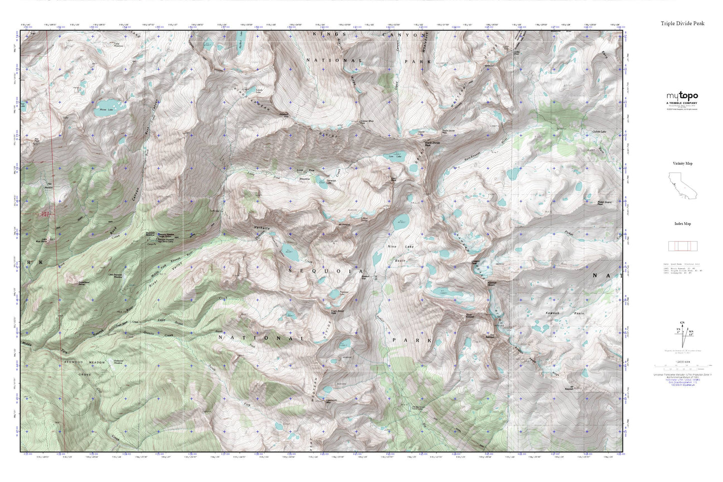
Topographic map of Triple Divide Peak in the state of California. From the MyTopo Explorer Series.
This topo map features shaded relief and comes with UTM / MGRS and Latitude/Longitude grids.
For more than two decades, MyTopo has provided maps to the most adventurous among us.. those who love to explore our nation’s remote wilderness areas, climb our highest peaks, and trek across our vast public lands. This map is part of a curated collection of the most popular places for which MyTopo customers have designed maps. It is a “bucket list” of the most amazing places to hike, hunt, and explore.
This map contains the following named places: Alta Meadow,Alta Peak,Bearpaw Meadow,Bearpaw Meadow High Sierra Camp,Bearpaw Meadow Ranger Station,Black Kaweah,Buck Canyon,Buck Creek,Cliff Creek,Copper Mine Pass,Eagle Scout Creek,Eagle Scout Peak,Elizabeth Pass,Glacier Lake,Granite Creek,Hamilton Creek,Hamilton Lakes,Kaweah Gap,Kaweah Queen,Kings-Kaweah Divide,Lawson Peak,Lilliput Glacier,Lion Lake,Lion Rock,Lippincott Mountain,Little Bearpaw Meadow,Little Blue Dome,Lone Pine Creek,Lone Pine Meadow,Lonely Lake,Moose Lake,Mount Stewart,Nine Lake Basin,Old Big Arroyo Patrol Cabin,Panoramic View,Pear Lake,Precipice Lake,Red Kaweah,Redwood Meadow,Redwood Meadow Grove,Redwood Meadows Ranger Station,River Valley,Sugarbowl Dome,Tamarack Lake,Tharps Rock,Triple Divide Pass,Triple Divide Peak,Valhalla