MyTopo
Blue Mountain Lake MyTopo Explorer Series Map
Couldn't load pickup availability
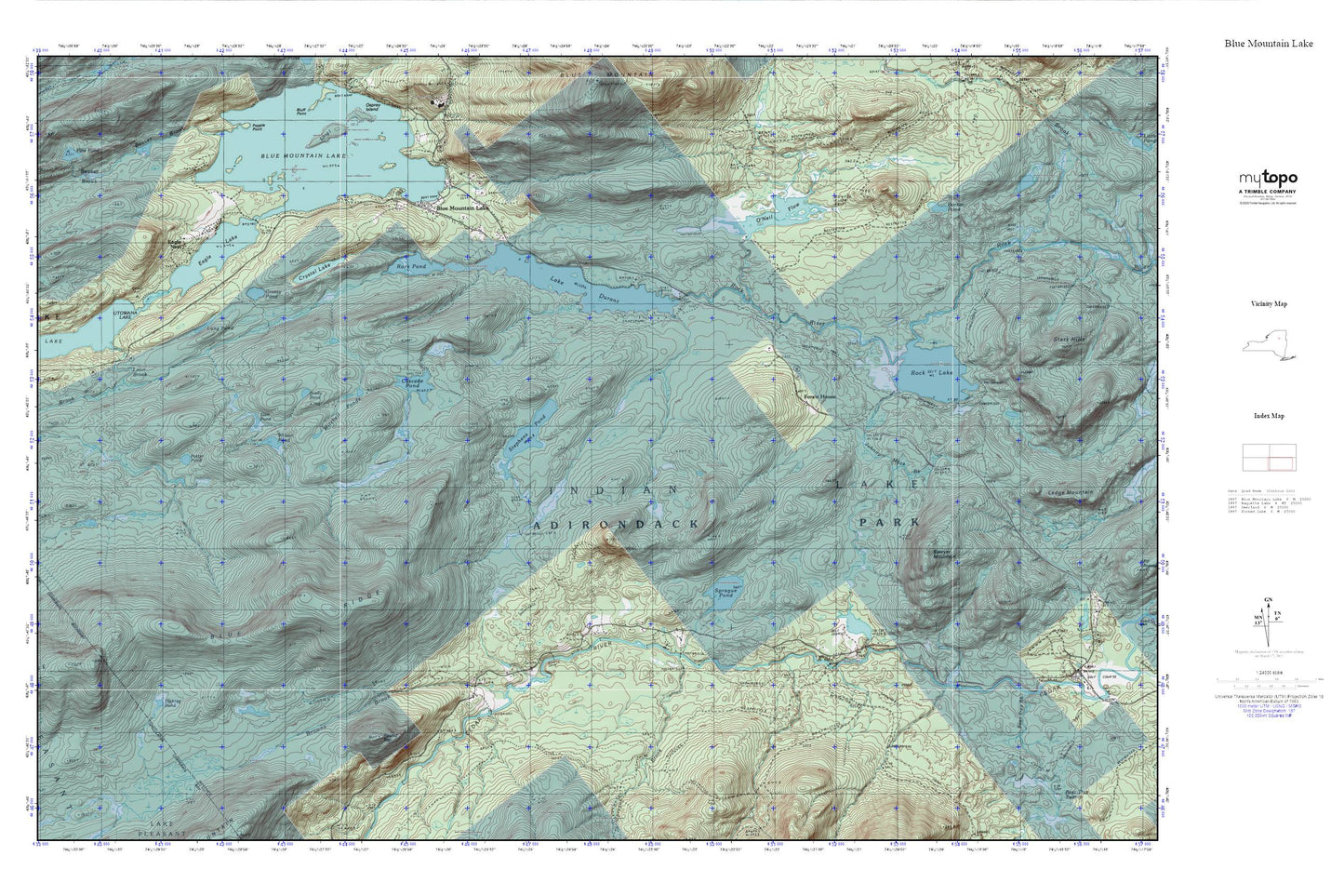
Topographic map of Blue Mountain Lake in the state of New York. From the MyTopo Explorer Series.
This topo map features shaded relief and comes with UTM / MGRS and Latitude/Longitude grids.
For more than two decades, MyTopo has provided maps to the most adventurous among us.. those who love to explore our nation’s remote wilderness areas, climb our highest peaks, and trek across our vast public lands. This map is part of a curated collection of the most popular places for which MyTopo customers have designed maps. It is a “bucket list” of the most amazing places to hike, hunt, and explore.
This map contains the following named places: Barker Pond,Blue Mountain Lake,Blue Mountain Lake Post Office,Blue Mountain Lake Volunteer Fire Department,Blue Ridge,Brady Pond,Browns Brook,Cascade Pond,Crystal Lake,Dishrag Pond,Eagle Lake,Eagle Nest,Eagle Nest Seaplane Base,Forest House,Grassy Pond,Johnny Mack Brook,Lake Durant,Lake Durant Camp,Long Pond,Loon Brook,Mitchell Ponds,Northville Lake Placid Trail,O'Neil Flow,Potter Pond,Rock Lake,Rock Pond,Round Top,Sawyer Mountain,Slim Pond,Sprague Brook,Sprague Pond,Stephens Pond,Wakely Lodge Golf Course,Wilson Pond