MyTopo
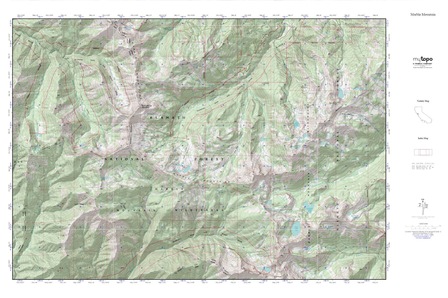
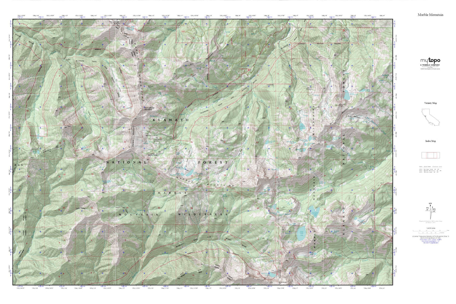
Marble Mountain MyTopo Explorer Series Map
Couldn't load pickup availability
Topographic map of Marble Mountain in the state of California. From the MyTopo Explorer Series.
This topo map features shaded relief and comes with UTM / MGRS and Latitude/Longitude grids.
For more than two decades, MyTopo has provided maps to the most adventurous among us.. those who love to explore our nation’s remote wilderness areas, climb our highest peaks, and trek across our vast public lands. This map is part of a curated collection of the most popular places for which MyTopo customers have designed maps. It is a “bucket list” of the most amazing places to hike, hunt, and explore.
This map contains the following named places: Ananias Camp,Angel Lake,Aspen Lake,Big Elk Lake,Big Rock Camp,Big Rock Fork,Black Marble Mountain,Box Camp Mountain,Buckhorn Lake,Buzzard Lake,Calf Lake,Campbell Lake,Campbell Lake 180 Dam,Chinquapin Lake,Cliff Lake,Cold Spring,Dads Pocket,Death Valley,Death Valley Creek,Deep Lake,Dogwood Lake,Elk Peak,Elk Valley,Frying Pan Lake,Gate Lake,Gem Lake,Grindstone Camp,Jewel Lake,Jumpoff,Kidder Lake,Little Elk Lake,Little Elk Lake Creek,Little Marble Valley,Log Lake,Long High Lake,Lovers Camp,Lower Sky High Lake,Marble Mountain,Marble Valley,Marble Valley Guard Station,Millers Cabin,Muse Meadow,Rainy Lake,Rainy Valley,Rainy Valley Creek,Red Rock Creek,Red Rock Valley,Shadow Lake,Sky High Lakes,Sky High Valley,Soft Water Spring,Spirit Lake,Summit Lake,Summit Meadow Lake,Toms Lake,Toms Valley Creek,Upper Sky High Lake,Whisky Camp,Wolverine Lake,Wooley Creek Pocket